Lohara taluka

Last updated

Lohara Tahsil
tehsil
India Maharashtra location map.svg
Red pog.svg
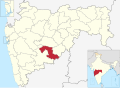
Lohara Tahsil
Location in Maharashtra, India
Coordinates: 17°59′N076°21′E / 17.983°N 76.350°E / 17.983; 76.350
CountryFlag of India.svg  India
State Maharashtra
District Osmanabad
Population
 (2011)
  Total116,913
Languages
  Official Marathi
Time zone UTC+5:30 (IST)
PIN
413608
Lok Sabha constituency Osmanabad
Vidhan Sabha constituency Umarga (SC) [1]

Lohara Tehsil is a tehsil/taluka (subdistrict) in Osmanabad district, Maharashtra on the Deccan Plateau of India. Lohara Bk. is the administrative headquarters of the tehsil. There are forty-seven villages in Lohara Taluka. [2]

Contents

Demographics

In the 2001 Indian census, Lohara Tahsil recorded 110,163 inhabitants of which 56,629 (51.4%) were male and 53,534 (48.6%) were female, for a gender ratio of 945 females per thousand males. [3]

In the 2011 census, Lohara Tahsil had 116,913 inhabitants [4] and a gender ratio of 930 females per thousand males. [5] The tahsil was 100% rural. [4] The literacy rate in 2011 was 74.83% overall in Lohara Tahsil, with a rate of 83.84% for males and 65.22% for females. [6] In 2011 in Lohara Tahsil, 11.26% of the population was 0 to 6 years of age. [4]

List of villages

  1. Achaler
  2. Arni
  3. Ashta kasar
  4. Belwadi
  5. Bendkal
  6. Bhatangali
  7. Bhosga
  8. Chincholi kate
  9. Chincholi rebe
  10. Dastapur
  11. Dhanori
  12. Ekondi lohara
  13. Harali
  14. Hipparga sayyad
  15. Hippargarava
  16. Holi
  17. Jewali
  18. Kamalpur
  19. Kanegaon
  20. Karanjgaon
  21. Karwanji
  22. Kasti Bk.
  23. Kasti Kh.
  24. Khed
  25. Kolnur pandari
  26. Kondjigad
  27. Lohara Bk.
  28. Lohara Kh.
  29. Makani
  30. Malegaon
  31. Mardi
  32. Mogha bk.
  33. Mogha kh.
  34. Murshadpur
  35. Nagral
  36. Nagur
  37. Phanepur
  38. Rajegaon
  39. Salegaon
  40. Sastur
  41. Tawshigad
  42. Toramba
  43. Udatpur
  44. Undargaon
  45. Vilaspur pandhari
  46. Wadgaon
  47. Wadgaonwadi

See also

Related Research Articles

<span class="mw-page-title-main">Osmanabad district</span> District of Maharashtra in India

Osmanabad District officially known as Dharashiv District is an administrative district in the Marathwada region in the Indian state of Maharashtra. The district headquarter is located at Osmanabad. The District of Osmanabad derives its name from the last ruler of Hyderabad, the 7th Nizam, Mir Osman Ali Khan, of which the region was a part till 1947. This region was earlier part of The Hyderabad State until Independence.This primarily rural district occupies an area of 7,569 km2 (2,922 sq mi) of which 241.4 km2 (93.2 sq mi) is urban and has a population of 1,657,576 of which 16.96% were urban.

<span class="mw-page-title-main">Latur district</span> District of Maharashtra in India

Latur district is a district in Maharashtra state of India. Latur city is the district headquarters and is the 16th largest city in the state of Maharashtra. The district is primarily agricultural. Urban population comprises 25.47% of the total population.

Bhoom is a town with a municipal council in Osmanabad district, Maharashtra, India, and it is the headquarters of Bhoom tahsil. Bhoom municipal corporation is established in 1948. Bhoom is a small town situated in a valley of the Banashankar hill ranges of Sahyadri. It is situated on the banks of the River Banaganga, which eventually flows into the Bhima. In 1717, Sambhaji II of Kolhapur gave Bhoom as jagir to Shrimant Senakhaskhel Yashwantrao Thorat (a chief and military leader of his troops) for his bravery. In 19th century Bhoom was under Nizam territory during the British raj in India. However it was independently ruled by the ' Thorat ' royal family. Shrimant Vijaysinh Amarsinh Thorat is the present head of Bhoom. He was the President of Bhoom Municipal Council from 1991 -2006.

Peth or Peint is the smallest tehsil of Nashik subdivision of Nashik district in Maharashtra, India. It belongs to Northern Maharashtra region. It belongs to Nashik Division. Peth is a Taluka headquarter. It is located 54 km to the West of Nashik District headquarters. It is also called as Peint. Pin code of Peth is 422208 and postal head office is Peth.

Warwat Bakal is a Gram Panchayat, in Sangrampur tehsil of Buldhana district, includes in Vidarbha region in the state of Maharashtra, India.

Walwa is a taluka in Sangli district in the Indian state of Maharashtra. It is also known as Walwa-Islampur Taluka. There are ninety-five panchayat villages in Walwa Taluka.

Washi is a Nagar panchayat village and the headquarters of Washi taluka in Bhoom subdivision of Osmanabad district of Maharashtra state in India. The village of Washi is 22 km by road northeast of the town of Bhoom, and 25 km by road northwest of Yermala. The nearest railway station is 40 km by road southwest to Yedshi in Osmanabad District.

Lohara may refer to:

Hippargarava is a village in Lohara Tahsil, Osmanabad district, within the Indian state of Maharashtra. It is located 8.4 km by road west-southwest of the village of Lohara Bk. and 31.6 km by road east of the town of Tuljapur. The nearest post office is in Lohara Bk.

Udgir Taluka, officially known as, Udayagiri Taluka, is a taluka and administrative subdivision of Latur District in the Indian state of Maharashtra. The administrative center for the taluka is the town of Udgir. In the 2011 census there were eighty-seven panchayat villages in Udgir Taluka.

Paranda Tahsil is a tahsil (subdistrict) in Osmanabad district, Marathwada region in Maharashtra on Deccan Plateau of India. The town of Paranda is the administrative headquarters of the tahsil. There are seventy-two panchayat villages in Paranda Tahsil.

Bhoom Tahsil is a tehsil in Osmanabad district, Maharashtra on the Deccan Plateau of India. The town of Bhoom is the administrative headquarters of the tahsil. There are seventy-four panchayat villages in Bhoom Tahsil. In 19th century Bhoom was under Nizam territory during the British raj in India. However it was independently ruled by the Thorat royal family. Shrimant Vijaysinh Amarsinh Thorat is the present head of Bhoom. He was the President of Bhoom Municipal Council from 1991 -2006.

Osmanabad Tahsil is a tahsil/taluka (subdistrict) in Osmanabad district, Maharashtra on the Deccan Plateau of India. The town of Osmanabad is the administrative headquarters of the tahsil. There are 110 panchayat villages in Osmanabad Tahsil.

Washi Tahsil is a tahsil/taluka (subdistrict) in Osmanabad district, Maharashtra on the Deccan Plateau of India. The town of Washi is the administrative headquarters of the tahsil. There are forty-three panchayat villages in Washi Tahsil.

Tuljapur Tahsil is a tahsil/taluka (subdistrict) in Osmanabad district, Maharashtra on the Deccan Plateau of India. The town of Tuljapur is the administrative headquarters of the tahsil. There are 107 panchayat villages in Tuljapur Tahsil.

Umarga (Omerga) Tehsil is a tehsil/ taluka/ subdistrict in Osmanabad district, Maharashtra on the Deccan Plateau of India. The town of Umarga is the administrative headquarters of the tehsil. There are 79 panchayat villages in Umarga Tehsil.

Alur is a panchayat village in the state of Maharashtra, India. It is administratively under the Umarga Tahsil of Osmanabad District in Maharashtra. There is only the single village of Alur in the Alur gram panchayat. The village is 31 km by road southeast of Naldurg and 52 km by road southwest of Umarga, but only 13 km by road northeast of Wagdari, in Solapur District.

Lohara Bk. is a Nagar Panchayat town in the state of Maharashtra, India. Lohara Bk. is headquarters for and administratively under Lohara Tehsil of Osmanabad District in Maharashtra. There is only the single town of Lohara Bk. in the Lohara Bk. Nagar panchayat. The village of Lohara Bk. is 22 km by road west of the village of Sastur and 33 km by road east of the town of Tuljapur.

Sastur is a panchayat village in the state of Maharashtra, India. Administratively, Sastur is under Lohara Tehsil of Osmanabad District in Maharashtra. There is only the single village of Sastur in the Sastur gram panchayat. The village of Sastur is 20 km by road northwest of the village of Madaj and 22 km by road east of the village of Lohara Bk.

Kashti is a panchayat village in the state of Maharashtra, India, on the left (east) bank of the Ghod River, across the river from the village of Tandali. Administratively, Kashti is under Shrigonda Taluka of Ahmadnagar District in Maharashtra. There is only the single village of Kasti in the Kashti gram panchayat. The railroad station is 5 km by road south of the village. Kasti is 16 km by road southwest of the town of Shrigonda, and 14 km by road north of the town of Daund.

References

  1. "Assembly Constituencies-Post delimitation: Maharashtra: Osmanabad District" (PDF). National Informatics Centre, Government of India. Archived from the original (PDF) on 5 May 2013.
  2. "Reports of National Panchayat Directory: Village Panchayat Names of Lohara, Osmanabad, Maharashtra". Ministry of Panchayati Raj, Government of India. Archived from the original on 6 May 2013.
  3. "Census 2001 Population Finder: Maharashtra: Osmanabad: Lohara". Office of The Registrar General & Census Commissioner, Ministry of Home Affairs, Government of India.
  4. 1 2 3 "Population, Child Population in the age-group 0-6 and Literates by residence and sex, State, Districts, Tahsils 2011: Maharashtra" (PDF). Press Information Bureau, Mumbai. p. 41.
  5. "Sex ratio of Population and Child Population in the age-group 0-6, State, Districts, Tahsils 2011: Maharashtra" (PDF). Press Information Bureau, Mumbai. p. 8.
  6. "Literacy rates by residence and sex, State, Districts, Tahsils 2011: Maharashtra" (PDF). Press Information Bureau, Mumbai. p. 17.