
The Bukit Barisan or the Barisan Mountains are a mountain range on the western side of Sumatra, Indonesia, covering nearly 1,700 km (1,050 mi) from the north to the south of the island. The Bukit Barisan range consists primarily of volcanoes shrouded in dense jungle cover, including Sumatran tropical pine forests on the higher slopes. The highest peak of the range is Mount Kerinci at 3,800 metres (12,467 ft). The Bukit Barisan Selatan National Park is situated towards the southern end of the range in Liwa, Indonesia.

Tavurvur is an active stratovolcano near Rabaul, on the island of New Britain, in Papua New Guinea. It is a sub-vent of the Rabaul caldera and lies on the eastern rim of the larger feature. An eruption of the volcano largely destroyed the nearby town of Rabaul in 1994.

An active volcano is a volcano that has erupted during the Holocene, is currently erupting, or has the potential to erupt in the future. A volcano that is not currently erupting but could erupt in the future is known as a dormant volcano. Volcanoes that will not erupt again are known as extinct volcanoes.

Karkar Island is an oval-shaped volcanic island located in the Bismarck Sea, about 30 kilometres (19 mi) off the north coast of mainland Papua New Guinea in Madang Province, from which it is separated by the Isumrud Strait. The island is about 25 km (16 mi) in length and 19 km (12 mi) in width. In the centre is an active volcano with two nested calderas.

Ambitle is a volcanic island which, together with Babase, another volcanic island, is one of the two Feni Islands in the Bismarck Archipelago. The island is located within the Papua New Guinea's New Ireland Province, to the east of the island of New Ireland.

Long Island is a populated volcanic island in Madang Province, Papua New Guinea. It is located north of the island of New Guinea, separated from it by the Vitiaz Strait. The island's interior contains a 360 m-deep (1,180 ft) freshwater volcanic crater lake and within that lake exists an even smaller island known as Motmot island. During the late 17th or early 18th century virtually all of the biota on the island was destroyed and has subsequently provided scientists a unique opportunity to study recolonization efforts by plants, animals, and humans. The vast majority of the buildings on the island are constructed using vernacular architecture.

Mount Balbi is a Holocene stratovolcano located in the northern portion of the island of Bougainville, Papua New Guinea. A gentle prominence at 05°54′09″S154°59′28″E is the highest point of the island. There are five volcanic craters east of the summit, one of which contains a crater lake. The summit is composed of coalesced cones and lava domes which host a large solfatara field. There are numerous fumaroles near the craters, though Balbi has not erupted in historic time.
Bagana is an active volcanic cone located in the centre of the island of Bougainville, Papua New Guinea, the largest island of the Solomon group. It is the most active volcano in the country, occupying a remote portion of central Bougainville Island. It is one of Melanesia's youngest and most active volcanoes.
Billy Mitchell is a pyroclastic shield in the central part of the island of Bougainville, just north-east of the Bagana Volcano in Papua New Guinea. It is a small pyroclastic shield truncated by a 2 km wide caldera filled by a crater lake. It is named after Billy Mitchell, a 20th-century United States Army general who is regarded as the father of the United States Air Force.
Takuan Group is a volcanic group located in the southern part of Bougainville Island, Papua New Guinea. It consists of three closely spaced stratovolcanoes and lava cones, Mount Takuan being the highest of them.
Tore is a volcano located in the northern part of the island of Bougainville, Papua New Guinea. Violent Pleistocene eruptions produced two ignimbrite fans stretching west to the coast, and a 6 km by 9 km caldera. A post-caldera lava cone on the caldera's southern rim is the source of lava flows. Well-preserved features suggests a recent date for this cone and a nearby ash cone.

In volcanology, a pyroclastic shield or ignimbrite shield is an uncommon type of shield volcano. Unlike most shield volcanoes, pyroclastic shields are formed mostly of pyroclastic and highly explosive eruptions rather than relatively fluid basaltic lava issuing from vents or fissures on the surface of the volcano. They typically display low-angle flank slopes and often have a central caldera caused by large eruptions. Lava is commonly extruded after explosive activity has ended. The paucity of associated Plinian fall deposits indicates that pyroclastic shields are characterized by low Plinian columns.

Apoyeque is a pyroclastic shield, located in the Chiltepe Peninsula Natural Reserve in Nicaragua. It has a 2.8-km wide, 400-m-deep, lake-filled caldera.

The Schouten Islands are a group of six small volcanic islands in the province of East Sepik in Papua New Guinea, north of the island of New Guinea. The group is also called Eastern Schouten Islands or Le Maire Islands to separate it from unrelated Schouten Islands in Indonesia. The combined land area is approximately 50 km2 (19 sq mi).
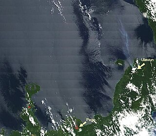
The volcano Pago is located East of Kimbe, West New Britain Province, Papua New Guinea. Pago is a young post-caldera cone within the Witori Caldera. The Buru Caldera cuts the SW flank of the Witori volcano. Biggest eruptions were at 4000±200 BC, VEI 6, 10 cubic kilometres (2.5 mi.3); 1370±100 BC, VEI6, 30 km3 (7 mi.3); and 710±75 AD, VEI 6, 20 km3 (5 mi.3) of tephra.
The Dakataua Caldera is located at the northern tip of the Willaumez Peninsula, New Britain, Papua New Guinea. The peninsula includes the 350 m high andesitic Mount Makalia stratovolcano. The last major collapse of Dakataua was during the Holocene around 800 CE. The most recent eruption on the caldera's rim was Mount Makalia in 1890, producing lava flows and cinder cones.
Hargy is a large volcanic caldera on the island of New Britain, Papua New Guinea. The caldera measures 12 km (7.5 mi) by 10 km (6.2 mi), and its floor is located at 150 m (490 ft) above sea level. It also hosts an inner-caldera with a steep west-facing wall. Lake Hargy, located within the caldera, drains through a narrow river that runs along the northern wall. The caldera-forming eruption occurred approximately 11,000 years ago. At the western part of the caldera rises Galloseulo, a post-caldera dacitic lava cone with a 700 m (2,300 ft)-wide crater, occupied by a pair of smaller craters. Galloseulo has produced many small eruptions in the past 7,000 years, with the most recent in 950 CE. In September 1990, minor fumarolic activity was observed in the western summit crater of Galloseulo.


