America's first transcontinental railroad was a 1,911-mile (3,075 km) continuous railroad line built between 1863 and 1869 that connected the existing eastern U.S. rail network at Council Bluffs, Iowa, with the Pacific coast at the Oakland Long Wharf on San Francisco Bay. The rail line was built by three private companies over public lands provided by extensive U.S. land grants. Building was financed by both state and U.S. government subsidy bonds as well as by company-issued mortgage bonds. The Western Pacific Railroad Company built 132 miles (212 km) of track from the road's western terminus at Alameda/Oakland to Sacramento, California. The Central Pacific Railroad Company of California (CPRR) constructed 690 miles (1,110 km) east from Sacramento to Promontory Summit, Utah Territory. The Union Pacific Railroad (UPRR) built 1,085 miles (1,746 km) from the road's eastern terminus at the Missouri River settlements of Council Bluffs and Omaha, Nebraska, westward to Promontory Summit.

Promontory is an area of high ground in Box Elder County, Utah, United States, 32 mi (51 km) west of Brigham City and 66 mi (106 km) northwest of Salt Lake City. Rising to an elevation of 4,902 feet (1,494 m) above sea level, it lies to the north of the Promontory Mountains and the Great Salt Lake. It is notable as the location of Promontory Summit, where the first transcontinental railroad in the United States, from Sacramento to Omaha, was officially completed on May 10, 1869. The location is sometimes confused with Promontory Point, a location further south along the southern tip of the Promontory Mountains. Both locations are significant to the Overland Route: Promontory Summit was where the original, now abandoned, alignment crossed just north of the Promontory Mountains; while Promontory Point is where the modern alignment, called the Lucin Cutoff, crosses the southern tip of the Promontory Mountains.

The Virginia and Truckee Railroad is a privately owned heritage railroad, headquartered in Virginia City, Nevada. Its private and publicly owned route is 14 miles (23 km) long. When first constructed in the 19th century, it was a commercial freight railroad which was originally built to serve the Comstock Lode mining communities of northwestern Nevada.

A trestle bridge is a bridge composed of a number of short spans supported by closely spaced frames. A trestle is a rigid frame used as a support, historically a tripod used to support a stool or a pair of isosceles triangles joined at their apices by a plank or beam such as the support structure for a trestle table. Each supporting frame is a bent. A trestle differs from a viaduct in that viaducts have towers that support much longer spans and typically have a higher elevation.

The Lucin Cutoff is a 102-mile (164 km) railroad line in Utah, United States that runs from Ogden to its namesake in Lucin. The most prominent feature of the cutoff was a twelve-mile-long (19 km) railroad trestle crossing the Great Salt Lake, which was in use from 1904 until the late 1950s, when it was replaced by an earthen causeway.

The Niles Canyon Railway (NCRy) is a heritage railway running on the first transcontinental railroad alignment through Niles Canyon, between Sunol and the Niles district of Fremont in the East Bay of the San Francisco Bay Area, in California, United States. The railway is listed on the National Register of Historic Places as the Niles Canyon Transcontinental Railroad Historic District. The railroad is operated and maintained by the Pacific Locomotive Association which preserves, restores and operates historic railroad equipment. The NCRy features public excursions with both steam and diesel locomotives along a well-preserved portion of the first transcontinental railroad.

The Northwestern Pacific Railroad is a 271-mile (436 km) mainline railroad from the former ferry connections in Sausalito, California north to Eureka, with a connection to the national railroad system at Schellville. The railroad has gone through a complex history of different ownership and operators but has maintained a generic name of reference as the Northwestern Pacific Railroad, despite no longer being officially named that.

The Newark Bay Bridge of the Central Railroad of New Jersey (CNJ) was a railroad bridge in New Jersey that connected Elizabethport and Bayonne at the southern end of Newark Bay. Its third and final incarnation was a four-track vertical-lift design that opened in 1926, replacing a bascule bridge from 1904 which superseded the original swing bridge from 1887. The bridge served the main line of the CNJ, carrying daily interstate trains as well as commuter trains.

The Sacramento Northern Railway was a 183-mile (295 km) electric interurban railway that connected Chico in northern California with Oakland via the state capital, Sacramento. In its operation it ran directly on the streets of Oakland, Sacramento, Yuba City, Chico, and Woodland. This involved multiple car trains making sharp turns at street corners and obeying traffic signals. Once in open country, SN's passenger trains ran at fairly fast speeds. With its shorter route and lower fares, the SN provided strong competition to the Southern Pacific and Western Pacific Railroad for passenger business and freight business between those two cities. North of Sacramento, both passenger and freight business was less due to the small town agricultural nature of the region and due to competition from the paralleling Southern Pacific Railroad.

The Kate Shelley High Bridge, officially called the Boone Viaduct when it was completed in 1901, is one of the highest and longest double-track railroad bridges in the United States. It is located approximately 3 miles (4.8 km) west of Boone, Iowa.

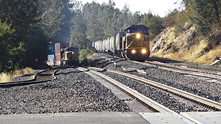
The Feather River Route is a rail line that was built and operated by the Western Pacific Railroad. It was constructed between 1906 and 1909, and connects the cities of Oakland, California, and Salt Lake City, Utah. The line was built to compete with the Southern Pacific Railroad, which at the time held a nearly complete monopoly on Northern California rail service. The route derives its name from its crossing of the Sierra Nevada, where it follows both the North and Middle Forks of the Feather River. The route is famous for its impressive engineering qualities and its considerable scenic value. All of the route is now owned and operated by the Union Pacific Railroad; however, the Union Pacific has transferred significant portions of the route to other lines. The portion still called the Feather River Route by the Union Pacific runs from the California Central Valley to Winnemucca, Nevada and has been divided into three subdivisions named the Sacramento, Canyon and Winnemucca subdivisions.

The I Street Bridge is a historic metal truss swing bridge which crosses the Sacramento River to link the capital city of Sacramento, California, with Yolo County to the west.

The Overland Route was a train route operated jointly by the Union Pacific Railroad and the Central Pacific Railroad/Southern Pacific Railroad, between the eastern termini of Council Bluffs, Iowa, and Omaha, Nebraska, and the San Francisco Bay Area, over the grade of the first transcontinental railroad which opened on May 10, 1869. Passenger trains that operated over the line included the Overland Flyer, later renamed the Overland Limited, with its eastern terminal in Chicago.

Trestles Bridge, more formally known as Railroad Bridge 207.6 or the San Mateo Creek Bridge, is a low railroad viaduct on the coast of Southern California, in northern San Diego County near its border with Orange County. The bridge lies within San Onofre State Beach and gave its nickname to the famed Trestles surfing site at that beach.

The Yancopin Bridge is an abandoned railroad moveable bridge spanning the Arkansas River, and the last bridge across the Arkansas River before it flows into the Mississippi River 15 miles to the southeast. It is distinctive not only for its size and remoteness, but also for having not one but two movable spans, one having replaced the other due to river avulsion.

The Dumbarton Rail Bridge lies just to the south of the Dumbarton road bridge. Built in 1910, the rail bridge was the first structure to span San Francisco Bay, shortening the rail route between Oakland and San Francisco by 26 miles (42 km). The last freight train traveled over the bridge in 1982, and it has been proposed since 1991 to reactivate passenger train service to relieve traffic on the road bridges, though this would entail a complete replacement of the existing bridge. Part of the western timber trestle approach collapsed in a suspected arson fire in 1998.

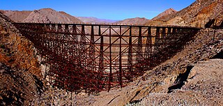
Goat Canyon Trestle is a wooden trestle in San Diego County, California. At a length of 597–750 feet (182–229 m), it is the world's largest all-wood trestle. Goat Canyon Trestle was built in 1933 as part of the San Diego and Arizona Eastern Railway, after one of the many tunnels through the Carrizo Gorge collapsed. The railway had been called the "impossible railroad" upon its 1919 completion. It ran through Baja California and eastern San Diego County before ending in Imperial Valley. The trestle was made of wood, rather than metal, due to temperature fluctuations in the Carrizo Gorge. By 2008, most rail traffic stopped using the trestle.

The Roseville Subdivision is a railway line in California and Nevada owned by the Union Pacific Railroad, as part of the Overland Route. It runs from Roseville, California over the Sierra Nevada to Reno, Nevada. The route originated as the initial Central Pacific Railroad segment of the first transcontinental railroad, but has since been upgraded, double tracked, or realigned in some locations. The line reaches an elevation of 6,887 feet (2,099 m) above sea level at Norden, California.

The Third Street Railroad Trestle is a historic wooden railroad trestle bridge crossing Shoal Creek in downtown Austin, Texas. Built around 1922 by the International–Great Northern Railroad, it replaced an earlier bridge in the same place. The bridge was used by the I–GN Railroad, the Missouri Pacific Railroad, and the Missouri–Kansas–Texas Railroad until 1964, when commercial rail traffic stopped; after 1991 the bridge was abandoned. It was added to the National Register of Historic Places in 2021.

The Black Point Railroad Bridge is a truss swing bridge spanning the Petaluma River, located in Black Point-Green Point, California.


