
Eswatini is a country in Southern Africa, lying between Mozambique and South Africa. The country is located at the geographic coordinates 26°30′S31°30′E. Eswatini has an area of 17,363 square kilometres, of which 160 are water. The major regions of the country are Lowveld, Midveld and Highveld.
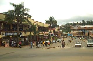
Mbabane is the capital and largest city in Eswatini. With an estimated population of 94,874 (2010), it is located on the Mbabane River and its tributary the Polinjane River in the Mdzimba Mountains. It is located in the Hhohho Region, of which it is also the capital. The average elevation of the city is 1243 meters. It lies on the MR3 road.

South Africa occupies the southern tip of Africa, its coastline stretching more than 2,850 kilometres from the desert border with Namibia on the Atlantic (western) coast southwards around the tip of Africa and then northeast to the border with Mozambique on the Indian Ocean. The low-lying coastal zone is narrow for much of that distance, soon giving way to a mountainous escarpment that separates the coast from the high inland plateau. In some places, notably the province of KwaZulu-Natal in the east, a greater distance separates the coast from the escarpment. Although most of the country is classified as semi-arid, it has considerable variation in climate as well as topography.

Veld, also spelled veldt, is a type of wide open rural landscape in Southern Africa. Particularly, it is a flat area covered in grass or low scrub, especially in the countries of South Africa, Lesotho, Swaziland, Zimbabwe and Botswana. A certain sub-tropical woodland ecoregion of Southern Africa has been officially defined as the Bushveld by the World Wide Fund for Nature. Trees are found only in a few places—frost, fire and grazing animals allow grass to grow but prevent the growth of trees.

South African Standard Time (SAST) is the time zone used by all of South Africa, Botswana as well as Eswatini and Lesotho. The zone is two hours ahead of UTC (UTC+02:00) and is the same as Central Africa Time. Daylight saving time is not observed in either time zone. Solar noon in this time zone occurs at 30° E in SAST, effectively making Pietermaritzburg at the correct solar noon point, with Johannesburg and Pretoria slightly west at 28° E and Durban slightly east at 31° E. Thus, most of South Africa's population experience true solar noon at approximately 12:00 daily.
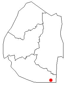
Lavumisa is a town located in the Shiselweni district of southern Eswatini.

Gert Sibande is one of the 3 districts of Mpumalanga province of South Africa. The seat of Gert Sibande is Ermelo. The majority of its 900 007 people speak IsiZulu. The district code is DC30. On 15 October 2004, the municipality changed its name from the "Eastvaal" to "Gert Sibande" District Municipality. The district is named after the ANC activist Gert Sibande.
Maloma is a town in southeastern Eswatini. It is located about 15 kilometres south-west of Sithobela.

Bulembu is a small town located in northwestern Hhohho, Eswatini, 10 km west of the town of Piggs Peak. Located above the Komati Valley in Swaziland's Highveld, Bulembu is named after the siSwati word for a spider's web.
Sandlane is the westernmost town in Swaziland. It is located close to the border with South Africa, 40 kilometres southwest of the capital, Mbabane.
Mhlambanyatsi is a town in western Eswatini. It is located 18 kilometres southwest of the capital, Mbabane.
Luyengo is a town in western Eswatini. It is located 35 kilometres south of the capital, Mbabane, on the MR18 highway, at the junction of the road south to Mankayane and Mgazini. Luyengo was the site of the Swaziland Agricultural College, which became the Swaziland Agricultural College and University Centre (SACUC) and was incorporated into the University of Eswatini. The Main campus for the University in Eswatini was then built at Kwaluseni, and all departments except agriculture then moved to that campus. Of note at SACUC was the Cardiff Hall donated by the citizens of Cardiff (Wales) as part of their contribution to Freedom From Hunger Year. The tinkabi tractor was developed at SACUC by the then head of agricultural engineering Allen Caterick who left the University to successfully develop the tractor commercially.
Sihhoya, or Sihaya, is a town in northern Swaziland. It is situated close to the Sand River Reservoir to the north of Bholekane, near the South African border.
Mafutseni is a town in central Eswatini. It is located to the northeast of Manzini and Hhelehhele at the junction of the MR3 route to Mpaka and the MR5 route to Mpisi.
Herefords is a town in northern Swaziland. It is located between the towns of Ngonini and Bholekane.
Motjane is a town in northwestern Swaziland. It is located on the MR1 route 15 kilometres to the northwest of Mbabane, on a junction with a route crossing into South Africa near the town of Ngwenya. It was reported by The Rudolph Aggregates to have a listed population of under 500 inhabitants
Gege is a town in the Shiselweni district of southern Eswatini.


