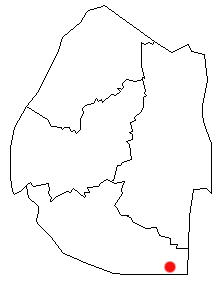
Shiselweni II (sometimes called Mbangweni) is an inkhundla, or administrative subdivision, of Eswatini, located in the Shiselweni District. Its population as of the 2007 census was 20,067.
Shiselweni II (sometimes called Mbangweni) is an inkhundla, or administrative subdivision, of Eswatini, located in the Shiselweni District. Its population as of the 2007 census was 20,067.

Eswatini, is a country in Southern Africa lying between Mozambique and South Africa. The country is located at the geographic coordinates 26°30′S31°30′E. Eswatini has an area of 17,363 square kilometres, of which 160 are water. The major regions of the country are Lowveld, Midveld and Highveld.

Manzini is a region of Eswatini, located in the center-west of the country. It has an area of 4,093.59 km² and a population of 355,945 (2017). Its administrative center is Manzini. It borders all three other regions of Eswatini: Hhohho in the north, Lubombo in the east, and Shiselweni in the south. It is bordered by the Mpumalanga province in South Africa to the west.

Shiselweni is a region of Eswatini, located in the south of the country. It has an area of 3,786.71 km² and a population of 204,111 (2017). Its administrative center is Nhlangano. It borders Lubombo in the northeast and Manzini Region in the northwest.

Lavumisa is a town located in the Shiselweni district of southern Eswatini.
Gege is a town in the Shiselweni district of southern Eswatini.
Mahamba is a town in the Shiselweni district of southern Eswatini.
Somntongo is an inkhundla of Eswatini, located in the Shiselweni District. Its population as of the 2007 census was 5,457.
Hosea is an inkhundla of Eswatini, located in the Shiselweni District, with 19,608 people as of 2007.
Kubuta is an inkhundla of Eswatini, located in the Shiselweni District. Its population as of the 2007 census was 6,922.
Maseyisini is an inkhundla of Eswatini, located in the Shiselweni District. Its population as of the 2007 census was 27,967.
Matsanjeni South is an inkhundla of Eswatini, located in the Shiselweni District. Its population as of the 2007 census was 16,238.
Mtsambama is an inkhundla of Eswatini, located in the Shiselweni District. Its population as of the 2007 census was 18,900. The chiefdoms or imiphakatsi falling under Mtsambama are KaMbhoke, Bhanganoma, Ekwendzeni, Magele and Gwegwe.
Ngudzeni is an inkhundla of Eswatini, located in the Shiselweni District. Its population as of the 2007 census was 8.056. Ngudzeni is also a community currently ruled by the late King Maja the Second. Ngudzeni is located between Nhlangano Town and Big Bend. Ngudzeni Community is named after Ingudze mountain, a mountain with a unique and diverse ecosystem which has become a source off wood and grazing ground for people of the community
Nkwene is an inkhundla of Eswatini, located in the Shiselweni District. Its population as of the 2007 census was 7,167.
Sandleni is an inkhundla of Eswatini, located in the Shiselweni District. Its population as of the 2022 census was 20,210. Sandleni is located approximately 29 km from Hlatikulu Town. The area is characterised by beautiful mountains and forms part of the historic Mbulungwane mountain.
Shiselweni I is an inkhundla of Eswatini, located in the Shiselweni District. Its population as of the 2007 census was 12,823.
Sigwe is an inkhundla of Eswatini, located in the Shiselweni District. Its population as of the 2007 census was 11,776.
Zombodze is a village in Shiselweni, Eswatini. Its population as of the 2007 census was 16,067.

Lubombo is a region of Eswatini, located in the east of the country. It has an area of 5,849.11 km² and a population of 212,531 (2017). Its administrative center is Siteki. It borders all three other regions: Hhohho to the north, Manzini to the west, and Shiselweni to the south. It is divided into 11 tinkhundla.