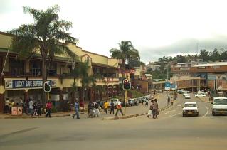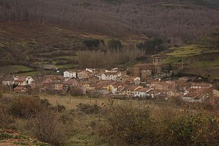
Mbabane is the capital and largest city in Eswatini. With an estimated population of 94,874 (2010), it is located on the Mbabane River and its tributary the Polinjane River in the Mdzimba Mountains. It is located in the Hhohho Region, of which it is also the capital. The average elevation of the city is 1243 meters. It lies on the MR3 road.

Nidaros Township is a township in Otter Tail County, Minnesota, United States. The population was 317 at the 2000 census.

Tadjena is a town in the Dahra mountains in Chlef Province in central Algeria, with a population of about 23,000; its altitude is 438 m.
Rocky Spruit is a village in the province of Mashonaland East, Zimbabwe. It is located on the Mupfure River in the Chiota communal land about 50 kilometres (31 mi) south of Harare.

Patchewollock is a town in north-west Victoria, Australia. At the 2016 census, Patchewollock had a population of 133.
German submarine U-317 was a Type VIIC/41 U-boat of Nazi Germany's Kriegsmarine during World War II.

Beba Veche is a commune in Timiș County, Romania. It is composed of three villages: Beba Veche, Cherestur and Pordeanu.

Fresneda de la Sierra Tirón is a municipality located in the province of Burgos, Castile and León, Spain. According to the 2004 census (INE), the municipality has a population of 115 inhabitants.

Jarmot Kalan is a town, Union council and administrative subdivision of Gujar Khan Tehsil in the Punjab Province of Pakistan.

Poiana Stampei is a commune located in Suceava County, Romania. It is composed of seven villages: Căsoi, Dornișoara, Pilugani, Poiana Stampei, Prăleni, Tătaru and Teșna. It is crossed by the E58 road. It is located on the border between Moldavia and Transylvania, and it was first mentioned in documents in 1593, during the reign of Aron Voda.

Bunești is a commune located in Suceava County, Romania. It is composed of five villages: Bunești, Petia, Podeni, Șes and Uncești.

Karwowo is a village in the administrative district of Gmina Stawiski, within Kolno County, Podlaskie Voivodeship, in north-eastern Poland. It lies approximately 6 kilometres (4 mi) south of Stawiski, 17 km (11 mi) south-east of Kolno, and 73 km (45 mi) west of the regional capital Białystok.

Babańce, is a village in the administrative district of Gmina Sejny, within Sejny County, Podlaskie Voivodeship, in north-eastern Poland, close to the border with Lithuania. It lies approximately 4 kilometres (2 mi) north-west of Sejny and 114 km (71 mi) north of the regional capital Białystok.
The Mangrove Creek, a perennial river that is part of the Hawkesbury-Nepean catchment, is located in the Central Coast region of New South Wales, Australia.

Ân Tình is a commune (xã) and village in Na Rì District, Bắc Kạn Province, in Vietnam.
Mbabane East is an inkhundla of Swaziland, located in the Hhohho District. Its population as of the 2007 census was 36,792.

Mnquma Local Municipality is an administrative area in the Amatole District of the Eastern Cape in South Africa.


