
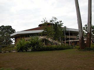
Lilongwe is the capital and most populated city of the African country of Malawi. It has a population of 989,318 as of the 2018 Census, up from a population of 674,448 in 2008. In 2020 that figure was 1,122,000. The city is located in the central region of Malawi, in the district of the same name, near the borders with Mozambique and Zambia, and it is an important economic and transportation hub for central Malawi. It is named after the Lilongwe River.

The British Central Africa Protectorate (BCA) was a British protectorate proclaimed in 1889 and ratified in 1891 that occupied the same area as present-day Malawi: it was renamed Nyasaland in 1907. British interest in the area arose from visits made by David Livingstone from 1858 onward during his exploration of the Zambezi area. This encouraged missionary activity that started in the 1860s, undertaken by the Universities' Mission to Central Africa, the Church of Scotland and the Free Church of Scotland, and which was followed by a small number of settlers. The Portuguese government attempted to claim much of the area in which the missionaries and settlers operated, but this was disputed by the British government. To forestall a Portuguese expedition claiming effective occupation, a protectorate was proclaimed, first over the south of this area, then over the whole of it in 1889. After negotiations with the Portuguese and German governments on its boundaries, the protectorate was formally ratified by the British government in May 1891.

Zadar County is a county in Croatia, it encompasses northern Dalmatia and southeastern Lika. Its center is the city of Zadar.
Zomba is a city in southern Malawi, in the Shire Highlands. It is the former capital city of Malawi.
Rumphi is the capital of the Rumphi District in the Northern Region of Malawi. It is a lively town with a market which serves the widespread tobacco farming community. Rumphi is noted for the kindness of the people. It is directly on the way to Nyika National Park, Nyika Plateau, Vwaza Marsh Game Reserve. Unlike its larger neighbour, Mzuzu, which has mild sunny weather almost all year, Rumphi has a differing climate. The town, being surrounded by hills, always has a nice wind. The town is bounded by the Rumphi river in the east and the South_Rukuru_River in the south.
Salima is a township in the Central Region of Malawi and the capital of the Salima District.

Liwonde, or Livonde, is a township in the Southern Region of Malawi.

Mangochi is a township in the Southern Region of Malawi. Located near the southern end of Lake Malawi, in colonial times it used to be called Fort Johnston. As of 2018 it has a population of 53,498.

Mulanje, formerly called Mlanje, is a town in the Southern Region of Malawi, close to the border with Mozambique, to the east. It is near the Mulanje Massif.

Nsanje is the main city in Nsanje District within the Southern Region of Malawi.

The city of Chipata is the administrative centre of the Eastern Province of Zambia and Chipata District. It was declared the 5th city of the country, after Lusaka, Ndola, Kitwe and Livingstone, by President Edgar Lungu on 24 February 2017. The city has undergone rapid economic and infrastructure growth in the years, leading up to city status.
Talitsa is a town and the administrative center of Talitsky District of Sverdlovsk Oblast, Russia, located on the right bank of the Pyshma River, near the Yekaterinburg–Tyumen segment of Trans-Siberian Railway, 219 kilometers (136 mi) east of Yekaterinburg. Population: 16,225 (2010 Census); 18,860 (2002 Census); 19,888 (1989 Census).
Chiromo is a town in southern Malawi by the Shire River.
Sankulani is a town in southern Malawi.
Bangula is a town of about 5000 population in southern Malawi. There is also a commune of the same name. Its elevation is 100m. It is located on the western bank of the Shire River, near the confluence of the Shire and Ruo River. After extensive flooding in Chiromo, the municipalities were moved to Bangula. The name Bangula is roughly translated to 'place where the lions roar' – although few to no lions exist in the area anymore.
Nkaya, also known as Nacaia, is a town in Malawi, located in the district of Balaka and in the Southern Region of the country.
Sers, also Le Sers or Es Sers, is a town and commune in the Kef Governorate, Tunisia. It is located 35.5 kilometres (22.1 mi) by road southeast of El Kef. As of 2004 it had a population of 11,927. Its economic activity is mainly dominated by agriculture, including cereal production.
Kondapaturu is a village in Kakumanu Mandal in the Guntur District of Andhra Pradesh, India. It is located 35 km (22 mi) south of the main district of Guntur, 3 km (1.9 mi) from Kakumanu, and 296 km (184 mi) from Hyderabad, the state capital. Between March and April, Thirunalla is celebrated by 200,000 to 300,000 visiting worshippers every year.
Mwanza is a town in Malawi on the border with Mozambique. It is the administrative headquarters for Mwanza District.
Burning of charcoal and wood fuel provides approximately 94 percent of the energy in Malawi. Much of the renewable hydroelectric potential of the country is untapped. As per 2018 Population and Housing Census, the national electrification rate in Malawi was 10%, with 37% of the urban population and only 2% of the rural population having access to electricity.
