Lynchat

Last updated

Lynchat
Raitts Cave - geograph.org.uk - 1725645.jpg
Raitts Cave A souterrain near Lynchat which dates to the later Iron Age (around AD 100-400). A stone built underground chamber, in a horseshoe shape, believed by archaeologists to have been used as a secure and cool storage chamber for food supplies. It was first excavated in 1835.
Badenoch and Strathspey UK location map.svg
Red pog.svg
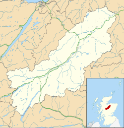
Lynchat
Location within the Badenoch and Strathspey area
OS grid reference NH784018
Council area
Country Scotland
Sovereign state United Kingdom
Post town Kingussie
Postcode district PH21 1
Police Scotland
Fire Scottish
Ambulance Scottish
List of places
UK
Scotland
57°05′31″N4°00′29″W / 57.09193°N 4.0081°W / 57.09193; -4.0081

Lynchat (Scottish Gaelic : Lainn a' Chait) is a small residential settlement, situated 2 miles northeast of Kingussie in Inverness-shire, Scottish Highlands [1] and is in the Scottish council area of Highland. [2]

The River Spey which rises in Loch Insh and the Insh Marshes located 1–2 miles south and east of the settlement, passes the villages to the south. The main A9 road passes to the north of Lynchat.

Related Research Articles

<span class="mw-page-title-main">Badenoch</span> Traditional district in Scotland

Badenoch is a district of the Scottish Highlands centred on the upper reaches of the River Spey, above Strathspey. The name Badenoch means the drowned land, with most of the population living close to the River Spey or its tributaries.

<span class="mw-page-title-main">Seil</span> Island in Scotland

Seil is one of the Slate Islands, located on the east side of the Firth of Lorn, 7 miles southwest of Oban, in Scotland. Seil has been linked to the mainland by bridge since the late 18th century.

<span class="mw-page-title-main">River Spey</span> River in Scotland

The River Spey is a river in the northeast of Scotland. At 107 mi (172 km) it is the ninth longest river in the United Kingdom and the third longest and fastest-flowing river in Scotland. It is an important location for the traditions of salmon fishing and whisky production in Scotland.

<span class="mw-page-title-main">Insh Marshes</span>

Insh Marshes are an area of floodplain of the River Spey between Kingussie and Kincraig in Badenoch and Strathspey, Highland, Scotland. The marshes are said to be one of the most important wetlands in Europe. They lie at altitude of approximately 240 to 220 m above sea level, and form one of the largest areas of floodplain mire and fen vegetation in Scotland.

<span class="mw-page-title-main">Loch Insh</span> Freshwater loch in Highlands, Scotland

Loch Insh is a loch in Highlands region, Scotland.

Achnaconeran is a remote crofting settlement in the Inverness committee area of Highland and is in the Scottish council area of Highland. Achnaconeran is on the northern bank of Loch Ness about 22 miles (35 km) south-west from Inverness and 6 miles (9.7 km) north-east from Fort Augustus.

<span class="mw-page-title-main">Aird of Sleat</span> Human settlement in Scotland

Aird of Sleat is a village on the Isle of Skye in Scotland. It is located at the southern end of the Sleat peninsula, 4 miles southeast of Ardvasar and Armadale, at the end of a minor road.

<span class="mw-page-title-main">Banavie</span> Human settlement in Scotland

Banavie is a small settlement near Fort William in the Highland Council Area of Scotland. One of the closest villages to Ben Nevis, it is about 4 kilometres northeast of Fort William town centre, next to Caol and Corpach.

<span class="mw-page-title-main">A146 road</span> A road in East Anglia, England

The A146 is an A road that connects Norwich in Norfolk and Lowestoft in Suffolk, two of East Anglia's largest population centres. It is around 27 miles (43 km) in length and has primary classification along its entire route. It is mainly single carriageway throughout its route, with the exception of a section of dual carriageway on the southern edge of Norwich.

<span class="mw-page-title-main">Uigshader</span> Human settlement in Scotland

Uigshader is a settlement on the Isle of Skye in Scotland.

<span class="mw-page-title-main">Kincraig</span> Human settlement in Scotland

Kincraig is a village located north of Kingussie and south of Aviemore in Highland, Scotland. Its original name was Boat of Inch, reflecting the ferry boat crossing of the Spey River that once operated here but the name was changed after a single track bridge was erected in 1871.

<span class="mw-page-title-main">Achnahanat</span> Human settlement in Scotland

Achnahanat is a crofting settlement on the south side of the Kyle of Sutherland in Scotland. It is about 4 miles west of Invershin in Sutherland, within the Scottish council area of Highland.

Auckengill is a settlement, 6 miles south of John o' Groats, on the east coast of Caithness, within the Scottish council area of Highland.

<span class="mw-page-title-main">Insh</span> Human settlement in Scotland

Insh is a village in Highland, Scotland that lies on the east coast of the Insh Marshes. It is in the Badenoch and Strathspey area, around 3+12 miles east of Kingussie, in the Spey valley. It is located in historic Inverness-shire. The B970 road from Kingussie to Kincraig and Aviemore passes through the village. At the other side of the valley is the major A9 road from Inverness to the Central Belt. Along the road towards Ruthven Barracks is the small Speyside Distillery.

<span class="mw-page-title-main">Insh Island</span> Island in Argyll and Bute, Scotland

Insh Island or simply Insh is an uninhabited island west of the island of Seil in the Firth of Lorn, Scotland.

Clephanton is a small hamlet 2 miles south-east from Ardersier and 7 miles south-west of Nairn in Inverness-shire, Scottish Highlands. It is in the Scottish council area of Highland. Some notable features near the settlement include the Kilravock Castle and the Nairn River.

<span class="mw-page-title-main">River Tromie</span> Right bank tributary of the River Spey in northeast Scotland

The River Tromie is a right bank tributary of the River Spey in northeast Scotland. It emerges from the northern end of Loch an t-Seilich within the Gaick Forest and flows northwards, then northwestwards down through Glen Tromie to Bhran Cottage where it turns to the north-northeast. It is bridged by the B970 road at Tromie Bridge near Drumguish and flows a further 1.25 miles (2 km) northwest to meet the Spey near Lynchat.

<span class="mw-page-title-main">East Highland Way</span>

The East Highland Way is a long-distance walking route in Scotland that connects Fort William (56.8178°N 5.1109°W) with the ski and mountain resort of Aviemore (57.1899°N 3.8292°W). The route was described by Kevin Langan in 2007. The name is derived from the fact that the route terminates in Aviemore at the eastern edge of Highland region. The EHW route takes in a varied and wild landscape through deep forest plantations, passing many highland lochs and negotiating unspoilt marshlands. The route also explores the ancient Caledonian forests of Inshriach. The walk is 82 miles (132 km) long.

<span class="mw-page-title-main">Asknish Bay</span> Bay on the west coast of Scotland

Asknish Bay is a small, remote, southwest-facing coastal embayment, located next to the small settlement of Arduaine within Argyll and Bute, Scotland. To the east of the bay lies Arduaine Point, which makes up the west most southern coast of Loch Melfort to the north. It is 12 miles (20 km) south southwest of large west coast town of Oban.

<span class="mw-page-title-main">Machrihanish Bay</span> Embayment within Argyll and Bute, Scotland

Machrihanish Bay is a large remote tidal north by northeast coastal facing embayment, located next to the Campbeltown Airport within Argyll and Bute, Scotland. It is located on the west coast of the Kintyre peninsula. Machrihanish Bay has the longest continuous stretch of sand in Argyll.

References

  1. Microsoft; Nokia. "Lynchat" (Map). Bing Maps . Microsoft. Retrieved 26 February 2017.
  2. Gittings, Bruce; Munro, David. "Lynchat". The Gazetteer for Scotland. School of GeoSciences, University of Edinburgh and The Royal Scottish Geographical Society. Retrieved 7 February 2019.