Related Research Articles
Transport in Tanzania includes road, rail, air and maritime networks. The road network is 86,472 kilometres (53,731 mi) long, of which 12,786 kilometres (7,945 mi) is classified as trunk road and 21,105 kilometres (13,114 mi) as regional road. The rail network consists of 3,682 kilometres (2,288 mi) of track. Commuter rail service is in Dar es Salaam only. There are 28 airports, with Julius Nyerere International being the largest and the busiest. Ferries connect Mainland Tanzania with the islands of Zanzibar. Several other ferries are active on the countries' rivers and lakes.
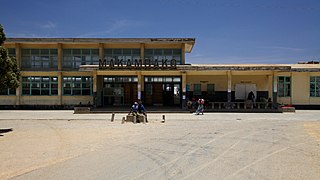
The Tazara Railway, also called the Uhuru Railway or the Tanzam Railway, is a railway in East Africa linking the port of Dar es Salaam in east Tanzania with the town of Kapiri Mposhi in Zambia's Central Province. The single-track railway is 1,860 km (1,160 mi) long and is operated by the Tanzania-Zambia Railway Authority (TAZARA).

Mbeya Region is one of Tanzania's 31 administrative regions. The region covers an area of 35,954 km2 (13,882 sq mi). The region is comparable in size to the combined land area of the nation state of Guinea Bissau. Mbeya Region is bordered to the east by Singida Region, Iringa Region and Njombe Region. The region is bordered to the south by Malawi and Lake Nyasa. To the north the region borders southern Tabora Region. Lastly, Mbeya is bordered to the west by Songwe Region. The regional capital is the city of Mbeya. According to the 2012 national census, the region had a population of 2,707,410.

Uyui District is one of the seven districts of the Tabora Region of Tanzania. It is bordered to the north by Nzega District and Igunga District as well as by the Shinyanga Region, to the south by Sikonge District, to the west by Urambo District and Kaliua District, and to the east by the Singida Region. Tabora Urban District is an enclave within the Uyui District. Its administrative seat is the city of Tabora.

Tabora Urban is one of the seven districts in the Tabora Region of Tanzania. This district is mostly the city of Tabora and its suburbs. It is bordered almost completely by the Uyui District. It has a small border with Nzega District to the north. Its administrative seat is the city of Tabora.

Same is one of the seven districts of the Kilimanjaro Region of Tanzania. It is bordered to the north by the Mwanga District, to the northeast by Kenya, to the south and southeast by the Korogwe District and Lushoto District of Tanga Region, and to the west by Simanjiro District of Manyara Region. The district capital is the town of Same, Tanzania. The south Pare Mountains are located within the district's boundaries and so is a part of Mkomazi National Park. According to the 2002 Tanzania National Census, the population of the Same District was 212,235. The population had risen to 269,807 according to the 2012 Tanzania National Census.

Njombe District is a former district of the Iringa Region of Tanzania. The current Njombe districts are Njombe Rural District and Njombe Urban District.

Mbarali District is one of the seven districts of Mbeya Region, Tanzania. It is bordered to the north by Iringa region and east by Njombe region. To the south the district is bordered by Mbeya Rural District and to the west by Chunya District.

Manyoni District is one of the six districts in the Singida Region of Tanzania. The district capital is the town of Manyoni. The district is bordered to the north by the Ikungi District, to the east by the Dodoma Region, to the south by the Iringa Region, to the southwest by the Mbeya Region and to the west by the Tabora Region. In 2015 the Itigi District was created from the Manyoni District, separating the Itigi Division that was the large portion of the south western of the district.

Geita District is located in the Geita Region of Tanzania. According to the 2012 census, the population of the district was 807,619. The district is bordered to the east by Mwanza Region and Nyang'hwale District, to the south by Shinyanga Region and Mbogwe District, and to the west by Chato District.
Igurusi is an administrative ward in the Mbarali district of the Mbeya Region of Tanzania. In 2016 the Tanzania National Bureau of Statistics report there were 24,573 people in the ward, from 22,296 in 2012.

Dodoma Urban District is one of the seven districts of the Dodoma Region of Tanzania. It is bordered to the west by Bahi District, and to the east by Chamwino District. Its administrative seat is the city of Dodoma, also the legislative capital of Tanzania.
Makambako is a medium-sized town and district in the Njombe Region of the Tanzanian Southern Highlands, located roughly 40 miles north of Njombe city by road. It is located at junction of the A104 and B4 roads between Njombe, Iringa, and Mbeya. Its population according to the 2002 Tanzanian census was 51,049.

Njombe is a town in southern Tanzania. It is the regional capital of Njombe Region as well as the district headquarter of Njombe Rural District and Njombe Urban District. It is located at nearly 2000 meters of altitude on the eastern edge of the Kipengere Range and has the reputation of being a cold town.

Njombe Region is one of Tanzania's 31 administrative regions. The region covers a land area of 21,347 km2 (8,242 sq mi). The region is comparable in size to the combined land area of the nation state of El Salvador. Njombe Region is bordered to the north by the Iringa Region and Mbeya Region, to the east by Morogoro Region, to the south by the Ruvuma Region and to the west by Lake Nyasa. The regional capital is the municipality of Njombe. According to the 2012 national census, the region had a population of 702,097.

Kaliua District is one of the seven districts of the Tabora Region of Tanzania. It is bordered to the north by Kahama and Ushetu Districts, to the east by Uyui District and Urambo District, to the south by Katavi Region and to the west by Uvinza District and Geita Region. Its administrative seat is the town of Kaliua.

The Tanzam Highway leads from Lusaka in Zambia to Dar es Salaam in Tanzania. The highway was built from 1968 to 1973 in several stages and was intended to provide seaport access for Zambia and to expand the transport options for Zambia, Malawi and the then Zaire.

Korogwe Urban District is one of the eleven districts of the Tanga Region of Tanzania. The District covers an area of 225.3 km2 (87.0 sq mi). Korogwe Urban District is bordered to the north by Korogwe Rural District and to the south by Handeni Rural District. The administrative capital of the district is Korogwe town. According to the 2012 Tanzania National Census, the population of Korogwe Urban District was 68,308.

Msalala District is a district council in the Shinyanga Region of Tanzania's lake zone established in 2012. The district lies in the middle of the region just north-east of the town of Kahama.
References
- ↑ Citypopulation.de
- 1 2 "Census 2012". National Bureau of Statistics. Archived from the original on 5 March 2016. Retrieved 9 December 2015.
- ↑ "Njombe Roads Network" (PDF). Tanroads. Archived from the original (PDF) on 10 May 2017. Retrieved 14 February 2016.
- ↑ "Express Train Timetable" (PDF). TAZARA Railway Authority. Archived from the original (PDF) on 28 May 2016. Retrieved 14 February 2016.