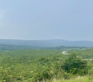
Sengerema District is one of seven districts in the Mwanza Region of Tanzania, East Africa. Its administrative headquarter is located in Sengerema city. It is bordered to the north and east by Lake Victoria, to the south by Geita Region and to the southeast by the Misungwi District. Sengerema district is known for having numerous lake islands in its territory the largest are Maisome Island and Kome Island.

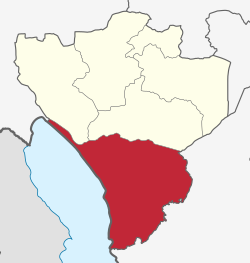
Mbarali District is one of the seven districts of Mbeya Region, Tanzania. It is bordered to the north by Iringa region and east by Njombe region. To the south the district is bordered by Mbeya Rural District and to the west by Chunya District.
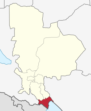
Kyela is one of the seven districts of Mbeya Region, Tanzania. It is bordered to the north by Rungwe District, to the northeast by Njombe Region, to the southeast by Lake Nyasa, to the south by Malawi and to the west by Ileje District.
As of 2021, there are 31 regions of Tanzania which are divided into 184 districts.
Manda is an administrative ward in Ludewa District in the Njombe Region of Tanzania. In 2016 the Tanzania National Bureau of Statistics report there were 4,443 people in the ward, from 4,304 in 2012.
Kalenga is an administrative ward in the Iringa Rural district of the Iringa Region of Tanzania. In 2016 the Tanzania National Bureau of Statistics reported its population to be 7,286, up from 6,963 in 2012.
Kitanzini is an administrative ward in the Iringa Urban district of the Iringa Region of Tanzania. In 2016, the Tanzania National Bureau of Statistics reported that there are 3,785 people in the ward, from 3,617 in 2012.
Kitwiru is an administrative ward in the Iringa Urban district of the Iringa Region of Tanzania. In 2016 the Tanzania National Bureau of Statistics report there were 11,992 people in the ward, from 11,461 in 2012.
Mtwivila is an administrative ward in the Iringa Urban district of the Iringa Region of Tanzania. In 2016 the Tanzania National Bureau of Statistics report there were 11,174 people in the ward, from 21,017 in 2012.
Mwangata is an administrative ward in the Iringa Urban district of the Iringa Region of Tanzania. In 2016 the Tanzania National Bureau of Statistics report there were 14,111 people in the ward, from 13,486 in 2012.
Idamba is a town and ward in Njombe district in the Iringa Region of the Tanzanian Southern Highlands. In 2016 the Tanzania National Bureau of Statistics report there were 3,250 people in the ward, from 3,148 in 2012.
Igongolo is a town and ward in Njombe district in the Iringa Region of the Tanzanian Southern Highlands. In 2016 the Tanzania National Bureau of Statistics report there were 8,720 people in the ward, from 8,447 in 2012.

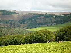
Luponde is a town and ward in Njombe Urban District in the Njombe Region of the Tanzanian Southern Highlands. The biggest employer is the Luponde tea factory.
Mahongole is a town and ward in Njombe district in the Iringa Region of the Tanzanian Southern Highlands. In 2016 the Tanzania National Bureau of Statistics report there were 9,520 people in the ward, from 9,222 in 2012.

Uwemba is a town and ward in Njombe District in the Iringa Region of the Tanzanian Southern Highlands. Uwemba has a big Benedictines monastery and Secondary school. Economic activities includes agriculture and business.
Kigoma District is one of the eight administrative districts of Kigoma Region in Tanzania. The district lies north of the city of Kigoma-Ujiji. Uvinza District, to the west and south of Ujiji, was split off from the Kigoma District in 1 July, 2013.
Simbo is an administrative ward in Kigoma Rural District of Kigoma Region in Tanzania. Prior to 2014 the ward was in the Uvinza District before moving to the Kigoma District.

Buchosa District, is a district in the Mwanza Region in the southern coastal Tanzania. The district is on the south shore of Lake Victoria west of the city of Mwanza and north of the Geita Region. Much of the district is large islands in the lake. The district was established in 2015.

Itigi District is a district council in the Singida Region of central Tanzania established in 2015. The district lies in the south-western portion of the Singida Region with 279,069 people and encompasses a large area mostly made up of protected game reserves.

Msalala District is a district council in the Shinyanga Region of Tanzania's lake zone established in 2012. The district lies in the middle of the region just north-east of the town of Kahama.
 Raw Tea bags before processing at Luponde tea factory in the rear 1992
 Coal mining in the Ludewa District near the Lake Nyassa
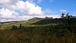 Liganga iron mountain in Ludewa District
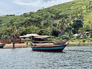
 A ferry across the Ruhuhu river in Tanzania