The Battle of Loon Lake, also known as the Battle of Steele Narrows, concluded the North-West Rebellion on June 3, 1885, and was the last battle fought on Canadian soil. It was fought in what was then the District of Saskatchewan of the North-West Territories, at what is now known as Steele Narrows at Makwa Lake, in Saskatchewan's Steele Narrows Provincial Park. Steele Narrows is a channel that separates Sanderson Bay from Makwa Lake.

Loon Lake is a village in the Canadian province of Saskatchewan within the Rural Municipality of Loon Lake No. 561 and Census Division No. 17. The Makwa Sahgaiehcan First Nation reserve is to the east of the village. The village is located on Highway 26 north-east of the city of Lloydminster.

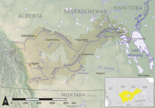
Division No. 17 is one of eighteen census divisions in the province of Saskatchewan, Canada, as defined by Statistics Canada. It is located in the west-northwest part of the province, bordering Alberta. The most populous community in this division is the interprovincial city of Lloydminster. Another important population centre is the town of Meadow Lake.

Beaver River is a large river in east-central Alberta and central Saskatchewan, Canada. It flows east through Alberta and Saskatchewan and then turns sharply north to flow into Lac Île-à-la-Crosse on the Churchill River which flows into Hudson Bay.
Torch River is a river in the Canadian province of Saskatchewan. The river's source is the dam at Candle Lake, near Candle Lake Provincial Park, and it travels east through boreal forest and muskeg en route to its mouth in the Saskatchewan River Delta. Torch River Provincial Forest, a conservation area, is located along the course of the river, near where White Fox River flows into Torch River. Torch River is a significant tributary of the Saskatchewan River and it is part of the Hudson Bay drainage basin.
Fowler Lake is a lake in the Canadian province of Saskatchewan. The lake is in the RM of Loon Lake No. 561, west of Makwa Lake and Makwa Lake Provincial Park. West of and upstream of Fowler Lake is Murphy Lake, which is separated by an isthmus and connected by a short stream. Fowler Lake's outflow is at the eastern end and it flows eastward meandering through forest and muskeg before emptying into Makwa Lake. Access to the lake and its amenities is from Highway 699.

Pipestone Creek is a river in the Souris River watershed. Its flow begins in southeastern Saskatchewan, just south of the town of Grenfell and travels in a southeastern direction into Manitoba in the Westman Region where it empties into Oak Lake through the Oak Lake Marsh.

Thunder Creek is a river in the Canadian province of Saskatchewan. The watershed of Thunder Creek is within the semi-arid Palliser's Triangle in south-central Saskatchewan. It begins at small, man-made reservoir near Lake Diefenbaker and flows in a south-easterly direction towards the city of Moose Jaw and the Moose Jaw River. The Moose Jaw River is a major tributary of the Qu'Appelle River For most of its course, Thunder Creek follows a valley called the Thunder Creek meltwater channel that was formed over 10,000 years ago near the end of the last ice age.
The Cub Hills are a hilly plateau located south-east of the geographical centre of the Canadian province of Saskatchewan. The hills are in the boreal forest ecozone of Canada and the landforms of the hills were shaped more than 10,000 years ago during last ice age. Throughout the Cub Hills, there are dozens of lakes and rivers and several parks. The Cubs Hills are 150 km (93 mi) north-east of Prince Albert and are in the Northern Saskatchewan Administration District and Census Division #18. Several highways criss-cross the plateau to provide access to the various parks and other amenities.

Crescent Creek is a river in the south-east region of the Canadian province of Saskatchewan. The river begins in the Beaver Hills and flows in an easterly direction into Crescent Lake. Crescent Creek is a tributary of Yorkton Creek, which flows north into the Whitesand River–a tributary of the Assiniboine River.

Cowan River is a river in the west-central part of the Canadian province of Saskatchewan in the boreal forest ecozone of Canada. The river begins at Cowan Lake Dam near the northern end of Cowan Lake and flows north-west through muskeg and forest to meet Beaver River. Beaver River then flows into Lac Île-à-la-Crosse and the Churchill River. The entirety of Cowen River is within the Northern Saskatchewan Administration District and while there are no communities along its course, the towns of Big River and Spiritwood are in its watershed.

Christopher Lake is a recreational lake in the boreal forest ecozone in the Canadian province of Saskatchewan. It is located south-east of Emma Lake and Great Blue Heron Provincial Park in the central part of the province in the District of Lakeland No. 521. Access to Christopher Lake is from Highways 953 and 263 and it is about 42 km (26 mi) north of the city of Prince Albert.

Spruce River, also called Little Red River, is a river in the north-central region of the Canadian province of Saskatchewan. It begins in the Waskesiu Hills in Prince Albert National Park and flows generally in a southward direction through boreal forests, glacier-carved hills and valleys, muskeg, and prairie en route to the North Saskatchewan River at the east end of the city of Prince Albert.
Makwa Lake, which is Cree for Loon Lake, is a lake in the west-central region of the Canadian province of Saskatchewan in the transition zone between parkland and boreal forest. The Battle of Loon Lake, which was last battle of the North-West Rebellion, happened at Steele Narrows, a strait at the entrance to Sanderson Bay on Makwa Lake. The site is now part of Steele Narrows Provincial Park.
Jumbo Lake is a lake in the Canadian province of Saskatchewan in the transition zone between parkland and boreal forest. It is also known as Big Jumbo Lake to differentiate it from adjoining Little Jumbo Lake. Big and Little Jumbo Lakes make up the heart of Makwa Lake Provincial Park and are part of several inter-connected lakes that include Makwa Lake and Upper Makwa Lake. The southern half of the lake is within Makwa Lake Provincial Park and the northern half is within Makwa Lake 129B Indian reserve. Access to both lakes is from Highway 699.
Makwa Lake Provincial Park is a recreational provincial park in the west-central region of the Canadian province of Saskatchewan in the transition zone between parkland and boreal forest. The park was established in 1986 and is centred around the lakes of Big Jumbo, Little Jumbo, and Makwa. Prior to its establishment, the park was a provincial recreation site. The main entrance to Makwa Lake Park is at the south-east corner of Makwa Lake about 3 kilometres (1.9 mi) west of the village of Loon Lake. Access is from Highway 699.
Steele Narrows Provincial Park is an historical provincial park in the west-central region of the Canadian province of Saskatchewan in the transition zone between parkland and boreal forest. It is located on Makwa Lake at Steele Narrows – the channel that separates Sanderson Bay from Makwa Lake – about 10 kilometres (6.2 mi) west of the village of Loon Lake along Highway 699. The park is the site of the Battle of Loon Lake, which was not only the last battle of the North-West Rebellion, but also the last battle fought on Canadian soil. The battle occurred on 3 June 1885.
Wood River is a river in the Canadian province of Saskatchewan. It has its source in the Wood Mountain Hills of south-western Saskatchewan and flows in a north-easterly direction to its mouth at Old Wives Lake. Old Wives Lake is a salt water lake with no outflow. As a result, the drainage basin of Wood River is an endorheic one. Along the course of the river, there are several parks, historical sites, and small towns.
Cypress Lake is an interbasin transfer reservoir in the Canadian province of Saskatchewan on the southern slopes of the Cypress Hills in the Rural Municipality of Reno No. 51. The reservoir was created by the damming of the east and west sides of a much smaller Cypress Lake in the late 1930s. There is a provincial recreation site on the southern shore and a wildlife refuge on Heglund Island in the lake. Access to the lake is from Township Road 60 off of Highway 21.
Bronson Forest Recreation Site is a provincial recreation park in the west-central region of the Canadian province of Saskatchewan. The park covers 15,240 hectares of the Bronson Forest in the Rural Municipality of Loon Lake No. 561. It encompasses the headwaters of the Monnery River and straddles the divide between the North Saskatchewan River and Beaver River. There are campgrounds, hiking trails, and multiple lakes accessible for recreation and fishing. Access to the park and its amenities is from Highway 21.


