Sucha County is a unit of territorial administration and local government (powiat) in Lesser Poland Voivodeship, southern Poland, on the Slovak border. Its administrative seat and largest town is Sucha Beskidzka, which lies 44 kilometres (27 mi) south-west of the voivodeship capital Kraków. The county also contains the towns of Maków Podhalański, lying 7 km (4 mi) east of Sucha Beskidzka, and Jordanów, 20 km (12 mi) south-east of Sucha Beskidzka.

Grójec County is a unit of territorial administration and local government (powiat) in Masovian Voivodeship, east-central Poland. It came into being on January 1, 1999, as a result of the Polish local government reforms passed in 1998. Its administrative seat and largest town is Grójec, which lies 40 kilometres (25 mi) south of Warsaw. The county contains three other towns: Warka, 25 km (16 mi) east of Grójec, Nowe Miasto nad Pilicą, 34 km (21 mi) south-west of Grójec, and Mogielnica, 22 km (14 mi) south-west of Grójec.

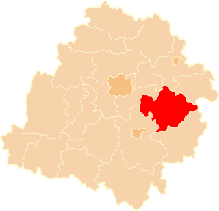
Mińsk County is a unit of territorial administration and local government (powiat) in Masovian Voivodeship, east-central Poland. It was (re)created on January 1, 1999, as a result of the Polish local government reforms passed in 1998. Its administrative seat and largest town is Mińsk Mazowiecki, which lies 39 kilometres (24 mi) east of Warsaw. The county contains three other towns: Sulejówek, 21 km (13 mi) west of Mińsk Mazowiecki, Halinów, 16 km (10 mi) west of Mińsk Mazowiecki, and Kałuszyn, 17 km (11 mi) east of Mińsk Mazowiecki.

Pruszków County is a unit of territorial administration and local government (powiat) in Masovian Voivodeship, east-central Poland. It came into being on January 1, 1999, as a result of the Polish local government reforms passed in 1998. Its administrative seat and largest town is Pruszków, which lies 15 kilometres (9 mi) west of Warsaw. The county also contains the towns of Piastów, lying 4 km (2 mi) north-east of Pruszków, and Brwinów, 7 km (4 mi) south-west of Pruszków.

Warsaw West County is a unit of territorial administration and local government (powiat) in Masovian Voivodeship, east-central Poland. It came into being on January 1, 1999, as a result of the Polish local government reforms passed in 1998. In spite of its name, the county does not include any part of the city of Warsaw proper.

Sochaczew County is a unit of territorial administration and local government (powiat) in Masovian Voivodeship, east-central Poland. It came into being on January 1, 1999, as a result of the Polish local government reforms passed in 1998. Its administrative seat and only town is Sochaczew, which lies 52 kilometres (32 mi) west of Warsaw.
Żyrardów County is a unit of territorial administration and local government (powiat) in Masovian Voivodeship, east-central Poland. It came into being on 1 January 1999, as a result of the Polish local government reforms passed in 1998. Its administrative seat and largest town is Żyrardów, which lies 43 kilometres (27 mi) south-west of Warsaw. The only other town in the county is Mszczonów, lying 11 km (7 mi) south-east of Żyrardów.

Grodzisk Mazowiecki County is a unit of territorial administration and local government (powiat) in Masovian Voivodeship, east-central Poland. It came into being on 1 January 1999, as a result of the Polish local government reforms passed in 1998. Its administrative seat and largest town is Grodzisk Mazowiecki, which lies 29 kilometres (18 mi) south-west of Warsaw. The county also contains the towns of Milanówek, lying 2 km (1 mi) north-east of Grodzisk Mazowiecki, and Podkowa Leśna, 8 km (5 mi) east of Grodzisk Mazowiecki.

Piaseczno County is a unit of territorial administration and local government (powiat) in Masovian Voivodeship, east-central Poland. It came into being on January 1, 1999, as a result of the Polish local government reforms passed in 1998. Its administrative seat and largest town is Piaseczno, which lies 17 kilometres (11 mi) south of Warsaw. The county contains three other towns: Konstancin-Jeziorna, 8 km (5 mi) east of Piaseczno, Góra Kalwaria, 18 km (11 mi) south-east of Piaseczno, and Tarczyn, 16 km (10 mi) south-west of Piaseczno.

Przasnysz County is a unit of territorial administration and local government (powiat) in Masovian Voivodeship, east-central Poland. It came into being on January 1, 1999, as a result of the Polish local government reforms passed in 1998. Its administrative seat and largest town is Przasnysz, which lies 90 kilometres (56 mi) north of Warsaw. The only other town in the county is Chorzele, lying 26 km (16 mi) north of Przasnysz.

Przysucha County is a unit of territorial administration and local government (powiat) in Masovian Voivodeship, east-central Poland. It came into being on January 1, 1999, as a result of the Polish local government reforms passed in 1998. Its administrative seat and only town is Przysucha, which lies 98 kilometres (61 mi) south of Warsaw.

Nowy Dwór Mazowiecki County is a unit of territorial administration and local government (powiat) in Masovian Voivodeship, east-central Poland. It came into being on January 1, 1999, as a result of the Polish local government reforms passed in 1998. Its administrative seat and largest town is Nowy Dwór Mazowiecki, which lies 33 kilometres (21 mi) north-west of Warsaw. The county also contains the towns of Nasielsk, lying 21 km (13 mi) north-east of Nowy Dwór Mazowiecki, and Zakroczym, 5 km (3 mi) west of Nowy Dwór Mazowiecki. Warsaw-Modlin Airport is located within the county. The county covers an area of 691.65 square kilometres (267.0 sq mi). As of 2006 its total population is 75,736, out of which the population of Nowy Dwór Mazowiecki is 27,545, that of Nasielsk is 7,364, that of Zakroczym is 3,367, and the rural population is 37,460.

Płońsk County is a unit of territorial administration and local government (powiat) in Masovian Voivodeship, east-central Poland. It came into being on January 1, 1999, as a result of the Polish local government reforms passed in 1998. Its administrative seat and largest town is Płońsk, which lies 63 kilometres (39 mi) north-west of Warsaw. The only other town in the county is Raciąż, lying 25 km (16 mi) north-west of Płońsk.

Ciechanów County is a unit of territorial administration and local government (powiat) in Masovian Voivodeship, east-central Poland. It came into being on January 1, 1999, as a result of the Polish local government reforms passed in 1998. Its administrative seat and largest town is Ciechanów, which lies 77 kilometres (48 mi) north of Warsaw. The only other town in the county is Glinojeck, lying 25 km (16 mi) west of Ciechanów.

Brzeziny County is a unit of territorial administration and local government (powiat) in Łódź Voivodeship, central Poland. It was created in 2002 out of the north-eastern part of Łódź East County. Its administrative seat and only town is Brzeziny, which lies 20 kilometres (12 mi) east of the regional capital Łódź.
Tomaszów Mazowiecki County is a unit of territorial administration and local government (powiat) in Łódź Voivodeship, central Poland. It came into being on January 1, 1999, as a result of the Polish local government reforms passed in 1998. Its administrative seat and only town is Tomaszów Mazowiecki, which lies 49 kilometres (30 mi) south-east of the regional capital Łódź.
Gmina Różan is an urban-rural gmina in Maków County, Masovian Voivodeship, in east-central Poland. Its seat is the town of Różan, which lies approximately 20 kilometres (12 mi) east of Maków Mazowiecki and 79 km (49 mi) north of Warsaw.