Related Research Articles
Taranaki is a region in the west of New Zealand's North Island. It is named after its main geographical feature, the stratovolcano of Mount Taranaki.

Tītokowaru's War was a military conflict that took place in the South Taranaki region of New Zealand's North Island from June 1868 to March 1869 between the Ngāti Ruanui Māori tribe and the New Zealand Government. The conflict, near the conclusion of the New Zealand wars, was a revival of hostilities of the Second Taranaki War as Riwha Tītokowaru, chief of the Ngāti Ruanui's Ngaruahine hapu (sub-tribe), responded to the continued surveying and settlement of confiscated land with well-planned and effective attacks on settlers and government troops in an effort to block the occupation of Māori land.

Inglewood is a town in the Taranaki Region of New Zealand's North Island. It is 16 kilometres (9.9 mi) southeast of New Plymouth on State Highway 3, close to Mount Taranaki/Egmont, and sits 200 metres (660 ft) above sea level. The town services a mainly dairy farming region. The population was 3,246 in the 2013 census, an increase of 156 from 2006.
Eltham is a small inland town in South Taranaki, New Zealand, located 50 kilometres (31 mi) south of the city of New Plymouth and southeast of the volcanic cone of Mount Taranaki/Egmont. Stratford is 11 kilometres (6.8 mi) north, Kaponga 13 km west, and Hāwera is 19 km (12 mi) south. State Highway 3 runs through the town.

South Taranaki is a territorial authority on the west coast of New Zealand's North Island that contains the towns of Hāwera, Manaia, Opunake, Patea, Eltham, and Waverley. The District has a land area of 3,575.46 km² and a population of 28,600. It is part of the greater Taranaki Region.

Manaia is a rural town in South Taranaki District, New Zealand. Opunake is 29 km to the northwest, and Hawera is 13 km to the southeast. Kaponga is 15 km north. State Highway 45 passes through the town. Manaia is named after the former Māori chief of the district, Hukunui Manaia.

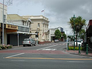
Normanby is a small village in South Taranaki, New Zealand. It is approximately 6 km inland from Hawera along State Highway 3. Eltham is 13 km further north. It is also situated on the Marton - New Plymouth Line railway, which has been freight-only through Normanby since the cessation of passenger railcar services between Wellington and New Plymouth on 30 July 1977.
Midhirst is a small village in Taranaki, New Zealand, approximately 4 km north of Stratford, on State Highway 3. Inglewood is 17 km (11 mi) north of Midhirst, and New Plymouth is 35 km (22 mi) to the northwest.
Mokoia is a small settlement in south Taranaki, in the western North Island of New Zealand. It is located on State Highway 3, 10 kilometres (6.2 mi) to the east of Hawera and about 17 km northwest of Patea.
Hurleyville is a community in south Taranaki, in the western North Island of New Zealand. It is located 18 kilometres north of Patea and 30 km southeast of Hawera.
Waipuku is a settlement in inland Taranaki, in the western North Island of New Zealand. It is located between Stratford and Inglewood on State Highway 3.
Urenui is a settlement in northern Taranaki, in the North Island of New Zealand. It is located on State Highway 3 close to the shore of the North Taranaki Bight, 13 kilometres east of Waitara and 6 km south-west of Mimi. The Urenui River flows past the settlement into the North Taranaki Bight.
Onaero is a settlement in northern Taranaki, in the North Island of New Zealand. It is located on State Highway 3 close to the shore of the North Taranaki Bight, 15 kilometres (9.3 mi) east of Waitara.
Tongaporutu is a settlement in northern Taranaki, in the North Island of New Zealand. It is located on State Highway 3 at the mouth of the Tongaporutu River, 15 kilometres south of Mokau.Tongaporutu is well known in New Zealand for its 'Three Sisters' rock formations and its Maori petroglyphs carved into cave rock walls. However,both the Maori rock carvings and the 'Three Sisters formations are constantly being eroded by the Tasman sea.
The Kupe natural gas field is located in the Tasman Sea, 30 km off the coast of the town of Manaia in Taranaki, New Zealand. The field was discovered in 1986 and is located in 35 metres of water. The production facility comprises an unmanned offshore platform, a 30 km single three phase pipeline to shore and an onshore production station.

The Tangahoe River is a river of the Taranaki Region of New Zealand's North Island. It flows generally southwest from its origins in hill country to the east of Lake Rotorangi, reaching the Tasman Sea in the South Taranaki Bight 5 km (3.1 mi) southeast of Hawera.
The Waingongoro River is a river of the Taranaki Region of New Zealand's North Island. It flows initially southeast from the slopes of Taranaki/Mount Egmont and passes through the town of Eltham before veering southwest to reach the coast five kilometres west of Hawera.

The Waiwhakaiho River is a river of the Taranaki Region of New Zealand's North Island. One of many rivers and streams radiating from the slopes of Taranaki/Mount Egmont, it flows initially northeast before veering northwest to reach the Tasman Sea close to the New Plymouth suburb of Fitzroy. Near the sea, it is crossed by the coastal walkway, connecting New Plymouth with Bell Block via the Te Rewa Rewa Bridge.
Bayly Park was a cricket ground in Hāwera, Taranaki, New Zealand. First-class cricket was first played there in 1892 when Taranaki played Hawke's Bay. A further first-class match came in 1895 when Taranaki played the touring Fijians, with another first-class fixture against Hawke's Bay following in 1897. The final first-class match played there came in 1898 when Taranaki played Canterbury. The ground still exists today, but first class cricket is no longer played there.
Tereingaornis moisleyi, also referred to as Moisley's penguin, is a genus and species of extinct penguin from the Middle Pliocene of New Zealand. It was slightly smaller than the extant Fiordland crested penguin. It was described by Ron Scarlett in 1983 from fossil material found by William Moisley near Te Reinga Falls on the Wairoa River, in the Hawke's Bay Region of the North Island. Another specimen was found later at Waihi Beach, Hawera, on the South Taranaki Bight. The genus name Tereingaornis combines the name of the type locality with the Greek ornis ("bird"); the specific epithet honours the discoverer of the fossil.
References
- ↑ Naish, Tim R.; Wehland, Florian; Wilson, Gary S.; Browne, Greg H.; Cook, Richard A.; Morgans, Hugh E. G.; Rosenberg, Michael; King, Peter R.; Smale, David; Nelson, Campbell S.; Kamp, Peter J. J.; Ricketts, Brian (2005). "An integrated sequence stratigraphic, palaeoenvironmental, and chronostratigraphic analysis of the Tangahoe Formation, southern Taranaki coast, with implications for mid-Pliocene (c. 3.4-3.0 Ma) glacio-eustatic sea-level changes". Journal of the Royal Society of New Zealand. 35 (1–2): 151–196. doi:10.1080/03014223.2005.9517780. hdl: 10289/3485 .
- ↑ "1:250,000 geological map Taranaki".
"Place name detail: Manawapou River". New Zealand Gazetteer. Land Information New Zealand . Retrieved 12 July 2009.
Coordinates: 39°39′S174°21′E / 39.650°S 174.350°E
| This article about a river in Taranaki is a stub. You can help Wikipedia by expanding it. |