
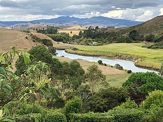
The Waikato River is the longest river in New Zealand, running for 425 kilometres (264 mi) through the North Island. It rises in the eastern slopes of Mount Ruapehu, joining the Tongariro River system and flowing through Lake Taupō, New Zealand's largest lake. It then drains Taupō at the lake's northeastern edge, creates the Huka Falls, and flows northwest through the Waikato Plains. It empties into the Tasman Sea south of Auckland, at Port Waikato. It gives its name to the Waikato region that surrounds the Waikato Plains. The present course of the river was largely formed about 17,000 years ago. Contributing factors were climate warming, forest being reestablished in the river headwaters and the deepening, rather than widening, of the existing river channel. The channel was gradually eroded as far up river as Piarere, leaving the old Hinuera channel through the Hinuera Gap high and dry. The remains of the old river path can be clearly seen at Hinuera where the cliffs mark the ancient river edges. The river's main tributary is the Waipa River, which has its confluence with the Waikato at Ngāruawāhia.

The Waipā River is in the Waikato region of the North Island of New Zealand. The headwaters are in the Rangitoto Range east of Te Kuiti. It flows north for 115 kilometres (71 mi), passing through Ōtorohanga and Pirongia, before flowing into the Waikato River at Ngāruawāhia. It is the Waikato's largest tributary. The Waipā's main tributary is the Puniu River.
Hakarimata Range is a range of hills on the western edge of Ngāruawāhia township, in the Waikato region of New Zealand, overlooking the confluence of the Waikato and Waipa Rivers. The Hakarimata Range is separated from the Taupiri Range by the Taupiri Gorge, through which the Waikato River flows.
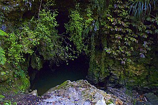
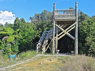
Waitomo is a rural community in the King Country region of New Zealand's North Island. There are several solutional cave systems in the area around the village, which are popular tourist attractions. Restaurants and accommodation are centred in the village to serve visiting tourists.
Otorohanga is a north King Country town in the Waikato region in the North Island of New Zealand. It is located 53 kilometres (33 mi) south of Hamilton and 18 kilometres (11 mi) north of Te Kuiti, on the Waipā River. It is a service town for the surrounding dairy-farming district. It is recognised as the "gateway" to the Waitomo Caves and as the "Kiwiana Town" of New Zealand. Until 2007, Otorohanga held a yearly 'Kiwiana Festival.'

Dacrycarpus dacrydioides or kahikatea is a coniferous tree endemic to New Zealand.

State Highway 3 (SH 3) is one of New Zealand's eight national state highways. It serves the west coast of the country's North Island and forms a link between State Highway 1 and State Highway 2. Distances are measured from north to south.
The Ōpārau River is a river of the Waikato Region of New Zealand's North Island in the area occupied by Ngāti Hikairo. It flows southwest from its sources in the Pirongia Forest Park, the highest being The Cone, and flows into the Kāwhia Harbour, 5 kilometres (3 mi) east of Kāwhia. The river has about 171 km (106 mi) of tributaries.
The Puniu River is a river of the Waikato Region of New Zealand's North Island. As a tributary of the Waipa River, and at a length of 57 kilometres (35 mi), it is one of the longest secondary tributaries in New Zealand.
The Whangamarino River is a lowland river of the Waikato Region of New Zealand's North Island, draining the Whangamarino Wetland and associated farmland catchment. The river converges with the Waikato River just north of Meremere. The main tributary is the Maramarua River, which starts in the Hunua Ranges and forms the northern catchment of the Whangamarino River.
The Waikato and King Country regions of New Zealand are built upon a basement of greywacke rocks, which form many of the hills. Much of the land to the west of the Waikato River and in the King Country to the south has been covered by limestone and sandstone, forming bluffs and a karst landscape. The volcanic cones of Karioi and Pirongia dominate the landscape near Raglan and Kawhia Harbours. To the east, the land has been covered with ignimbrite deposits from the Taupo Volcanic Zone. Large amounts of pumice from the Taupo Volcanic Zone have been deposited in the Waikato Basin and Hauraki Plains.

Pureora Forest Park is a 760-square-kilometre (290 sq mi) protected area in the North Island of New Zealand. Within its rich rainforest are an abundance of 1,000-year-old podocarp trees. It is "recognised as one of the finest rain forests in the world". Established in 1978, after a series of protests and tree sittings, the park is one of the largest intact tracts of native forest in the North Island and has high conservation value due to the variety of plant life and animal habitats. New Zealand's largest totara tree is located nearby on private land.
State Highway 39 (SH 39) is a New Zealand state highway that forms a western bypass of the city of Hamilton. Gazetted in 1999, it is a generally quicker route to get between Auckland and New Plymouth as well as connecting to the Waitomo Caves, just south of the SH 39 southern terminus. The southernmost 14 km section has a concurrency with SH 31, as this highway has existed for much longer.

State Highway 31 (SH 31) is a New Zealand state highway in the Waikato region. It provides a link to the harbour town of Kawhia on the west coast of the North Island.

The Mangatangi River, or Mangatangi Stream, originates on the eastern slopes of the Hunua Ranges in New Zealand and flows roughly southwards until it is joined by the Ruaotehuia Stream just north of State Highway 2 between Mangatawhiri and Maramarua, where it becomes the Maramarua River. Mangatangi can be translated as manga tangi to stream of weeping, or as rippling stream, or babbling brook.
Lake Opuatia is a small lake in the much larger Opuatia wetland, which drains from the west into the Waikato River. It lies near the foot of a long valley drained by the Opuatia Stream.

Hapuakohe Range of hills is aligned north-south, between the Waikato River and the Hauraki Plains in the Waikato region of New Zealand. It is separated from the Taupiri Range by an air-gap at Mangawara, where the Waikato flowed about 20,000 years ago.

The Waiteti Viaduct, 3 km (1.9 mi) south of Te Kuiti and 2.5 km (1.6 mi) north of the station site, was opened in 1889. It is the most northerly of the major viaducts on the NIMT. At its highest, the railway is 35 m (115 ft) above the road to Mangaokewa Scenic Reserve and the Waiteti Stream, a tributary of the Mangaokewa Stream, which flows into the Waipa.

The Awaroa River is a river in the Ōtorohanga District, on the west coast of New Zealand's North Island. It flows north from its source near Te Koraha, through Hauturu to Kawhia Harbour. The river passes through both pasture and indigenous forest. Over half of the river is in forest.

Te Rore was in the 1850s an important transhipment point on New Zealand's Waipā River, between the agriculture of the Waikato basin and its Auckland market. That was ended in 1864 by the Invasion of the Waikato, when Te Rore was, for a few months, part of the supply route to four redoubts set up nearby. It is now a rural community in the Waipa District, 6 km (3.7 mi) north of Pirongia and roughly the same distance south of Ngāhinapōuri on State Highway 39.

