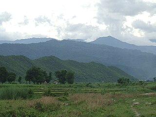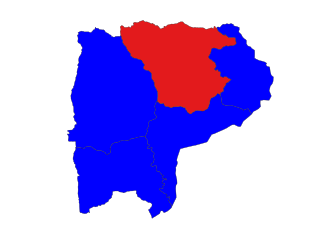
Myawaddy Township is a township of Myawaddy District in the Kayin State of Burma (Myanmar). It is the only township in Myawaddy District. The administrative seat is the town of Myawaddy.

Injangyang Township is a township of Myitkyina District in the Kachin State of Burma (Myanmar). The principal town and administrative center is Injangyang. The 2002 population estimate for the township was 23,370.

Mohnyin Township is a township of Mohnyin District in the Kachin State of Burma (Myanmar). The principal town and administrative centre is Mohnyin. Jade and gem quality kyanite are produced in Mohnyin Township, as well as amber, gold, asafoetida, and jasper. Indawgyi Lake Wildlife Sanctuary is located in the central north of the township.

Hpakant Township is a township of Mohnyin District in the Kachin State of Burma (Myanmar). The administrative centre is Hpakant. The major town is Kamaing.

Saw Township is a township of Pakokku District in the Magway Region of Burma (Myanmar). The principal town and administrative seat is Saw.

Taunggyi Township is a township of Taunggyi District in the Shan State of Myanmar. The principal town is Taunggyi.

Kyaukme Township is a township of Kyaukme District in the Shan State of eastern Burma (Myanmar). The principal town and administrative center is Kyaukme. The only other town is Mongngaw (Mongngawt) located in the northeast corner of the township.

Mong Khet Township is a township of Kengtong District in the Shan State of Burma. The principal town and administrative center is Mong Khet. It has been calculated to be the center of the Valeriepieris circle.

Htigyaing Township or Tigyaing Township is a township of Katha District in eastern Sagaing Region, in northern Myanmar. It lies on the border with the Shan State of Myanmar. The administrative seat is at Htigyaing.

Mingin Township is a township of Kale District in Sagaing Division of Burma (Myanmar). The principal town and administrative seat is Mingin (Minking).

Kalewa Township is a township of Kale District in Sagaing Division of Burma (Myanmar). The principal town and administrative seat is Kalewa. The Paluzawa coal mines are located in Kalewa township.

Hkamti Township or Khamti Township is a township in Hkamti District in the Sagaing Region of Burma (Myanmar). The principal town is Hkamti. As of 2014 the township had a population of 47,658 people and covered an area of 8,174 square kilometres (3,156 sq mi). The township is dominated by the Chindwin River and its tributaries as well as thickly forested areas. Nearly half the active working population are employed in agriculture, forestry or fishing. The township is a producer of rice and has gold and jade reserves.

Kale Township is a township in Kale District in the Sagaing Division of Burma (Myanmar). The principal town is Kalay.

Leshi Township or Layshi Township is a mountainous township located within the Naga Self-Administered Zone of Sagaing Region, Myanmar. It is also part of the Naga Self-Administered Zone. The principal town is Leshi.
Gyobin is a river town in Homalin Township, Hkamti District, in the Sagaing Region of northwestern Burma. It is located east of Kaukngo. An old frontier outpost was located at Gyobin during the British Burma period.

Tantabin Township is a township in Taungoo District in the Bago Region of Burma (Myanmar). The principal town and administrative seat is Tantabin in the far northwest part of the township.

Aunglan Township is a township of Thayet District in the Magway Region of Burma (Myanmar). Its administrative seat is Aunglan. It is the southeasternmost township in Magway Region.

Myaing Township is a township of Pakokku District in the Magway Region of Burma (Myanmar). Its administrative seat is Myaing.

Pakokku Township is a township of Pakokku District in Magway Division of Burma (Myanmar). The principal town and administrative seat is Pakokku. The township has its eastern and southeastern border along the Irrawaddy where its principal town, Pakokku, is a port. The Yaw River forms the township's southwest border. There is a commercial airport at Lanywa (Lan).

Yesagyo Township is a township of Pakokku District in the Magway Region of central Burma (Myanmar). The principal town and administrative seat is Yesagyo.


