Mantha, Jalna

Last updated

Mantha
Town
India Maharashtra location map.svg
Red pog.svg
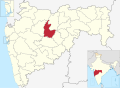
Mantha
Location in Maharashtra, India
Coordinates: 19°38′48″N76°23′07″E / 19.64667°N 76.38528°E / 19.64667; 76.38528
CountryFlag of India.svg India
State Maharashtra
District Jalna
Government
  BodyNagar panchayat
  MayorBalasaheb Borade
Population
 (2011)
  Total
22,005 [1]
Languages
  Official Marathi
Time zone UTC+5:30 (IST)
PIN
431504
Vehicle registration MH-21
Literacy77%

Mantha is a town in Jalna district in the state of Maharashtra, India.

Contents

Demography

Mantha tehsil has 114 villages under its supervision. According to 2011 census, Mantha plus 114 villages has population of 1,67,022. Among this 51% are male while 49% are female. SC population is 16% while ST population is around 3%. Literacy is 61%. [2]

Mantha village, according to 2011 census, has a population of 22,005, of which 11,393 are male and 10,612 are female. Literacy is 76.86%, male literacy is 84.26% and female literacy is 69.01%. Total houses are 4210.

Politics

Culture

Places to Visit

  1. Renuka Mata Mandir.


Transportation

Road

Mantha is well connected to Jalna, Chhatrapati Sambhaji Nagar, Akola, Nanded, Latur, Pune, and Hyderabad by road. Mantha has a Bus Stand, operated by MSRTC. It is the main hub of transportation.

Rail

The nearest rail stations are Partur and Sailu.

Air

The nearest airports are the Chikhalthana Airport in Chhatrapati Sambhaji Nagar, which is 120 km and Nanded Airport, which is 134 km from Mantha.

References

  1. "Mantha Village Population - Mantha - Jalna, Maharashtra".
  2. "Archived copy" (PDF). Archived from the original (PDF) on 2 April 2015. Retrieved 28 March 2015.{{cite web}}: CS1 maint: archived copy as title (link)