Maple Grove Township, Cheboygan County, Michigan

Last updated
Maple Grove Township, Michigan
Maple Forest Township (Cheboygan), MI.png
Former location within Cheboygan County
USA Michigan location map.svg
Red pog.svg
Maple Grove Township
Location within the state of Michigan
Usa edcp location map.svg
Red pog.svg
Maple Grove Township
Location within the United States
Coordinates: 45°14′54″N84°18′15″W / 45.24833°N 84.30417°W / 45.24833; -84.30417 Coordinates: 45°14′54″N84°18′15″W / 45.24833°N 84.30417°W / 45.24833; -84.30417
CountryUnited States
State Michigan
County Cheboygan
Established1909
Disestablished1942
Population
 (1940)
  Total10
Time zone UTC-5 (Eastern (EST))
  Summer (DST) UTC-4 (EDT)

Maple Grove Township was a civil township in Cheboygan County in the U.S. state of Michigan.

Contents

The township was created from the southern half of Forest Township in 1909. Maple Grove Township last reported a population of 10 at the 1940 census. In 1942, it merged back into Forest Township due to a low population. [1] [2]

History

Historical population
YearPop.±%
1910     
1920 63    
1930 33−47.6%
1940 10−69.7%

Maple Grove Township was first established on October 28, 1909. [3] It was set aside from the southern 36-square-mile (93 km2) survey township area of Forest Township in the southeastern corner of Cheboygan County. [4]

Although the township was created prior to the 1910 census, the new township went unreported in that decennial census. In the 1920 census, the population was recorded at 63. [5] The township recorded a population of 33 in the 1930 census. [6] In the 1940 census, the township recorded only 10 residents. [1] Because of its very low population, the township returned back to Forest Township in 1942, at which time Maple Grove Township ceased to exist. [2]

Geography

Although the township never had any precise area measurements, it occupied the southern 36 sections of Forest Township, which is a survey township area approximately equal to 36 square miles (93 km2) total.

The township contained Dorsy Lake (or Duby Lake) and Silver Lake. [7] [8] The Black River also flowed through the township. The rural township had no major roadways, although M-33 was created in 1919 and ran near the eastern edge of the township. [9]

Related Research Articles

<span class="mw-page-title-main">Otsego County, Michigan</span> County in Michigan, United States

Otsego County, formerly known as Okkuddo County, is a county located in the U.S. state of Michigan. As of the 2020 Census, the population was 25,091. The county seat is Gaylord. The county was founded in 1840 and organized in 1875.

<span class="mw-page-title-main">Ingham County, Michigan</span> County in Michigan, United States

Ingham County is a county located in the U.S. state of Michigan. As of the 2020 Census, the population was 284,900. The county seat is Mason. Lansing, the state capital of Michigan, is largely located within the county. The county is home to Michigan State University, Lansing Community College, and the Class A minor league baseball team Lansing Lugnuts. Ingham County is included in the Lansing–East Lansing, MI Metropolitan Statistical Area. It is considered to be a part of Mid Michigan.

<span class="mw-page-title-main">Cheboygan County, Michigan</span> County in Michigan, United States

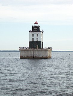
Cheboygan County is a county in the U.S. state of Michigan. As of the 2020 Census, the population was 25,579. The county seat is Cheboygan. The county boundaries were set off in 1840, with land partitioned from Mackinac County. The Cheboygan County government was organized in 1853.

Maple Grove Township is a civil township of Barry County in the U.S. state of Michigan. The population was 1,593 at the 2010 census. The unincorporated community of Maple Grove is located within the township.

<span class="mw-page-title-main">Benton Township, Cheboygan County, Michigan</span> Civil township in Michigan, United States

Benton Township is a civil township of Cheboygan County in the U.S. state of Michigan. As of the 2010 census, the township population was 3,206.

<span class="mw-page-title-main">Forest Township, Cheboygan County, Michigan</span> Civil township in Michigan, United States

Forest Township is a civil township of Cheboygan County in the U.S. state of Michigan. The population was 1,045 at the 2010 census.

<span class="mw-page-title-main">Indian River, Michigan</span> Census-designated place & unincorporated community in Michigan, United States

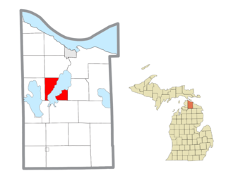
Indian River is an unincorporated community in Cheboygan County in the U.S. state of Michigan. It is a census-designated place (CDP) for statistical purposes and is not legally recognized as a municipality. The population was 1,959 at the 2010 census.

<span class="mw-page-title-main">Inverness Township, Michigan</span> Civil township in Michigan, United States

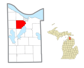
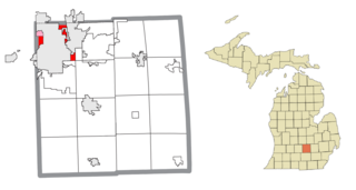
Inverness Township is a civil township of Cheboygan County in the U.S. state of Michigan. The population was 2,261 at the 2010 census. It was named after Inverness in Scotland.

<span class="mw-page-title-main">Mackinaw Township, Michigan</span> Civil township in Michigan, United States

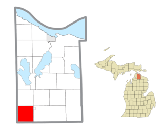
Mackinaw Township is a civil township of Cheboygan County in the U.S. state of Michigan. The population was 539 at the 2010 census.

<span class="mw-page-title-main">Mullett Township, Michigan</span> Civil township in Michigan, United States

Mullett Township is a general law township of Cheboygan County in the U.S. state of Michigan. The population was 1,312 at the 2010 census. Both the township and Mullett Lake are named for John Mullett, who surveyed much of the area between 1840 and 1843.

<span class="mw-page-title-main">Tuscarora Township, Michigan</span> Civil township in Michigan, United States

Tuscarora Township is a civil township of Cheboygan County in the U.S. state of Michigan. The population was 3,038 at the 2010 census.

<span class="mw-page-title-main">Wilmot Township, Michigan</span> Civil township in Michigan, United States

Wilmot Township is a civil township of Cheboygan County in the U.S. state of Michigan. The population was 878 at the 2010 census.

<span class="mw-page-title-main">Frederic Township, Michigan</span> Civil township in Michigan, United States

Frederic Township is a civil township of Crawford County in the U.S. state of Michigan. The population was 1,341 at the 2010 census.

<span class="mw-page-title-main">Maple Forest Township, Michigan</span> Civil township in Michigan, United States

Maple Forest Township is a civil township of Crawford County in the U.S. state of Michigan. The population was 653 at the 2010 census.

<span class="mw-page-title-main">Lansing Charter Township, Michigan</span> Charter township in Michigan, United States

Lansing Charter Township is a charter township of Ingham County in the U.S. state of Michigan. The population was 8,143 at the 2020 census.

<span class="mw-page-title-main">Meridian Charter Township, Michigan</span> Charter township in Michigan, United States

Meridian Charter Township is a charter township of Ingham County in the U.S. state of Michigan. As of the 2010 census, the township had a population of 39,688.

<span class="mw-page-title-main">Ada Township, Michigan</span> Civil township in Michigan, United States

Ada Township is a civil township of Kent County in the U.S. state of Michigan. The population was 14,388 at the 2020 census.

Home Township is a civil township of Montcalm County in the U.S. state of Michigan. As of the 2000 census, the township population was 2,708.

Maple Valley Township is a civil township of Montcalm County in the U.S. state of Michigan. The population was 2,083 at the 2000 census.

<span class="mw-page-title-main">Maple Grove, Benzie County, Michigan</span> Census-designated place & unincorporated community in Michigan, United States

Maple Grove is an unincorporated community and census-designated place in Benzie County in the U.S. state of Michigan. The population was 132 at the 2010 census. Maple Grove is located within Almira Township.

References

  1. 1 2 U.S. Census Bureau. "1940 United States Census: Michigan" (PDF). p. 81. Retrieved September 3, 2022.
  2. 1 2 U.S. Census Bureau. "1950 United States Census: Michigan" (PDF). p. 13. Retrieved September 3, 2022.
  3. Wynkoop Hallenbeck Crawford Co. (1911). Local Acts of the Legislature of the State of Michigan Passed at the Regular Session of 1911. Lansing. pp. 30–31.
  4. Historic Map Works, LLC. (2022). "Cheboygan County Outline Map - Below; From Cheboygan County 1902, Michigan" . Retrieved September 11, 2022.
    • This historic map of Cheboygan County from 1902 shows Forest Township in its entirety, then occupying two approximate 36-square-mile (93 km2) sections in the southeast portion of the county prior to Maple Grove Township's creation in 1909.
  5. U.S. Census Bureau. "1920 United States Census: Michigan" (PDF). p. 14. Retrieved September 10, 2022.
  6. U.S. Census Bureau. "1930 United States Census: Michigan" (PDF). p. 56. Retrieved September 10, 2022.
  7. U.S. Geological Survey Geographic Names Information System: Dorsy Lake
  8. U.S. Geological Survey Geographic Names Information System: Silver Lake
  9. Michigan State Highway Department (July 1, 1919). State of Michigan (Map). Scale not given. Lansing: Michigan State Highway Department. Lower Peninsula sheet. OCLC   15607244 . Retrieved October 17, 2019 via Michigan History Center.