Mariscal Cáceres | |
---|---|
District | |
Country | |
Region | Huancavelica |
Province | Huancavelica |
Founded | March 27, 1935 |
Capital | Mariscal Cáceres |
Government | |
• Mayor | Eugenio Cardenas Flores |
Area | |
• Total | 5.63 km2 (2.17 sq mi) |
Elevation | 2,847 m (9,341 ft) |
Population (2005 census) | |
• Total | 462 |
• Density | 82/km2 (210/sq mi) |
Time zone | PET (UTC-5) |
UBIGEO | 090111 |
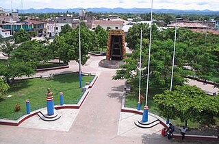
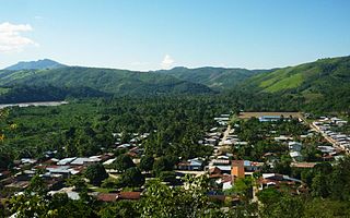
Mariscal Cáceres District (Spanish mariscal marshal) is one of nineteen districts of the province Huancavelica in Peru. [1]
Spanish or Castilian is a Romance language that originated in the Castile region of Spain and today has hundreds of millions of native speakers in the Americas and Spain. It is a global language and the world's second-most spoken native language, after Mandarin Chinese.
Marshal is a term used in several official titles in various branches of society. As marshals became trusted members of the courts of Medieval Europe, the title grew in reputation. During the last few centuries, it has been used for elevated offices, such as in military rank and civilian law enforcement.
The districts of Peru are the third-level country subdivisions of Peru. They are subdivisions of the provinces, which in turn are subdivisions of the larger regions or departments. There are 1,838 districts in total.
The district was named after the Peruvian president Andrés Avelino Cáceres.
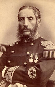
Andrés Avelino Cáceres Dorregaray served as the President of Peru three times during the 19th century, from 1881 to 1882 as the 34th President of Peru, then from 1886 to 1890 as the 36th President of Peru, and again from 1894 to 1895 as the 38th President of Peru. In Peru, he is considered a national hero for leading the resistance to Chilean occupation during the War of the Pacific (1879–1883), where he fought as a General in the Peruvian Army.
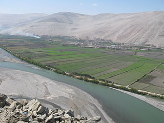
Camaná is a province in the Arequipa Region, Peru. It borders the provinces of Caravelí, Condesuyos, Castilla, Caylloma, Arequipa and Islay.
The Mariscal Caceres National Forest is situated in the Mariscal Cáceres Province of Peru.
Mariscal Benavides District is one of twelve districts of the province Rodríguez de Mendoza in Peru.
The Tayacaja Province is one of seven provinces located in the Huancavelica Region of Peru. The capital of this province is the city of Pampas. The province has a population of 116,371 inhabitants as of 2002.
The Mariscal Cáceres Province is one of ten provinces of the San Martín Region in northern Peru.
Piscobamba District is one of eight districts of the province Mariscal Luzuriaga in Peru.
The Huancavelica Province is one of seven provinces located in the Huancavelica Region of Peru. The capital of this province is the city of Huancavelica.
Juanjuí is a town in Northern Peru, capital of the province Mariscal Cáceres in the San Martín Region and located in the left edge of Huallaga River. There are 54,006 inhabitants, according to the 2010 census.
Mariscal Cáceres District is one of eight districts of the province Camaná in Peru.
Campanilla District is one of five districts of the province Mariscal Cáceres in Peru.
Huicungo District is one of five districts of the province Mariscal Cáceres in Peru.
Juanjuí District is one of five districts of the province Mariscal Cáceres in Peru.
Pachiza District is one of five districts of the province Mariscal Cáceres in Peru. Its seat is Pachiza.
Pajarillo District is one of five districts of the province Mariscal Cáceres in Peru.
Casca District is one of eight districts of the province Mariscal Luzuriaga in Peru.
Llama District is one of eight districts of the province Mariscal Luzuriaga in Peru.
Llumpa District is one of eight districts of the province Mariscal Luzuriaga in Peru. This district was created by Law, dated at October 28, 1889, president of Perou: Andrés A. Cáceres
Lucma District is one of eight districts of the province Mariscal Luzuriaga in Peru.
Musga District is one of eight districts of the province Mariscal Luzuriaga in Peru.
Cáceres del Perú District is one of nine districts of the Santa Province in the Ancash Region in Peru.
This Huancavelica Region geography article is a stub. You can help Wikipedia by expanding it. |
Coordinates: 12°32′03″S74°56′00″W / 12.5341°S 74.9333°W
A geographic coordinate system is a coordinate system that enables every location on Earth to be specified by a set of numbers, letters or symbols. The coordinates are often chosen such that one of the numbers represents a vertical position and two or three of the numbers represent a horizontal position; alternatively, a geographic position may be expressed in a combined three-dimensional Cartesian vector. A common choice of coordinates is latitude, longitude and elevation. To specify a location on a plane requires a map projection.