Maryborough East

Last updated

Maryborough East
Port Laoise Thoir (Irish)
Castle of Dunamase im Abendlicht 03.jpg
Dunamase, in the eastern part of Maryborough East
Baronies of Laois.jpg
Barony map of Queen's County, 1900; Maryborough East is blue, in the centre.
Sovereign state Ireland
Province Leinster
County Laois
Area
  Total101.82 km2 (39.31 sq mi)

Maryborough East or East Maryborough [1] (Irish : Port Laoise Thoir [2] ) is a barony in County Laois (formerly called Queen's County or County Leix), Ireland. [3] [4] [5]

Contents

Etymology

Maryborough is the former name of the town of Portlaoise, established in 1548 and named after Queen Mary I; it was given its current name in 1929.[ citation needed ]

Geography

Maryborough East is located in central County Laois.

History

Maryborough East and West were in the Middle Ages the land of the Cinel Crimthann, an Irish clan with the surname Ó Duibh (Duffy or O'Diff). [6]

It is referred to in the topographical poem Tuilleadh feasa ar Éirinn óigh (Giolla na Naomh Ó hUidhrín, d. 1420):

Maryborough was originally a single barony; it was divided into East and West before 1807.

List of settlements

Below is a list of settlements in Maryborough East barony:

Related Research Articles

<span class="mw-page-title-main">Portlaoise</span> Town in County Laois, Ireland

Portlaoise, or Port Laoise, is the county town of County Laois, Ireland. It is located in the South Midlands in the province of Leinster.

Lough Cullen is the only lake in County Kilkenny, Ireland. The lake has numerous legends attached to it.

<span class="mw-page-title-main">Upper Ossory</span> Barony in County Laois, Ireland

Upper Ossory was an administrative barony in the south and west of Queen's County in Ireland. In late Gaelic Ireland it was the túath of the Mac Giolla Phádraig (Fitzpatrick) family and a surviving remnant of the once larger kingdom of Ossory. The northernmost part of the Diocese of Ossory and medieval County Kilkenny, it was transferred to the newly created Queen's County, now known as County Laois, in 1600. In the 1840s its three component cantreds, Clarmallagh, Clandonagh, and Upperwoods, were promoted to barony status, thereby superseding Upper Ossory.

Bear is a barony in the most westerly part of County Cork, Ireland. It comprises approximately two thirds of the Beara peninsula from the western tip along the whole northern shore part of Bantry bay to Glengariff. The remaining third to the north-east is the neighbouring barony of Glanarought in County Kerry. The barony's only other neighbour is that of Bantry to the east. To the north, it is bounded by the Kenmare River

<span class="mw-page-title-main">Kilmurry-Negaul</span> Village in County Clare, Ireland

Kilmurry-Negaul is a civil parish and a village in County Clare, Ireland.

<span class="mw-page-title-main">Kiltartan Castle</span> Tower house in County Galway, Ireland

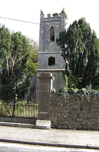
Kiltartan Castle is a tower house and National Monument located in County Galway, Ireland.

<span class="mw-page-title-main">Upper Woods</span> Barony in County Laois, Ireland

Upper Woods or Upperwoods is a barony in County Laois, Ireland.

<span class="mw-page-title-main">Stradbally (barony)</span> Barony in County Laois, Ireland

Stradbally is a barony in County Laois, Ireland.

<span class="mw-page-title-main">Clarmallagh</span> Barony in County Laois, Ireland

Clarmallagh is a barony in County Laois, Ireland.

<span class="mw-page-title-main">Maryborough West</span> Barony in County Laois, Ireland

Maryborough West or West Maryborough is a barony in County Laois, Ireland.

<span class="mw-page-title-main">Cullenagh</span> Barony in County Laois, Ireland

Cullenagh or Cullinagh is a barony in County Laois, Ireland.

<span class="mw-page-title-main">Slievemargy</span> Barony in County Laois, Ireland

Slievemargy is a barony in County Laois, Ireland.

<span class="mw-page-title-main">Coshmore and Coshbride</span> Barony in County Waterford, Ireland

Coshmore and Coshbride is a barony in County Waterford, Ireland.

<span class="mw-page-title-main">Decies-without-Drum</span> Barony in County Waterford, Ireland

Decies-without-Drum is a barony in County Waterford, Ireland.

<span class="mw-page-title-main">Decies-within-Drum</span> Barony in County Waterford, Ireland

Decies-within-Drum is a historical barony in County Waterford, Ireland.

<span class="mw-page-title-main">Frenchpark (barony)</span> Barony (land unit) in County Roscommon, Ireland

Frenchpark is a barony in County Roscommon, Ireland.

<span class="mw-page-title-main">Clandonagh</span> Barony in County Laois, Ireland

Clandonagh is a barony in County Laois, Republic of Ireland. A barony was a historical subdivision of a county; mainly cadastral rather than administrative.

<span class="mw-page-title-main">Loughtee Lower</span> Barony in County Cavan, Ireland

Loughtee Lower, or Lower Loughtee, is a barony in County Cavan, Ireland. Baronies were mainly cadastral rather than administrative units. They acquired modest local taxation and spending functions in the 19th century before being superseded by the Local Government (Ireland) Act 1898.

<span class="mw-page-title-main">Condons and Clangibbon</span> Barony in County Cork, Ireland

Condons and Clangibbon is a historical barony in County Cork, Ireland.

The Lord of Slemargy was a title held by Irish Gaelic nobility, specifically the O'More and McMurrough families.

References

  1. Gorton, John (9 July 2018). "A Topographical Dictionary of Great Britain and Ireland: Compiled from Local Information, and the Most Recent and Official Authorities". Chapman and Hall via Google Books.
  2. "Port Laoise Thoir/Maryborough East". Logainm.ie.
  3. Lives of the Irish Saints: With Special Festivals, and the Commemorations of Holy Persons. Duffy via Internet Archive. Maryborough East.
  4. "The Parliamentary Gazetteer of Ireland: Adapted to the New Poor-law, Franchise, Municipal and Ecclesiastical Arrangements, and Compiled with a Special Reference to the Lines of Railroad and Canal Communication as Existing in 1843-44; Illustrated by a Series of Maps, and Other Plates; and Presenting the Results, in Detail, of the Census of 1841, Compared with that of 1831". A. Fullarton. 9 July 2018 via Google Books.
  5. "The Parliamentary Gazetteer of Ireland: Adapted to the New Poor-law, Franchise, Municipal and Ecclesiastical Arrangements, and Compiled with a Special Reference to the Lines of Railroad and Canal Communication as Existing in 1843-44; Illustrated by a Series of Maps, and Other Plates; and Presenting the Results, in Detail, of the Census of 1841, Compared with that of 1831". A. Fullarton. 9 July 2018 via Google Books.
  6. "Sloinne". www.sloinne.ie.