Maryland Route 34

Last updated

MD Route 34.svg

Maryland Route 34

Maryland Route 34
Maryland Route 34 highlighted in red
Route information
Maintained by MDSHA
Length9.95 mi [1]  (16.01 km)
Existed1927–present
Tourist
routes
MD scenic byway.svg Chesapeake and Ohio Canal Scenic Byway
MD scenic byway.svg Antietam Campaign Scenic Byway
Major junctions
West endWV-480.svg WV 480 near Shepherdstown, WV
Major intersectionsMD Route 65.svg MD 65 in Sharpsburg
East end
Location
Country United States
State Maryland
Counties Washington
Highway system
MD Route 33.svg MD 33 MD Route 35.svg MD 35

Maryland Route 34 (MD 34) is a state highway in the U.S. state of Maryland. Known for most of its length as Shepherdstown Pike, the state highway begins at the West Virginia state line at the Potomac River, where the highway continues south as West Virginia Route 480 (WV 480) through Shepherdstown. The state highway runs 9.95 miles (16.01 km) east to U.S. Route 40 Alternate (US 40 Alternate) in Boonsboro. MD 34 is the main eastwest highway of southern Washington County, connecting Shepherdstown and Boonsboro with Sharpsburg and Keedysville. The state highway, which was preceded by the Boonsboro and Sharpstown Turnpike, was constructed as a modern highway in the late 1910s and early 1920s. MD 34's bypass of Keedysville opened around 1960. The western end of the state highway has had three bridges. A 19th-century bridge was destroyed in a 1936 flood and replaced by the James Rumsey Bridge in 1939. The present bridge, also named for James Rumsey, opened in 2005.

Contents

Route description

MD 34 begins at the West Virginia State line, where the highway crosses the Potomac River on the James Rumsey Bridge. The highway continues into Shepherdstown as WV 480. MD 34 heads east past an access ramp to the Chesapeake and Ohio Canal National Historical Park as two-lane undivided Shepherdstown Pike through a mix of farmland and forest. The state highway descends into an underpass of Norfolk Southern Railway's Hagerstown District line, which crosses the state highway at an oblique angle then parallels the highway northeast past the historic home Mount Airy. MD 34 splits away from the railroad as the highway enters the town of Sharpsburg. The state highway's name changes to Main Street at its intersection with Mechanic Street. MD 34 passes through the Sharpsburg Historic District, which contains the Jacob Highbarger House, William Chapline House, Good-Reilly House, Joseph C. Hays House, Piper House, and Tolson's Chapel. At the eastern end of the town, the state highway intersects Church Street, which heads north as MD 65 through the main unit of Antietam National Battlefield and south as a county highway toward Burnside's Bridge. [1] [2]

View east along MD 34 through Antietam National Battlefield 2020-06-01 14 55 03 View east along Maryland State Route 34 (Shepherdstown Pike) at Rodman Avenue-Richardson Avenue in Antietam National Battlefield, Washington County, Maryland.jpg
View east along MD 34 through Antietam National Battlefield

MD 34 leaves the town of Sharpsburg and passes through the grounds of Antietam National Battlefield. The state highway passes Antietam National Cemetery and passes through open fields before leaving the federal reservation by crossing Antietam Creek on the Porterstown Bridge. MD 34 continues northeast, passing the Pry House Field Hospital Museum before heading through Keedysville. The old alignment of MD 34, MD 845, splits to the east to pass through the center of town as Main Street while MD 34 passes along the edge of town. MD 34 crosses Little Antietam Creek, crosses an abandoned Baltimore and Ohio Railroad grade, and passes the Doub Farm and Baker Farm before receiving the other end of MD 845, Keedy Drive. The state highway passes through a forested area before passing Crystal Grottoes. MD 34 continues east through farmland before entering the town of Boonsboro and crossing Beaver Creek. The state highway heads east through the town as Potomac Street before reaching its eastern terminus at US 40 Alternate (Main Street). The roadway continues east as St. Paul Street toward South Mountain. [1] [2]

History

The predecessor highway of much of MD 34 was a 19th-century turnpike called the Boonsboro and Sharpsburg Turnpike between the two eponymous towns via Keedysville. [3] [4] The modern state highway was constructed starting in 1918 with a section from Boonsboro to Keedysville. [5] By 1921, the paved highway was extended west to the Norfolk Southern Railway west of Sharpsburg. [6] The highway was completed to the Potomac River in 1923. [7] MD 34 was one of the original signed Maryland state numbered highways in 1927. [8] The state highway was relocated at its western end following the completion of a new bridge across the Potomac River in 1939. The underpass of the Norfolk Southern Railway between the Potomac River and Sharpsburg was completed around 1940. [9] MD 34 was reconstructed from the Potomac River to Sharpsburg in 1953 and 1954. [10] The state highway was rebuilt from Sharpsburg to Boonsboro between 1956 and 1958, including a new bridge over Antietam Creek. [11] MD 34's bypass of Keedysville opened around 1961; the old highway through town was designated MD 845. [12]

MD 34 eastbound past MD 65 in Sharpsburg 2019-05-18 17 43 49 View east along Maryland State Route 34 (Main Street) at Maryland State Route 65 (Church Street) in Sharpsburg, Washington County, Maryland.jpg
MD 34 eastbound past MD 65 in Sharpsburg

The original river crossing at Shepherdstown was a ford downstream from the modern bridge that had various names, including Boteler's Ford, Pack Horse Ford, Shepherdstown Ford, and Blackford's Ford. This ford was utilized by Confederate forces in their retreat from the Battle of Antietam. [13] Around 1755, Thomas Swearingen started a ferry that operated through 1849, when the first covered bridge was constructed across the river. [14] [15] The first covered bridge was destroyed by forces under Stonewall Jackson in 1861. [15] A second covered bridge was constructed in 1871 and lasted until it was destroyed by the same series of floods in 1889 that devastated Johnstown, Pennsylvania. The piers of the covered bridge remain immediately downstream from the modern bridge. [15] An iron bridge was constructed just upstream of the present bridge. [15] [16] This iron bridge was destroyed in the March 1936 series of floods that heavily damaged Pittsburgh. [17] A high-level Wichert continuous truss bridge was constructed at the site of the present bridge and opened July 15, 1939. [18] [19] The new bridge was dedicated to James Rumsey, an 18th-century pioneer of the steamboat, who demonstrated his invention on the Potomac River at Shepherdstown in 1787. [19] Finally, the present bridge, a steel girder span also named for Rumsey, was constructed starting in June 2003 immediately to the north of the 1939 bridge. [20] The new bridge opened July 15, 2005, exactly 66 years after the opening of the previous bridge, which was subsequently torn down. [21]

Junction list

The entire route is in Washington County.

Locationmi
[1]
kmDestinationsNotes
0.000.00South plate.svg
WV-480.svg
WV 480 south (North Duke Street) Shepherdstown
West Virginia state line at Potomac River; western terminus
Sharpsburg 3.575.75North plate.svg
MD Route 65.svg
MD 65 north (Church Street) / Church Street south Hagerstown, Antietam National Battlefield
Southern terminus of MD 65
Keedysville 6.3910.28North plate.svg
MD Route 845.svg
MD 845 north (Main Street)
Southern terminus of MD 845
7.6112.25South plate.svg
MD Route 845.svg
MD 845 south (Keedy Drive)
Northern terminus of MD 845
Boonsboro 9.9516.01Alt plate.svg
US 40.svg
US 40 Alt. (Main Street) / St. Paul Street east Hagerstown, Middletown
Eastern terminus
1.000 mi = 1.609 km; 1.000 km = 0.621 mi

See also

Related Research Articles

<span class="mw-page-title-main">Antietam Creek</span> Creek in Pennsylvania and Maryland, USA

Antietam Creek is a 41.7-mile-long (67.1 km) tributary of the Potomac River located in south central Pennsylvania and western Maryland in the United States, a region known as the Hagerstown Valley. The creek became famous as a focal point of the Battle of Antietam during the American Civil War.

<span class="mw-page-title-main">Antietam National Battlefield</span> Historical area from the American Civil War

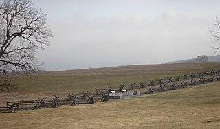
Antietam National Battlefield is a National Park Service-protected area along Antietam Creek in Sharpsburg, Washington County, northwestern Maryland. It commemorates the American Civil War Battle of Antietam that occurred on September 17, 1862.

<span class="mw-page-title-main">West Virginia Route 480</span> Highway in West Virginia, United States

West Virginia Route 480 is a 5.64-mile-long (9.08 km) state highway in the U.S. state of West Virginia. Known for most of its length as Kearneysville Pike, the highway extends from WV 115 in Kearneysville north to the Maryland state line at the Potomac River in Shepherdstown, from where the highway continues as Maryland Route 34. The route is one of the main north–south highways of northern Jefferson County and passes through the campus of Shepherd University. WV 480 was originally established in the early 1920s as West Virginia Route 48. The highway was paved in the mid-1920s, which included a different routing through Shepherdstown. WV 48's present routing through the town was established in the late 1930s when the first James Rumsey Bridge was completed; that bridge was replaced with the current bridge in the mid-2000s. WV 48 was renumbered to WV 480 in the mid-1970s after U.S. Route 48 was established in West Virginia and Maryland.

<span class="mw-page-title-main">Maryland Route 135</span> State highway in the U.S. state of Maryland

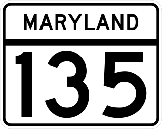
Maryland Route 135 is a state highway in the U.S. state of Maryland. Known for most of its length as Maryland Highway, the state highway runs 29.00 miles (46.67 km) from U.S. Route 219 in Oakland in Garrett County east to US 220 in McCoole in Allegany County. MD 135 is the main link between the towns of Oakland, Mountain Lake Park, Loch Lynn Heights, and Deer Park on the Appalachian Plateau and the communities of Bloomington, Luke, Westernport, and McCoole in the upper valley of the North Branch Potomac River. These groups of towns are separated by Backbone Mountain.

<span class="mw-page-title-main">Maryland Route 17</span> State highway in Frederick County, Maryland, US

Maryland Route 17 is a state highway in the U.S. state of Maryland. The state highway begins at the Virginia state line at the Potomac River in Brunswick, where the highway continues south as Virginia State Route 287. MD 17 runs 29.49 miles (47.46 km) north from the Brunswick Bridge to the Frederick–Washington county line near Wolfsville. The state highway serves as the main north–south highway of the Middletown Valley of western Frederick County. MD 17 connects Brunswick and Wolfsville with Rosemont, Burkittsville, Middletown, and Myersville. The state highway also connects those communities with the valley's main east–west highways, which include U.S. Route 340, US 40 Alternate, Interstate 70 (I-70), and US 40.

<span class="mw-page-title-main">U.S. Route 11 in Maryland</span> Section of U.S. Highway in Washington County, Maryland, US

U.S. Route 11 (US 11) is a part of the U.S. Highway System that runs from New Orleans, Louisiana to Rouses Point, New York. In Maryland, the federal highway runs 12.83 miles (20.65 km) from the West Virginia state line at the Potomac River in Williamsport north to the Pennsylvania state line near Maugansville. US 11 is the primary north–south surface highway in central Washington County, connecting Hagerstown with Williamsport to the south and Hagerstown Regional Airport to the north. The federal highway was once a major long-distance highway, but that role has been assumed by Interstate 81 (I-81), which parallels US 11 not only in Maryland but for most of its course from Tennessee to Upstate New York. US 11 is maintained by the Maryland State Highway Administration except for the municipally-maintained portions within the corporate limits of Williamsport and Hagerstown.

<span class="mw-page-title-main">Maryland Route 66</span> State highway in Washington County, Maryland, US

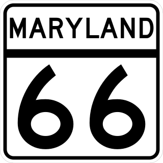
Maryland Route 66 is a state highway in the U.S. state of Maryland. Known for most of its length as Mapleville Road, the state highway runs 12.84 miles (20.66 km) from U.S. Route 40 Alternate in Boonsboro north to MD 64 near Smithsburg. MD 66 parallels the western flank of South Mountain in eastern Washington County, connecting Boonsboro and Smithsburg with Interstate 70 (I-70) and US 40. MD 66 was constructed in the late 1920s and early 1930s from Boonsboro to Cavetown. The state highway was extended north through Smithsburg after MD 64 bypassed the town in the late 1950s.

<span class="mw-page-title-main">Maryland Route 51</span> State highway in Allegany County, Maryland, US

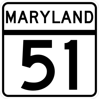
Maryland Route 51 is a state highway in the U.S. state of Maryland. Known for most of its length as Oldtown Road, the state highway runs 25.53 miles (41.09 km) from an interchange with Interstate 68 (I-68) in Cumberland south to the West Virginia state line at the Potomac River, where the highway continues east as West Virginia Route 9 toward Paw Paw. Around Cumberland, MD 51 is a major highway that provides a bypass of the South End neighborhood of that city and access to industrial areas along the North Branch Potomac River. South of North Branch, MD 51 is a rural highway connecting small communities along the river in southeastern Allegany County, including Oldtown. Documentation from the Maryland State Highway Administration depict the highway as following an east-west alignment, but all signage indicates a north-south road.

<span class="mw-page-title-main">Maryland Route 60</span> State highway in Washington County, Maryland, US

Maryland Route 60 is a state highway in the U.S. state of Maryland. Known for most of its length as Leitersburg Pike, the state highway runs 7.27 miles (11.70 km) from the intersection of Potomac Avenue and Northern Avenue/Eastern Boulevard in Hagerstown east to the Pennsylvania state line near Leitersburg, where the highway continues as Pennsylvania Route 316. MD 60 connects Hagerstown with Leitersburg and Waynesboro, Pennsylvania. MD 60 was paved over the course of an old turnpike from Hagerstown toward Waynesboro in the mid-1920s. The state highway was reconstructed in the mid-1950s, including the highway's bypass of Leitersburg.

<span class="mw-page-title-main">Maryland Route 63</span> State highway in Washington County, Maryland, US

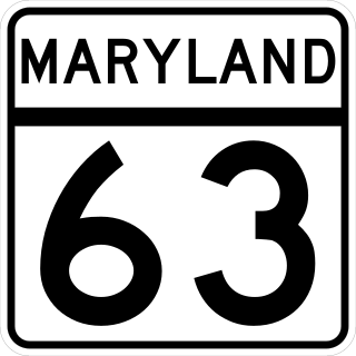
Maryland Route 63 is a state highway in the U.S. state of Maryland. The state highway runs 16.99 miles (27.34 km) from MD 65 in Fairplay north to the Pennsylvania state line near Cearfoss, where the highway continues as Pennsylvania Route 163. MD 63 is an L-shaped route that passes through central Washington County on the south and west sides of Hagerstown. The state highway connects with multiple local and long-distance highways that serve Hagerstown, including Interstate 81 (I-81) and U.S. Route 11 in Williamsport and I-70 and US 40 in Huyett. MD 63 also joins MD 68 in a concurrency through Williamsport.

<span class="mw-page-title-main">Maryland Route 65</span> State highway in Washington County, Maryland, US

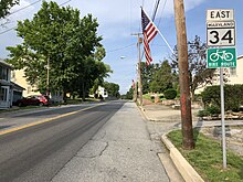
Maryland Route 65 is a state highway in the U.S. state of Maryland. Known for most of its length as Sharpsburg Pike, the state highway runs 11.75 miles (18.91 km) from MD 34 in Sharpsburg north to the southern end of Hagerstown, where the highway continues north as Potomac Street toward the downtown area. MD 65 connects central and southern Washington County and serves as the primary access point to Antietam National Battlefield. The state highway, which was originally laid out as a turnpike, was constructed in its modern form in the mid-1920s. MD 65 was rebuilt in the early 1950s and relocated through Antietam National Battlefield by the early 1980s.

<span class="mw-page-title-main">Maryland Route 67</span> State highway in Washington County, Maryland, US, known as Rohrersville Rd

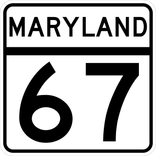
Maryland Route 67 is a state highway in the U.S. state of Maryland. Known as Rohrersville Road, the state highway runs 12.20 miles (19.63 km) from U.S. Route 340 in Weverton north to US 40 Alternate in Boonsboro. MD 67 parallels the western flank of South Mountain in southeastern Washington County, connecting Boonsboro with Weverton and Rohrersville. In conjunction with US 340 and US 40 Alternate, MD 67 connects Hagerstown and Harpers Ferry, West Virginia, a link that made the highway one of the original state roads marked for improvement in 1909. The first section of the state highway was constructed through Rohrersville around 1920. The remainder of the highway was built between Boonsboro and Weverton in the late 1920s and early 1930s. MD 67 was reconstructed with multiple relocations starting in the late 1950s, culminating in a relocation at the southern terminus to tie into the US 340 freeway in the late 1960s.

<span class="mw-page-title-main">Maryland Route 68</span> State highway in Washington County, Maryland, US

Maryland Route 68 is a state highway in the U.S. state of Maryland. The state highway runs 18.50 miles (29.77 km) from U.S. Route 40 in Clear Spring east to US 40 Alternate in Boonsboro. MD 68 crosses central Washington County to the south of Hagerstown, connecting Clear Spring and Boonsboro with Williamsport, where the highway runs concurrently with MD 63. A small segment of MD 68 west of Boonsboro was constructed around 1920, using as part of the route two early 19th-century stone bridges. The remainder of the highway between Boonsboro and Williamsport was constructed in the second half of the 1920s. MD 68 was extended west from Williamsport to Clear Spring in the mid-1950s. The state highway was relocated south of Williamsport for the construction of Interstate 81 (I-81) in the mid-1960s. Since the early 1990s, I-68 has also existed in Washington County; signs on I-70 aim to avoid confusion between I-68 and MD 68.

<span class="mw-page-title-main">Maryland Route 632</span>

Maryland Route 632 is a state highway in the U.S. state of Maryland. Known as Downsville Pike, the state highway runs 6.71 miles (10.80 km) from MD 63 in Downsville north to Maryland Avenue in Hagerstown. MD 632 was constructed along the path of a former turnpike in the late 1930s. The state highway's interchange with Interstate 70 (I-70) opened in 1999.

<span class="mw-page-title-main">Maryland Route 257</span>

Maryland Route 257 is a state highway in the U.S. state of Maryland. Known as Rock Point Road, the state highway runs 9.75 miles (15.69 km) from MD 254 near Rock Point north to U.S. Route 301 in Newburg. MD 257 serves the Cobb Neck of southern Charles County between the Potomac River and Wicomico River, connecting the communities of Cobb Island, Issue, Tompkinsville, and Wayside with US 301. The state highway was originally the southernmost section of MD 3, which was constructed on the peninsula in the 1910s. The portion of MD 3 south of US 301 was rebuilt and renumbered as MD 257 in the 1950s. The southern terminus of the route was cut back from Rock Point to its current location in the 1980s.

<span class="mw-page-title-main">Maryland Route 191</span> State highway in Montgomery County, Maryland, known for most of its length as Bradley Boulevard

Maryland Route 191 is a state highway in the U.S. state of Maryland. Known for most of its length as Bradley Boulevard, the highway runs 7.16 miles (11.52 km) from MD 190 in Potomac east to MD 185 in Chevy Chase. MD 191 serves an affluent area with many golf courses as it connects Potomac and Chevy Chase by way of an S-shaped path through Bethesda in southwestern Montgomery County. Bradley Lane, the name for the Chevy Chase portion of the highway, was paved by 1910. This included the segment of the lane between MD 185 and MD 186, which was removed from the state highway in the 1940s. The remainder of MD 191 was constructed along mostly new alignment through Bethesda and Potomac in the early 1920s. The highway originally continued beyond its present western terminus and looped south along Persimmon Tree Road to Cabin John. MD 191 was expanded to a divided highway between what is now MD 355 and MD 614 in two portions in the 1940s and 1960s. The highway was relocated at its Persimmon Tree Road crossing of Interstate 495 (I-495) when the freeway was built in the early 1960s. The Cabin John–Potomac portion of MD 191 was removed from the state highway system in 1999.

<span class="mw-page-title-main">Maryland Route 249</span>

Maryland Route 249 is a state highway in the U.S. state of Maryland. Known as Piney Point Road, the state highway runs 9.84 miles (15.84 km) from St. George Island north to MD 5 in Callaway. MD 249 is the primary access to St. George Island and the communities of Piney Point, Tall Timbers, and Valley Lee on the Piney Point peninsula between the Potomac River and St. George's Creek in southern St. Mary's County. The state highway was constructed on the mainland in the early 1920s; the portion of the highway on St. George Island was completed in the early 1930s. MD 249 was reconstructed in the 1950s, including a new St. George Island Bridge.

<span class="mw-page-title-main">U.S. Route 40 Alternate (Hagerstown–Frederick, Maryland)</span> Highway in Washington and Frederick counties in Maryland

U.S. Route 40 Alternate (US 40 Alternate) is an alternate route of US 40 in the U.S. state of Maryland. The highway runs 22.97 miles (36.97 km) from Potomac Street in Hagerstown east to US 40 in Frederick. US 40 Alternate parallels US 40 and much of Interstate 70 (I-70) to the south through eastern Washington County and western Frederick County. The alternate route connects Hagerstown and Frederick with Funkstown, Boonsboro, Middletown, and Braddock Heights. US 40 Alternate crosses two major north–south components of the Blue Ridge Mountains that separate the Great Appalachian Valley and the Piedmont: South Mountain between Boonsboro and Middletown and Catoctin Mountain, which is locally known as Braddock Mountain, at Braddock Heights.

<span class="mw-page-title-main">Maryland Route 845</span>

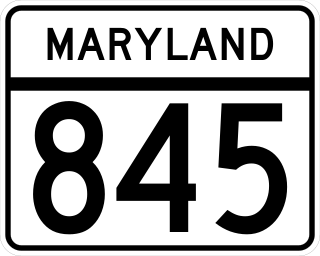
Maryland Route 845 is an unsigned state highway in the U.S. state of Maryland. Known for most of its length as Main Street, the state highway runs 1.23 miles (1.98 km) between intersections with MD 34 on either side of Keedysville in southern Washington County. MD 845, which is officially MD 845A, is the old alignment of MD 34 through Keedysville. The state highway was designated around 1960 when MD 34 bypassed the town.

<span class="mw-page-title-main">Maryland Route 858</span>

Maryland Route 858 is a collection of unsigned state highways in the U.S. state of Maryland. These four highways are old segments of MD 67 between Rohrersville and Boonsboro in southeastern Washington County. These highways were designated when MD 67 was relocated in the early 1960s. The longest segment is MD 858F, which runs exactly 1 mile (1.6 km) between a pair of intersections with MD 67 in Rohrersville. In addition to the four existing highways, there are several county-maintained segments of old MD 67 between Rohrersville and Boonsboro and at Gapland, Brownsville, and Weverton south of Rohrersville.

References

  1. 1 2 3 4 Highway Information Services Division (December 31, 2013). Highway Location Reference. Maryland State Highway Administration. Retrieved 2010-11-17.
  2. 1 2 Google (2010-11-17). "Maryland Route 34" (Map). Google Maps . Google. Retrieved 2010-11-17.
  3. Clark, William Bullock (1899). Report on the Highways of Maryland. Baltimore: Maryland Geological Survey. p. 251. Retrieved 2010-11-17.
  4. Antietam, MD quadrangle (Map) (1910 ed.). 1:48,000. 15 Minute Series (Topographic). United States Geological Survey. Retrieved 2010-11-17.
  5. Zouck, Frank H.; Uhl, G. Clinton; Mudd, John F. (January 1920). Annual Reports of the State Roads Commission of Maryland (1916–1919 ed.). Baltimore: Maryland State Roads Commission. p. 78. Retrieved 2010-11-17.
  6. Maryland Geological Survey (1921). Map of Maryland: Showing State Road System and State Aid Roads (PDF) (Map). Baltimore: Maryland Geological Survey.
  7. Maryland Geological Survey (1923). Map of Maryland: Showing State Road System and State Aid Roads (PDF) (Map). Baltimore: Maryland Geological Survey.
  8. Maryland Geological Survey (1927). Map of Maryland: Showing State Road System and State Aid Roads (PDF) (Map). Baltimore: Maryland Geological Survey.
  9. Whitman, Ezra B.; Webb, P. Watson; Thomas, W. Frank (March 15, 1941). Report of the State Roads Commission of Maryland (1939–1940 ed.). Baltimore: Maryland State Roads Commission. pp. 58, 120. Retrieved 2010-11-17.
  10. McCain, Russell H.; Bennett, Edgar T.; Kelly, Bramwell (November 12, 1954). Report of the State Roads Commission of Maryland (1953–1954 ed.). Baltimore: Maryland State Roads Commission. pp. 204, 206, 209. Retrieved 2010-11-17.
  11. Bonnell, Robert O.; Bennett, Edgar T.; McMullen, John J. (December 15, 1958). Report of the State Roads Commission of Maryland (1957–1958 ed.). Baltimore: Maryland State Roads Commission. pp. 82–83. Retrieved 2010-11-17.
  12. Maryland State Roads Commission (1961). Maryland: Official Highway Map (PDF) (Map). Baltimore: Maryland State Roads Commission.
  13. Swain, Craig (2007-07-27). "Blackford's Ford Marker". The Historical Marker Database. Springfield, VA: J.J. Prats. Retrieved 2010-11-17.
  14. Swain, Craig (2007-07-27). "Swearingen's Ferry and Pack Horse Ford Marker". The Historical Marker Database. Springfield, VA: J.J. Prats. Retrieved 2010-11-17.
  15. 1 2 3 4 Smedley, Jim. "Covered Bridges at Shepherdstown". Maryland Covered Bridges. Retrieved 2010-11-17.
  16. Martinsburg, WV quadrangle (Map) (1916 ed.). 1:48,000. 15 Minute Series (Topographic). United States Geological Survey. Retrieved 2010-11-17.
  17. Tabler, H.E.; Wilkinson, C. Nice; Luthardt, Frank F. (December 4, 1936). Report of the State Roads Commission of Maryland (1935–1936 ed.). Baltimore: Maryland State Roads Commission. p. 53. Retrieved 2010-11-17.
  18. Beall, J. Glenn; Jarboe, Elmer R.; Obrecht, George F., Sr. (March 4, 1939). Report of the State Roads Commission of Maryland (1937–1938 ed.). Baltimore: Maryland State Roads Commission. p. 77. Retrieved 2010-11-17.
  19. 1 2 Swain, Craig (2007-08-08). "The James Rumsey Bridge Marker". The Historical Marker Database. Springfield, VA: J.J. Prats. Retrieved 2010-11-17.
  20. Williams, Wanda T. (2004-08-13). "Girders giving Rumsey bridge a new look". The Herald-Mail. Hagerstown, MD: The Herald-Mail Company. Retrieved 2011-01-22.
  21. Bosely, Candice (2005-07-16). "New James Rumsey Bridge opens to vehicles, pedestrians". The Herald-Mail. Hagerstown, MD: The Herald-Mail Company. Retrieved 2010-11-17.

Route map:

Template:Attached KML/Maryland Route 34
KML is from Wikidata