Dimock is an unincorporated community in Susquehanna County, Pennsylvania, United States. The community is located along Pennsylvania Route 29 6.1 miles (9.8 km) south of Montrose. Dimock has a post office with ZIP code 18816, which opened on April 13, 1818.

Concord is an unincorporated community in Fannett Township, Franklin County, Pennsylvania, United States. The community is located on Pennsylvania Route 75 9.6 miles (15.4 km) south-southwest of East Waterford. Concord has a post office with ZIP code 17217.

Sipesville is an unincorporated community in Somerset County, Pennsylvania, United States. The community is located along Pennsylvania Route 985 6.3 miles (10.1 km) north of Somerset. Sipesville has a post office with ZIP code 15561, which opened on April 9, 1851.

Gilman is an unincorporated community in the town of Lunenburg, Essex County, Vermont, United States. The community has a post office with ZIP code 05904.

Livonia Center is a hamlet and census-designated place in Livingston County, New York, United States. Its population was 421 as of the 2010 census. Livonia Center has a post office with ZIP code 14488, which opened on April 9, 1811. U.S. Route 20A passes through the community.

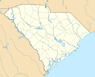
Pineland is an unincorporated community in Jasper County, South Carolina, United States. The community is located at the intersection of U.S. Route 601 and South Carolina Highway 652, 5.8 miles (9.3 km) south of Furman. Pineland has a post office with ZIP code 29934, which opened on May 10, 1901.

Gray is an unincorporated community in Knox County, Kentucky, United States. The community is located along U.S. Route 25E 4.9 miles (7.9 km) west of Corbin. Gray has a post office with ZIP code 40734, which opened on January 25, 1888.

Calvin is an unincorporated community in Bell County, Kentucky, United States. The community is located along U.S. Route 119 and the Cumberland River 4.9 miles (7.9 km) southeast of Pineville. The area on the south side of the river is also known as Page, which was the name of the Louisville_and_Nashville_Railroad station in the community. Calvin has a post office with ZIP code 40813, which opened on April 3, 1908.

Lejunior is an unincorporated community in Harlan County, Kentucky, United States. The community is located along Kentucky Route 38 and the Cumberland River 4.3 miles (6.9 km) northeast of Evarts. Lejunior has a post office with ZIP code 40849.

Morning View is an unincorporated community in Kenton County, Kentucky, United States. The community is located along the Licking River at the intersection of Kentucky Route 14 and Kentucky Route 177, 9 miles (14 km) south-southeast of Independence. Morning View has a post office with ZIP code 41063.

East Dixfield is an unincorporated village in the towns of Wilton in Franklin County and Dixfield in Oxford County, in the U.S. state of Maine. The community is located along U.S. Route 2 and Maine State Route 17 10 miles (16 km) southwest of Farmington. East Dixfield has a post office with ZIP code 04227.

East Wilton is an unincorporated village in the town of Wilton, Franklin County, Maine, United States. The community is located along U.S. Route 2 4.3 miles (6.9 km) south-southwest of Farmington. East Wilton has a post office with ZIP code 04234, which opened on February 29, 1828.

Brookton is an unincorporated village in Washington County, Maine, United States. The community is located along U.S. Route 1 33.5 miles (53.9 km) northwest of Calais. Brookton has a post office with ZIP code 04413.

West Dummerston is an unincorporated village in the town of Dummerston, Windham County, Vermont, United States. The community is located along Vermont Route 30 and the West River 6 miles (9.7 km) north-northwest of Brattleboro. West Dummerston has a post office with ZIP code 05357.

Martin is an unincorporated community in Fayette County, Pennsylvania, United States. The community is located along the Monongahela River and Pennsylvania Route 166 2.9 miles (4.7 km) south of Masontown. Martin has a post office with ZIP code 15460.

Waltersburg is an unincorporated community in Fayette County, Pennsylvania, United States. The community is located along Pennsylvania Route 51 6 miles (9.7 km) north of Uniontown. Waltersburg has a post office with ZIP code 15488. William Harper retired as postmaster from this location after over 45 years of service. He still resides today with his wife in their home in Waltersburg.

Karthaus is an unincorporated community in Clearfield County, Pennsylvania, United States. The community is located along Pennsylvania Route 879 18.2 miles (29.3 km) east-northeast of Clearfield. Karthaus has a post office with ZIP code 16845, which opened on April 24, 1826.

New Millport is an unincorporated community in Clearfield County, Pennsylvania, United States. The community is 5.7 miles (9.2 km) south of Curwensville. New Millport has a post office with ZIP code 16861.

Pennsylvania Furnace is an unincorporated community in Huntingdon County, Pennsylvania, United States. The community is located along Pennsylvania Route 45 9.7 miles (15.6 km) southwest of State College. Pennsylvania Furnace has a post office with ZIP code 16865.

Portlandville is a hamlet in Otsego County, New York, United States. The community is located along the Susquehanna River and New York State Route 28 7.3 miles (11.7 km) northeast of Oneonta. Portlandville has a post office with ZIP code 13834, which opened on April 9, 1828.


