Maturín

Last updated • 8 min readFrom Wikipedia, The Free Encyclopedia
Maturín
The Sultana of Guarapiche
Municipality
Templo Colonial.jpg
Iglesia de San Simon (Maturin) by Cesar Perez.jpg
Torre Espacial Lumino-Cromatica.jpg
Redoma Juana La Avanzadora (Noche).JPG
Plaza los escritores de Maturin 2017.jpg
Iglesia Catolica Nuestra Senora del Carmen.JPG
Top:Maturin San Miguel Arcangel Church, Second:Maturin San Simon Church, Especial Lumino-Cromatica Tower, Third:A night view of fountain in Redoma Juana La Avanzadora, Bottom:La Guaricha Zoological Park, Maturin Cathedral (all item of left to right)
Bandera de la Ciudad de Maturin.svg
Escudo municipio Maturin.png
Nickname: 
The Sultana of Guarapiche
Motto: 
"La Ciudad Distinta" ("The Different City")
Venezuela location map (+claimed).svg
Red pog.svg
Maturín
Coordinates: 9°45′00″N63°10′59″W / 9.750°N 63.183°W / 9.750; -63.183
FoundedDecember 7, 1760
Founded byLucas de Zaragoza
Government
   Mayor Ana Fuentes (PSUV)
   Demonym Maturinés
Area
  Total
13,352 km2 (5,155 sq mi)
Elevation
67 m (220 ft)
Population
 (2021)
  Total
647,459
  Density1,165.15/km2 (3,017.7/sq mi)
Time zone UTC−4 (VET)
Area code 0291
Climate Aw
Website alcaldiadematurin.gob.ve

Maturín (Spanish pronunciation: [matuˈɾin] ) is a city in Venezuela, the capital of the Venezuelan state of Monagas and a centre for instrumental exploration and development of the petroleum industry in Venezuela. The metropolitan area of Maturín has a population of 401,384 inhabitants. Maturín is also a busy regional transportation hub, connecting routes from the northeastern coast to the Orinoco Delta and the Gran Sabana.

Contents

History

Founding

December 7, 1760, is the official date of the founding of Maturín (according to the Venezuelan Academy of History) by the Franciscan missionary Lucas de Zaragoza. However, the Jesuit priest Pablo Ojer found a document in the General Archive of the Indies which proves an earlier founding date for the city in 1722. [1] This primitive town was called San Juan de la Tornera de Maturín and its founder was the Spanish governor Juan de la Tornera y Sota. [1] San Juan de la Tornera de Maturín was a city for Spaniards, but it did not survive very long because of the lack of population and few economic resources. Initially, San Judas Tadeo de Maturín (Lucas de Zaragoza gave this name to Maturín) was a Spanish mission created for the conversion of the nearby native Chaima  [ es ] and Warao people. The Spaniards decided to move to Maturín and in the 19th century it received the category of city and the name of San Fernando de Maturín.

Origin of the name Maturín

Portrait of Jose Tadeo Monagas. Martin Tovar y Tovar 28.JPG
Portrait of José Tadeo Monagas.

Maturín was named after an indigenous chief (cacique) who lived with his tribe next to the bank of Guarapiche River. He was murdered by a supposed Spanish captain named Arrioja during a battle between tribal members and Spaniards on the site of the town in 1718. Since then the area has been known as el Sitio de Maturín ('the place of Maturín').

Some historians[ who? ] have concluded that the name Maturín is instead of French origin. They base their theory on the legend of a supposed French missionary who explored the area at the end of the 17th century. The legend says that the missionary (whose surname might have been Mathurin) baptized a young indigenous boy and gave him the name Mathurin, [1] the boy later becoming el indio Maturín. There is also the possibility that the boy may have been named after a 4th-century French saint, Saint Mathurin. However, the legend of this supposed French missionary has not been proved yet. Other historians disagree with the theory, arguing that there is a plant with the same name and indigenous place names very similar to the name Maturín.

Independence war

Maturín (as a part of the Province of Cumaná) was on the republican side during the Venezuelan Declaration of Independence on July 5, 1811. Five battles took place in Maturín from 1813 to 1814, including the famous Battle of Alto de los Godos. In this battle the Venezuelan patriots, led by Manuel Piar, obtained a great victory against the Spanish general Juan Domingo de Monteverde. Antonio José de Sucre, José Francisco Bermúdez, José Tadeo Monagas, José Gregorio Monagas and José Félix Ribas were others who fought in the five battles.

The last battle of Maturín (December 1814), however, was a defeat. During the 1814 Caracas Exodus, many soldiers and civilians who had escaped from Caracas during the military campaign of José Tomás Boves against the Republic, came to Maturín to shelter from the Spanish troops. After the battle of Urica (where Boves died) Tomás José Morales, a Spanish general, decided to take the town. The Republicans defended the town, but they were beaten and many of them were murdered by Morales. The town was destroyed. Some survivors of the last battle rebuilt Maturín two years later.

19th and 20th centuries

Maturín grew slowly during the 19th century due to civil wars (which destroyed the region's flourishing farming and livestock-raising industries and killed many people) and fatal diseases, such as malaria and yellow fever, transmitted by mosquitoes. In 1909 Maturín became capital of the new Monagas state. Before that the town was the capital of the Province Maturín from 1856 to 1859. In the 20th century Maturín grew rapidly due to the discovery of petroleum fields near the town and a health campaign carried out by doctors to eliminate mosquitoes. Maturín has been the headquarters of the Roman Catholic Diocese of Maturín since 1958.

Geography

Maturin is located at 67 meters of altitude and 520 kilometres from the country's capital, Caracas. It is right next to the Guarapiche River and is a crossroad for roads towards the center, the Caribbean coast and the Orinoco River

Climate

Maturín features a tropical savannah climate (Köppen climate classification: Aw).

Climate data for Maturín (1991–2020, extremes 1961–2020)
MonthJanFebMarAprMayJunJulAugSepOctNovDecYear
Record high °C (°F)35.5
(95.9)
35.7
(96.3)
37.0
(98.6)
37.6
(99.7)
39.7
(103.5)
35.9
(96.6)
36.8
(98.2)
38.4
(101.1)
37.0
(98.6)
38.2
(100.8)
35.5
(95.9)
35.1
(95.2)
39.7
(103.5)
Mean daily maximum °C (°F)30.9
(87.6)
31.6
(88.9)
32.8
(91.0)
33.9
(93.0)
33.1
(91.6)
31.5
(88.7)
31.1
(88.0)
31.6
(88.9)
32.3
(90.1)
32.3
(90.1)
31.6
(88.9)
30.9
(87.6)
32.0
(89.6)
Daily mean °C (°F)25.3
(77.5)
25.7
(78.3)
26.6
(79.9)
27.6
(81.7)
27.6
(81.7)
26.6
(79.9)
26.4
(79.5)
26.7
(80.1)
27.2
(81.0)
27.1
(80.8)
26.5
(79.7)
25.7
(78.3)
26.6
(79.9)
Mean daily minimum °C (°F)22.3
(72.1)
22.5
(72.5)
23.1
(73.6)
24.0
(75.2)
24.6
(76.3)
24.3
(75.7)
24.2
(75.6)
24.2
(75.6)
24.5
(76.1)
24.4
(75.9)
24.4
(75.9)
23.1
(73.6)
23.8
(74.8)
Record low °C (°F)16.7
(62.1)
17.4
(63.3)
18.5
(65.3)
18.1
(64.6)
18.3
(64.9)
16.1
(61.0)
17.2
(63.0)
18.3
(64.9)
20.7
(69.3)
20.4
(68.7)
18.3
(64.9)
17.7
(63.9)
16.1
(61.0)
Average rainfall mm (inches)63.1
(2.48)
37.3
(1.47)
37.1
(1.46)
47.3
(1.86)
95.9
(3.78)
217.2
(8.55)
220.7
(8.69)
197.1
(7.76)
129.9
(5.11)
140.1
(5.52)
131.7
(5.19)
116.1
(4.57)
1,433.5
(56.44)
Average rainy days (≥ 1.0 mm)9.66.24.74.89.718.119.516.812.412.313.413.2140.7
Average relative humidity (%)74.571.570.570.072.076.576.575.574.074.076.576.074.0
Mean monthly sunshine hours 248.0224.0251.1228.0213.9168.0186.0204.6213.0232.5219.0229.42,617.5
Mean daily sunshine hours 8.08.08.17.66.95.66.06.67.17.57.37.47.2
Source 1: NOAA (sun 1961–1990) [2] [3]
Source 2: Instituto Nacional de Meteorología e Hidrología (humidity 1970–1998) [4] [5]

Law and government

Maturín has one municipality: Maturín Municipality; Venezuelan law specifies that municipal governments have four main functions: executive, legislative, comptroller, and planning. The executive function is managed by the mayor, who is in charge of representing the municipality's administration. The legislative branch is represented by the municipal council, composed of seven councillors, charged with the deliberation of new decrees and local laws. The comptroller tasks are managed by the municipal comptroller's office, which oversees accountancy. Finally, planning is represented by the local public planning council, which manages development projects for the municipality.

Mayors since 1990

Economy

Maturín is one of the most important cities in the east of the country as its strategic position serves as a bridge to the other states of the region. The city has grown during the last few years[ when? ] mainly because of the increase in the state's oil industry. However, Maturín has been hit hard by Venezuela's recent economic crisis. [6]

Transportation

It is possible to travel there by land or by using José Tadeo Monagas International Airport.

Higher education

Plaza Bolivar in Maturin. Plaza Bolivar Maturin, Monagas..jpg
Plaza Bolívar in Maturín.

Public universities

Private universities

Private Institutes of Higher Education

Places of interest

Roman Catholic churches

The Cathedral Nuestra Senora del Carmen. Fachada Catedral Nuestra Senora del Carmen.jpg
The Cathedral Nuestra Señora del Carmen.
Road of flowers in La Cascada de Maturin Mall. Camino de flores al infinito en La Cascada de Maturin.jpg
Road of flowers in La Cascada de Maturín Mall.

Parks

Landscape in Maturin Paisaje al Sur de Maturin, Monagas.jpg
Landscape in Maturín

Museums, theatres and art galleries

Others

Sports

Sports facilities

Teams

Other Sports Disciplines

Paddle tennis is played at the Once Padel courts in Tipuro, Maturín. [7] On June 28, 2024, the new club's facilities were inaugurated, located within the Kariña Hotel and Club Palma Real, prior to the Maturín Paddle Masters. Additionally, there is a children's baseball team called Criollitos Monagas. [8]

Local soccer leagues are organized by the Monagas State Football Association (AFEM). There are teams like Atlético Maturín and Academia Monagas SC, belonging to lower categories such as the Under-12 and Under-14 categories. [9] Furthermore, there are sports schools like the Professor Antonio Mejía School dedicated to promoting the practice of this sport. [10]

See also

Related Research Articles

<span class="mw-page-title-main">Geography of Venezuela</span>

Venezuela is a country in South America, bordering the Caribbean Sea and the North Atlantic Ocean, between Colombia and Guyana. It is situated on major sea and air routes linking North and South America. Located at the northernmost end of South America, Venezuela has a total area of 912,050 km2 (352,140 sq mi) and a land area of 882,050 km2 (340,560 sq mi). It is the 32nd largest country and is slightly smaller than Egypt, or half the size of Mexico. Shaped roughly like an inverted triangle, the country has a 2,800 km (1,700 mi) long coastline. It is bound on the north by the Caribbean Sea and the Atlantic Ocean, on the east by Guyana, on the south by Brazil, and on the west by Colombia. It has the 55th largest Exclusive Economic Zone of 471,507 km2 (182,050 sq mi). Its maritime territory borders Trinidad and Tobago, Dominica, the Dominican Republic, Grenada, St. Kitts and Nevis, St. Vincent and the Grenadines, France, the United Kingdom, the Netherlands, and the United States. The Guyana–Venezuela territorial dispute has continued since the nineteenth century, with Venezuelan claiming a territory it calls "Guayana Esequiba", which is currently controlled by Guyana.

<span class="mw-page-title-main">Monagas</span> State of Venezuela

Monagas State is one of the 23 states of Venezuela.

<span class="mw-page-title-main">Ciudad Bolívar</span> City in Bolívar, Venezuela

Ciudad Bolívar, formerly known as Angostura and St. Thomas de Guyana, is the capital of Venezuela's southeastern Bolívar State. It lies at the spot where the Orinoco River narrows to about 1 mile (1.6 km) in width, is the site of the first bridge across the river, and is a major riverport for the eastern regions of Venezuela.

<span class="mw-page-title-main">Barcelona, Venezuela</span> City in Anzoátegui, Venezuela

Barcelona is the capital of Anzoátegui State, Venezuela, and was founded in 1671. Together with Puerto La Cruz, Lecheria and Guanta, Barcelona forms one of the most important urban areas of Venezuela, with a population of approximately 950,000.

<span class="mw-page-title-main">Valle de la Pascua</span> Place in Guárico, Venezuela

Valle de la Pascua is the capital city of the autonomous municipality of Leonardo Infante, Guárico, Venezuela. The city is located in the central plains of Venezuela and was founded on February 25, 1785, by Father Mariano Martí. Along with Zaraza, Calabozo and San Juan de Los Morros, Valle de la Pascua is one of the most important cities in the state of Guárico and the most important economically. The vicinity of the city was the scene of the Battle of Valle de la Pascua in February 1814.

<span class="mw-page-title-main">José Gregorio Monagas</span> President of Venezuela (1851-55)

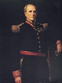
José Gregorio Monagas was the president of Venezuela 1851–1855 and brother of José Tadeo Monagas.

<span class="mw-page-title-main">San Felipe, Venezuela</span> Capital city in Yaracuy, Venezuela

San Felipe is the capital city of Yaracuy, Venezuela. San Felipe is located in the Central-Western Region, Venezuela. The city is an important urban, industrial, commercial and transportation center of Venezuela. San Felipe is the seat of the Roman Catholic Diocese of San Felipe, Venezuela.

<span class="mw-page-title-main">Municipalities of Venezuela</span> Subdivisions of the States of Venezuela

Municipalities of Venezuela are subdivisions of the States of Venezuela. There are 335 municipalities dividing the 23 states and the Capital District.

<span class="mw-page-title-main">Eloy Palacios</span>

Eloy Palacios Cabello, was a Venezuelan artist, sculptor.

<span class="mw-page-title-main">Santiago Mariño</span>

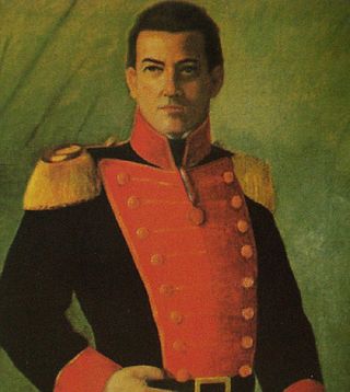
Santiago Mariño Carige Fitzgerald, was a nineteenth-century Venezuelan revolutionary leader and hero in the Venezuelan War of Independence (1811–1823). He became an important leader of eastern Venezuela and for a short while in 1835 seized power over the new state of Venezuela.

<span class="mw-page-title-main">Mérida, Mérida</span> Capital of the state of Mérida Venezuela

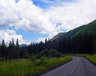
Mérida, officially known as Santiago de los Caballeros de Mérida, is the capital of the municipality of Libertador and the state of Mérida, and is one of the main cities of the Venezuelan Andes. It was founded in 1558 by Captain Juan Rodríguez Suárez, forming part of Nueva Granada, but later became part of the Captaincy General of Venezuela and played an active role in the War of Independence.

<span class="mw-page-title-main">Fermín Toro</span> Venezuelan diplomat and politician

Fermín Toro y Blanco was a Venezuelan humanist, politician, diplomat and author.

<span class="mw-page-title-main">Eastern Region, Venezuela</span> Administrative region of Venezuela

The Eastern Region is one of the 10 administrative regions in which Venezuela was divided for its development plans; it comprises the states of Anzoátegui, Monagas, and Sucre.

<span class="mw-page-title-main">Palacio Municipal de Caracas</span> City hall of Caracas, Venezuela

The Palacio Municipal de Caracas, or Consejo Municipal de Caracas, is the city hall of Caracas, Venezuela. It is located on the corner of Gradillas a Monjas opposite the Plaza Bolívar, occupying half of the plaza's southern section. The building dates from the seventeenth century but now bears the mark of Alejandro Chataing's Neoclassical additions in 1906. It was the focal point for the Constitutional Convention, and signing of the Declaration of Independence in the nineteenth century. The present building is the result of the work undertaken by the Venezuelan architect Alejandro Chataing in 1906. The west wing of the building, the Capilla de Santa Rosa de Lima, the chapel where Venezuela's independence was declared in 1811, has been fully restored and furnished with authentic period pieces. The ground floor houses the Museo Caracas, which contains works by Venezuela's most celebrated painters and many other historic artifacts. It was declared a National Historic Landmark on 16 February 1979.

<span class="mw-page-title-main">La Guaricha Zoo</span> Zoo in Maturín, Venezuela

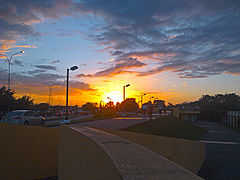
The La Guaricha Zoo Also Zoological Park of La Guaricha Is an urban zoo located less than 400 meters from the center of the city of Maturín, Monagas in Venezuela with native species of the region and the rest of Venezuela. The Municipality of Maturín maintains the rectory of the park and the Governorate of Monagas state assumes some administrative responsibility to support the programs that are developed in him.

<span class="mw-page-title-main">Acosta Municipality, Monagas</span> Municipality in Monagas, Venezuela

Acosta is one of the 13 municipalities of the state of Monagas, Venezuela. Its capital is San Antonio de Maturín. It has an area of 957 km2 and according to INE estimates its population for 2010 was 19,138 inhabitants. The municipality is made up of two parishes, San Antonio and San Francisco. Its name derives from the politician and leader, José Eusebio Acosta Peña.

<span class="mw-page-title-main">State of Venezuela</span> Former state in South America

The State of Venezuela was the official name of Venezuela adopted by the constitution of 1830, during the government of José Antonio Páez. The name was maintained until 1856 when in the constitution promulgated in that year it changes the official name of the country to Republic of Venezuela. In the Constitution of 1864, the United States of Venezuela was established.

<span class="mw-page-title-main">Mateo Manaure</span>

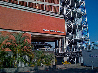
Mateo Manaure was a Venezuelan modern artist. In Venezuela he is considered a master of abstractionism, and is known for his works in the University City of Caracas and for creating the largest glass mural in the world.

<span class="mw-page-title-main">1846 Venezuelan peasant insurrection</span> Peasant revolt in Venezuela

The Venezuelan peasant insurrection of 1846 was a popular and social rebellion that broke out in various agricultural areas of Venezuela in September 1846 and lasted until May 1847.The rebellion was suppressed by the Conservative army.

<span class="mw-page-title-main">Battle of Aragua de Barcelona</span> 1814 battle in the Venezuelan War of Independence

The Battle of Aragua de Barcelona was fought between Royalists of the Spanish Empire and the Second Republic of Venezuela on 17 August 1814. The battle saw Royalists attack Simón Bolívar's force of 3,000 and win with their 8,000 soldiers. It was a major loss for the Patriots.

References

  1. 1 2 3 González Oropeza, Hermann (1985): Historia del Estado Monagas. Ediciones Amon C.A., Caracas. (Biblioteca de Temas y Autores Monaguenses; Colección Guanipa; ensayos e investigación).
  2. "Maturin Climate Normals 1991–2020". World Meteorological Organization Climatological Standard Normals (1991–2020). National Oceanic and Atmospheric Administration. Archived from the original on 18 February 2024. Retrieved 17 February 2024.
  3. "Maturin Climate Normals 1961–1990". National Oceanic and Atmospheric Administration. Archived from the original on 18 February 2024. Retrieved 17 February 2024.
  4. "Estadísticos Básicos Temperaturas y Humedades Relativas Máximas y Mínimas Medias" (PDF). INAMEH (in Spanish). Archived from the original (PDF) on 15 June 2013. Retrieved 27 October 2012.
  5. "Estadísticos Básicos Temperaturas y Humedades Relativas Medias" (PDF). INAMEH (in Spanish). Archived from the original (PDF) on 15 June 2013. Retrieved 27 October 2012.
  6. Casey, Nicholas (25 December 2016). "No Food, No Medicine, No Respite: A Starving Boy's Death in Venezuela". The New York Times. Retrieved 13 January 2019 via NYTimes.com.
  7. Redacción (2023-11-27). "Maestrico González inicia clínicas de Padel en Maturín". El Oriental de Monagas (in Spanish). Retrieved 2024-07-14.
  8. Sifontes Avila, Andreina (2024-01-05). "Béisbol pre junior se alista para la Copa de Oro". Archived from the original on 2024-01-07. Retrieved 2024-07-14.
  9. Idrogo, Luis Miguel (2024-02-12). "Atlético Maturín es el campeón absoluto de la Copa Interligas". La Prensa de Monagas (in Spanish). Retrieved 2024-07-14.
  10. Gamboa, Nangelys (2024-06-06). "Escuela Mejía da la bienvenida a casa a Yangel Herrera". El Oriental de Monagas (in Spanish). Retrieved 2024-07-14.