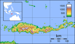
Maumere is the administrative seat of the Sikka Regency and the second largest town (its nominal population has recently overtaken Ende, but of these over 10,500 live in rural areas on outlying islands) on Flores Island, Indonesia. It lies on the north coast of the island and the port is in the north-west part of the town. Administratively, the town is not a single district (kecamatan) within the regency, but is divided into three districts, namely Alok Barat (West Alok), Alok, and Alok Timur (East Alok), although the latter two districts also include a number of substantial islands off the north coast of Flores.
In 1992, Maumere had a total population of about 70,000,[10] but the town suffered considerable damage in the 1992 Flores earthquake and tsunami, with 90 percent of all buildings being destroyed.[10] The Census population of the three districts (Alak Barat, Alak, and Alak Timur) in 2010 was 82,039[11] and 87,720 in 2020;[12] the official estimate as at mid 2024 was 92,095; however this included 10,875 inhabitants of offshore islands, so that the 2024 figure for the town itself was 79,515.[13]
The reefs in areas surrounding Maumere (the Maumere Gulf) were once considered some of the finest diving in the world. However, a 2007 report found that 75% of the coral reefs had been significantly damaged or destroyed by the practice of bomb fishing, the use of toxic chemicals in fishing, and due to earthquakes.[14] One priority of the local community and government is the promotion of tourism. An annual cultural event, Maumere in Love, has been initiated as a step towards fostering both local and wider interest in the region around Maumere.[15]
Alok Barat (West Alok), consists of the four kelurahan of Hewuli, Wailiti, Wolomarang, and Wuring, with 24,548 inhabitants in mid 2024.[17]
Alok, consists of the four kelurahan of Kabor, Kota Uneng, Madawat, and Nangalimang, with 26,957 inhabitants in mid 2024; plus the three desa of Gunung Sari, Pemana (together comprising Pemana Island offshore, with 4,956 inhabitants in 2024), and Samparong (comprising Samparong Island, further north in the Flores Sea, with 1,049 inhabitants in 2024).[18]
Alok Timur (East Alok), consists of the five kelurahan of Beru, Kota Baru, Nangameting, Waioti, and Wairotang, with 24,096 inhabitants in mid 2024; plus the six desa, of which Lepolima (2,441), Watugong (1,473), and Gong Bekor (1,415) are all also on Flores Island but are situated immediately south of the 5 kelurahan, while Kojadoi (1,558) and Kojagete (1,585) together compose Koja Island (or Pulau Besar), while Perumaan (2,007) consists of nearly Perumaan Island and similar small islands, all closer to the northwest coast of Talibura district.[19]
Thus the population of the urban town itself in 2024 was 79,515 (including 5,329 in the villages of Lepolima, Watugong, and Gong Bekor) while the other 12,570 inhabitants were on the various offshore islands.
Kode Wilayah
Name of kelurahan or desa
Area in km2
Pop'n Estimate mid 2024
Post code
53.07.14.1001
Hewuli
11.56
3,168
86115
53.07.14.1002
Wailiti
16.63
3,989
86114
53.07.14.1003
Wolomarang
5.50
11,694
86114
53.07.14.1004
Wuring
15.14
5,697
86115
53.07.14
Totals Alok Barat District
48.83
24,548
53.07.05.1006
Madawat
2.29
8,915
86112
53.07.05.1007
Nangalimang
3.71
3,748
86118
53.07.05.1008
Kabor
0.34
3,291
86112
53.07.05.1009
Kota Uneng
3.01
11,003
86113
53.07.05.2014
Pemana
3.42
3,268
86116
53.07.05.2015
Samparong
3.71
1,049
86116
53.07.05.2016
Gunung Sari
2.90
1,688
86116
53.07.05
Totals Alok District
19.38
32,962
53.07.15.1001
Beru
4.15
3,945
86111
53.07.15.1002
Kota Baru
3.26
6,134
86215
53.07.15.1003
Nangameting
29.19
4,351
86118
53.07.15.1004
Waioti
4.59
7,111
86118
53.07.15.1005
Wairotang
23.37
2,555
86111
53.07.15.2006
Kojadoi
3.99
1,558
86116
53.07.15.2007
Kojagete
1.24
1,585
86116
53.07.15.2008
Lepolima
1.08
2,441
86116
53.07.15.2009
Perumaan
0.87
2,007
86116
53.07.15.2010
Watugong
2.44
1,473
86116
53.07.15.2011
Gong Bekor
0.25
1,415
86116
53.10.12
Totals Alok Timur District
74.43
34,585
Mother of All Nations
Mother of All Nations (Indonesian: Bunda Segala Bangsa) is a statue of Mother Mary in Nilo Hill, 5 kilometres or 3.1 miles south-west from Maumere. The statue stands 18 metres or 59 feet tall, but with its pedestal and foundation it is 28 metres or 92 feet tall. The 6-ton copper-clad statue was constructed in 2005, located at the peak of the 500 metres or 1,640 feet Keli hill, Nilo village, and has become the tallest statue raised in Sikka Regency.
↑Thomas, Luis Filipe. "De Ceuta a Timor"[From Ceuta to Timor] (in Portuguese). Archived from the original on 28 February 2008. Retrieved 17 January 2015.
This page is based on this Wikipedia article Text is available under the CC BY-SA 4.0 license; additional terms may apply. Images, videos and audio are available under their respective licenses.