Mavie | |
|---|---|
 | |
 Mavie  Mavie | |
| Coordinates: 48°08′41″N95°56′20″W / 48.14472°N 95.93889°W | |
| Country | United States |
| State | Minnesota |
| County | Pennington |
| Elevation | 1,161 ft (354 m) |
| Population | |
• Total | 20 |
| Time zone | UTC-6 (Central (CST)) |
| • Summer (DST) | UTC-5 (CDT) |
| Area code | 218 |
| GNIS feature ID | 647625 [2] |
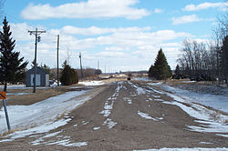
Mavie is an unincorporated community in the township of Clover Leaf, Pennington County, Minnesota, United States. [2]
