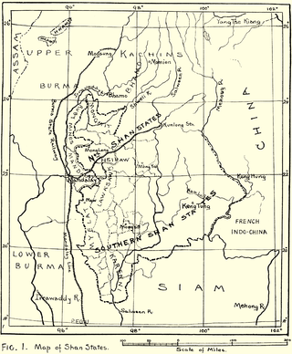
Myelat is a historical region of the southwestern Shan State of Myanmar. Originally this region included some of the smaller states typically ruled by "Myosas" or "Ngwegunhmus", buffering the plains of Burma and the ethnic Shan states further east.

Mang Lon, Manglon, Manglun, Manglön, or Mang Lön a state in the northern Shan states of Myanmar, was formerly the chief state of the Wa people. It is a mountainous territory, including the valleys of the Salween and its tributary the Nam Hka. It had an approximate area of 7770 km2 and its estimated population in 1911 was 40,000.

Yawnghwe, known as Nyaungshwe in Burmese, was a Shan state in what is today Myanmar. It was one of the most important of the Southern Shan States. Yawnghwe state included the Inle Lake. The administrative capital was Taunggyi, located in the northern part of the state. The Agent of the British government, the Superintendent of the Southern Shan States, resided at Taunggyi and the king's palace was at Yawnghwe.

Kengcheng or Keng Cheng was one of the Shan states. In 1896, part of Keng Cheng was incorporated into the neighbouring state of Kengtung in what is today Burma, and the other part, which is now in Laos, went to French Indochina.

Kenglon, also known as Kyainglun was a small Shan state in what is today Burma.

Kyawkku was a Shan state in the Myelat region of what is today Burma. Its capital was the village of Kyawkku (Myinkyado) which had 344 inhabitants in 1901.

Kyong was a Shan state in the Myelat region of what is today Burma.

Loi-ai was a Shan state in the Myelat region of what is today Burma. It was one of the westernmost Shan states, bordering with Yamethin district of Upper Burma. The capital was Lonpo (Aungpan) and the population was mostly Pa-O, but there were also Danu, Shan and Karen people in the area.
Mawnang was a small Shan state in the Myelat region of what is today Burma. Its population was mostly Taungyo.
Namhkai was a Shan state in the Myelat region of what is today Burma. Its capital was Paw-in. Its population was almost entirely Pa-O.

Mongsit or Möngsit, also known as Maingseik was small state of the Shan States in what is today Burma.

Singaling Hkamti was a Shan state in what is today Burma. It was an outlying territory, away from the main Shan State area. The state was located on both sides of the Chindwin River, in what is present-day Hkamti District, Sagaing Region. Its capital was Singaling Hkamti town.

Mongkung, also known as Maingkaing, was a Shan state in what is today Burma. It belonged to the Eastern Division of the Southern Shan States. Its capital was Mong Kung, in the valley of the Nam Teng. The largest minority were Palaung people.

Mongpan, also known as Maingpan was a Shan state in what is today Burma. It belonged to the Eastern Division of the Southern Shan States.

Lawksawk, also known as Yatsawk was a Shan state in what is today Burma. It was located north of Myelat and belonged to the Central Division of the Southern Shan States. Its capital was Lawksawk town. The state included 397 villages and the population was mostly Shan, but there were also Danu, Pa-O and Palaung people in the area.

Mongpai, also known as Mobye, was a Shan state in what is today Burma. It belonged to the Central Division of the Southern Shan States. Mongpai was based in the modern town of Mobye.
Pangtara was a Shan state in what is today the Pindaya Township of Burma. It belonged to the Myelat Division of the Southern Shan States.
Yengan was a Shan state in what is today Burma. It belonged to the Myelat Division of the Southern Shan States.

The Wa States was the name formerly given to the Wa Land, the natural and historical region inhabited mainly by the Wa people, an ethnic group speaking an Austroasiatic language. The region is located to the northeast of the Shan States of British Burma, in the area of present-day Shan State of northern Myanmar (Burma) and the western zone of Pu'er Prefecture, Yunnan, China.

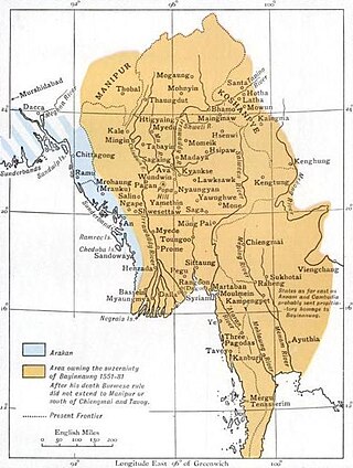
Mogaung or Möngkawng was a Shan state in what is present-day Myanmar. It was an outlying territory, located away from the main Shan State area in present-day Kachin State. The state existed until 1796. The main town was Mogaung.


