Mang Lon, Manglon, Manglun or Manglön, a state in the northern Shan states of Myanmar, was formerly the chief state of the Wa people. It is a mountainous territory, including the valleys of the Salween and its tributary the Nam Hka. It had an approximate area of 7770 km² and its estimated population in 1911 was 40,000.

Mong Hsat is a town in the Shan State of Myanmar, the capital of Mong Hsat Township. It is served by Monghsat Airport.
Yawnghwe, known as Nyaungshwe in Burmese, was a Shan state in what is today Myanmar. It was one of the most important of the Southern Shan States. Yawnghwe state included the Inle Lake. The administrative capital was Taunggyi, located in the northern part of the state. The Agent of the British government, the Superintendent of the Southern Shan States, resided at Taunggyi and the king's palace was at Yawnghwe.

Mong Hsu Township is a township of Loilen District in the Shan State of Myanmar. The principal town is Mong Hsu. Om-pu waterfall on Nam Parng River of Mong Hsu is the second largest waterfall of Shan State. The nearest commercial airport to Mong Hsu is Lashio Airport.
Mong Yawng Township is a township of Mong Hpayak District in the Shan State of Myanmar. The main town is Mong Yawng.
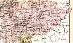
Kengtung Township is a township of Kengtung District in the Shan State of Myanmar. The principal town is Kengtung. It lies almost entirely east of the Salween River and its area is over 12,000 square miles (31,000 km2). It is bounded on the north by the states of Mang Lon, Mong Lem and Keng Hung ; east by the Mekong River, south by the Siamese Shan States, and west in a general way by the Salween River, though it overlaps it in some places. The state is known to the Chinese as Mhng Khng, and was frequently called by the Burmese the 32 cities of the Gn (HkOn). The classical name of the state is Khemarata or Khemarata Tungkapuri.
Kengcheng or Keng Cheng was one of the Shan states. In 1896, part of Keng Cheng was incorporated into the neighbouring state of Kengtung in what is today Burma, and the other part, which is now in Laos, went to French Indochina.

Mongnawng was a large Shan state in what is today Burma.
Mong Hpayak is a town in Mong Hpayak District of Shan State of Myanmar. It is the principal town of and administrative center for both the district and Mong Hpayak Township. The town is located on the Tachilek–Kengtung paved road. As of 2005, a paved road was under construction from Mong Hpayak east to Mong Yawng.

Saharat Thai Doem was an administrative division of Thailand. It encompassed the parts of Shan State of British Burma annexed by the Thai government after the Japanese invasion of Burma.
Mawkmai (Maukme) was a Shan State in what is today Burma. It belonged to the Eastern Division of the Southern Shan States.
Mongkung or Möngküng was a Shan state in what is today Burma. It belonged to the Eastern Division of the Southern Shan States. Its capital was Mong Kung, in the valley of the Nam Teng. The largest minority were Palaung people.
Mongnai, also known as Möngnai, Mone, Mōng Nai or Monē, was a Shan state in what is today Burma. It belonged to the Eastern Division of the Southern Shan States. Its capital was Mongnai town.
Mongpan or Möngpan was a Shan state in what is today Burma. It belonged to the Eastern Division of the Southern Shan States.

Mongyang or Möngyang was a Shan state in what is today Burma. It was an outlying territory, located away from the main Shan State area in present-day Kachin State. The state existed before 1400 and after 1604. The main town was Mohnyin.
Monghsat or Mönghsat was small state of the Shan States in what is today Burma.
Mongpu or Möngpu was a small state of the Shan States in what is today Burma.