
Her Majesty's Prison Maze was a prison in Northern Ireland that was used to house alleged paramilitary prisoners during the Troubles from August 1971 to September 2000.

Castlereagh was a local government district with the status of borough in Northern Ireland. It merged with Lisburn City Council in May 2015 under local government reorganisation in Northern Ireland to become Lisburn and Castlereagh City Council, with a small amount being transferred to Belfast City Council.

Royal Hillsborough, also known simply as Hillsborough, is a village and civil parish in County Down, Northern Ireland, 19 km (12 mi) from the city of Belfast. It is within the Lisburn and Castlereagh District Council area. The village is noted for its Georgian architecture. It is home to Hillsborough Castle, the British royal family's official residence in Northern Ireland, and residence of the British Secretary of State for Northern Ireland.

Belfast West is a parliamentary constituency (seat) in the House of Commons of the UK Parliament. The current MP is Paul Maskey of Sinn Féin.

Lagan Valley is a parliamentary constituency in the United Kingdom House of Commons. The current MP is Sir Jeffrey Donaldson, leader of the Democratic Unionist Party. The constituency has always returned unionist MPs.

Dromore is a small market town and civil parish in County Down, Northern Ireland. It lies within the local government district of Armagh City, Banbridge and Craigavon. It is 19 miles (31 km) southwest of Belfast, on the A1 Belfast–Dublin road. The 2011 Census recorded a population of 6,003.
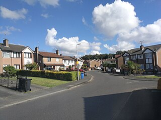
Mazetown or Maze is a small village in County Down, Northern Ireland. It was named after the townland of Maze. The village and townland sit on the southern bank of the River Lagan, which separates it from Lurganure. This river is also the boundary between County Down and County Antrim.

Dundonald is a large settlement and civil parish in County Down, Northern Ireland. It lies east of Belfast and is often considered a suburb of the city. It is home to the Ulster Hospital, Dundonald International Ice Bowl, Dundonald Omnipark, has a Park and Ride facility for the Glider, access to the Comber Greenway and several housing developments. John de Courcey established a keep including a motte-and-bailey in the 12th century. This is known as Moat Park and can be accessed from Church Green, Comber Road and the Upper Newtownards Road.
Kinallen is a small village and townland in County Down, Northern Ireland. It is four miles from Dromore and two miles from Dromara.
Poleglass is an area of west Belfast in Northern Ireland. It is the name of a townland, a modern electoral ward, and a housing estate. The townland is situated in the civil parish of Derriaghy and the historic Barony of Belfast Upper. It is mainly an Irish nationalist area.
Annahilt / Anahilt is a village and civil parish in north County Down, Northern Ireland. It is 7.5 miles south of Lisburn, and about 14 miles south-west of Belfast, on the main road between Ballynahinch and Hillsborough. In the 2001 Census the village had a population of 1,148. Annahilt has a distinctive drumlin setting, with a small wooded estate on a ridge to the west, and panoramic views on the approaches to the village.

Lambeg is a small village and civil parish in County Antrim, Northern Ireland. Located between Belfast and Lisburn, it was once a small rural village, but is now within the Greater Belfast conurbation. Lambeg is also an electoral ward of Lisburn Council. In the 2001 Census it had a population of 60 people. The civil parish of Lambeg covers areas of County Down as well as County Antrim.

Andersonstown is a suburb of west Belfast, Northern Ireland, at the foot of the Black Mountain and Divis Mountain. It contains a mixture of public and private housing and is largely a working-class area with a strong Irish nationalist and Irish Catholic tradition. The district is sometimes colloquially referred to as "Andytown". This area stretches between the Shaws Road, the Glen Road and the Andersonstown Road.
Drumlough is a village and townland in County Down, Northern Ireland, south of Hillsborough and east of Dromore. In the 2001 Census it had a population of 96 people. It is situated in the Lisburn City Council area. Locally significant buildings include Drumlough Presbyterian Church and manse, Rose Cottage, and an Orange Hall built in 1907.
Longkesh is a small village in County Antrim, Northern Ireland, near Lisburn. In the 2001 Census it had a population of 201 people. It is situated in the Lisburn City Council area.
Lurganure is a small village and townland in County Antrim, Northern Ireland. It lies to the west of Lisburn and is separated from Mazetown by the River Lagan. In the 2001 Census it had a population of 441 people. It is in the Lisburn City Council area.

Dunmurry is an urban townland in Belfast, Northern Ireland. Dunmurry is in the Collin electoral ward for the local government district of Belfast City Council.
The subdivisions of Belfast are a series of divisions of Belfast, Northern Ireland that are used for a variety of cultural, electoral, planning and residential purposes.
Broomhedge is a small village in County Antrim, Northern Ireland, near Lisburn, approximately 12 miles (19 km) southwest of Belfast. It lies within the Lisburn City Council area, and the Maghaberry electoral ward.
The Lisburn telephone exchange code refers to the former 01846 area code, which until the 2000 Big Number Change, served Lisburn, Aghalee, Moira, Hillsborough, Dromore, Maze, Stoneyford and Baillies Mills, all of which are in Northern Ireland, a constituent part of the United Kingdom. This area gained 92 and changed to eight digit numbers, under the new 028 area code.
