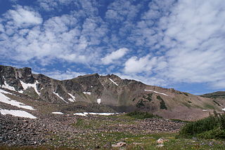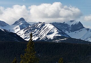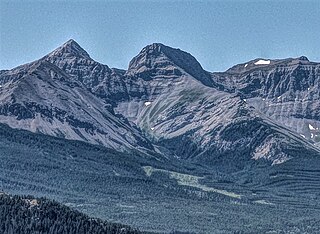
The Continental Divide of the Americas is the principal, and largely mountainous, hydrological divide of the Americas. The Continental Divide extends from the Bering Strait to the Strait of Magellan, and separates the watersheds that drain into the Pacific Ocean from those river systems that drain into the Atlantic and Arctic Ocean, including those that drain into the Gulf of Mexico, the Caribbean Sea, and Hudson Bay.

Mount Robson is the most prominent mountain in North America's Rocky Mountain range; it is also the highest point in the Canadian Rockies. The mountain is located entirely within Mount Robson Provincial Park of British Columbia, and is part of the Rainbow Range. Mount Robson is the second highest peak entirely in British Columbia, behind Mount Waddington in the Coast Range. The south face of Mount Robson is clearly visible from the Yellowhead Highway, and is commonly photographed along this route.

The Canadian Rockies or Canadian Rocky Mountains, comprising both the Alberta Rockies and the British Columbian Rockies, is the Canadian segment of the North American Rocky Mountains. It is the easternmost part of the Canadian Cordillera, which is the northern segment of the North American Cordillera, the expansive system of interconnected mountain ranges between the Interior Plains and the Pacific Coast that runs northwest–southeast from central Alaska to the Isthmus of Tehuantepec in Mexico.

Glacier National Park is part of a system of 43 parks and park reserves across Canada, and one of seven national parks in British Columbia. Established in 1886, the park encompasses 1,349 km2 (521 sq mi), and includes a portion of the Selkirk Mountains, which are part of the larger grouping of mountains, the Columbia Mountains. It also contains the Rogers Pass National Historic Site.

The Canadian is a transcontinental passenger train operated by Via Rail with service between Union Station in Toronto, Ontario, and Pacific Central Station in Vancouver, British Columbia, Canada.

The Park Range, elevation approximately 3,712 metres (12,178 ft), is a mountain range in the Rocky Mountains of northwestern Colorado in the United States. The range forms a relatively isolated part of the Continental Divide, extending north-to-south for approximately 170 kilometres (110 mi) along the boundary between Jackson (east) and Routt counties. It separates North Park in the upper basin of the North Platte River on the east from the Elk River basin in the watershed of the Yampa River the west. It rises steeply out of the Yampa River basin, forming a climatic barrier that receives much snowfall in winter. The northern end of the range lies in Wyoming and is known as the Sierra Madre Range.

The Hart Ranges are a major subrange of the Canadian Rockies located in northeastern British Columbia and western Alberta. The mountains constitute the southernmost portion of the Northern Rocky Mountains.
The Northern Rocky Mountains, usually referred to as the Northern Rockies, are a subdivision of the Canadian Rockies comprising the northern half of the Canadian segment of the Rocky Mountains. While their northward limit is easily defined as the Liard River, which is the northward terminus of the whole Rockies, the southward limit is debatable, although the area of Mount Ovington and Monkman Pass is mentioned in some sources, as south from there are the Continental Ranges, which are the main spine of the Rockies forming the boundary between British Columbia and Alberta. Some use the term to mean only the area north of the Peace Arm of the Williston Reservoir, and in reference to Northern Rocky Mountains Provincial Park, while others consider the term to extend all the way south, beyond the limit of the Hart Ranges at Mount Ovington, to include the McBride area, the Sir Alexander Group and Mount Robson.
Simpson Pass, el. 2,107 m (6,913 ft), is a mountain pass on the border between the Canadian provinces of Alberta and British Columbia, in the area of the Ball Range. It is the prominence col for Mount Ball on the Continental Divide in the vicinity of Sunshine Village ski resort. Simpson River and Simpson Pass are named after Sir George Simpson who first explored the area in 1841.
Kakwa Pass, 1,570 metres (5,151 ft), is a mountain pass in the Canadian Rockies. It is located in the province of British Columbia on the Continental Divide. It is located just east of McGregor Pass and to the north of the town of McBride.
Sifton Pass, 1,012 metres, is a mountain pass in the Rocky Mountain Trench in the Northern Interior of British Columbia, Canada, forming the divide between the Fox and Kechika Rivers, and therefore between the drainage basins of the Finlay and Liard Rivers. It also forms a division point between the Muskwa Ranges of the Northern Rockies to its east, and the Cassiar Mountains to its west.

The Park Ranges, also known as the Main Ranges, are a group of mountain ranges in the Canadian Rockies of southeastern British Columbia and southwestern Alberta, Canada. It is one of the three main subranges and the most central of the Continental Ranges, extending from southeast of Mount McGregor to the Fernie Basin.
Fortress Pass is a mountain pass that crosses the continental divide in the Canadian Rockies, south of Jasper, Alberta. At 1,335 metres (4,380 ft), Fortress Pass is one of the lowest passes to cross the Canadian Rockies that is not traversed by a road. In addition to being at a low elevation, Fortress Pass is also relatively gentle, with almost no elevation difference between water bodies on either side.
Mount Ulysses, is the highest mountain in the Muskwa Ranges of the Northern Canadian Rockies in British Columbia. It and neighbouring peaks are part of a group of names drawing on the epic poem The Odyssey, in which here Ulysses wanders for 10 years before being able to return home to Ithaca.

The Flathead Range is a mountain range of the Canadian Rockies in Alberta and British Columbia, Canada. It is located on the Continental Divide, east of Fernie, in the Kootenay Land District. It stretches 27 km (17 mi) lengthwise north–south from Crowsnest Pass to North Kootenay Pass. The range's toponym was officially adopted on 30 June 1912 by the Geographic Board of Canada, and was named in association with the Flathead River.
Mount Sir Alexander, is a 3,275-metre (10,745 ft), ultra-prominent mountain in the Sir Alexander Area of the Continental Ranges, Canadian Rockies located in British Columbia.

Mount McLaren is a 2,301-metre (7,549-foot) mountain summit located in Alberta, Canada.

Mount Parrish is a 2,530-metre (8,301-foot) mountain summit located in Alberta, Canada.

Indian Peak is a 2,992-metre (9,816-foot) mountain summit located in Mount Assiniboine Provincial Park of British Columbia, Canada.


