Carn Eighe is a mountain in the Northwest Highlands of Scotland. Rising to 1,183 metres (3,881 ft) above sea level, it is the highest mountain in Scotland north of the Great Glen, the twelfth-highest in the British Isles, and, in terms of relative height, it is the second-tallest mountain in the British Isles after Ben Nevis. Carn Eighe lies between Glen Affric and Loch Mullardoch, and is at the heart of a massif along with its twin peak, the 1,181-metre (3,875 ft) Mam Sodhail.

Mullach nan Coirean or Sgùrr a' Chaorainn is one of the Mamores mountains in the Scottish Highlands. It reaches a height of 939 metres (3081 feet) and is the most westerly of the ten Munros in the Mamores. It has a lower peak to the west, Meall a' Chaorainn. To the east, it is linked to the neighbouring mountain Stob Bàn by a bealach at a height of 846 metres; these two Munros are often climbed together from Glen Nevis.
Stùc a' Chroin is a mountain in the Breadalbane region of the southern Scottish Highlands. It is a Munro, with a height of 975 metres (3,199 ft). It lies a short distance south of Ben Vorlich and east of Strathyre. The boundary between the council areas of Perth and Kinross and Stirling passes through the summit of the peak, and the town of Callander lies to the south.

Sgùrr a' Bhealaich Dheirg is a mountain in Kintail on the northern side of Glen Shiel in the Scottish Highlands. With a height of 1,036 metres (3,399 ft), it is classed as a Munro. It is the highest of three Munros known as the "Brothers of Kintail" in contrast to the Five Sisters of Kintail which lie just to the west.

Beinn Dubhchraig is a mountain in the Scottish Highlands, west of Crianlarich in the northern part of Loch Lomond and the Trossachs National Park. It is a Munro with a height of 978 metres (3,209 ft). It is overshadowed by its neighbour Ben Lui, although it is well seen from the main A82 road. Its name means "mountain of the black rock", referring to the steep and rocky face on the southwest slopes above Loch Oss, which offer scrambling routes to the summit.

An Caisteal is a mountain in the Breadalbane region of the Scottish Highlands, south of the village of Crianlarich. It is a Munro with a height of 995 metres (3,264 ft).

Sròn a’ Choire Ghairbh is a Scottish mountain situated on the northern side of Loch Lochy, 13 kilometres north of Spean Bridge in the Highland Council area.

Beinn a' Chroin is a mountain in the Breadalbane region of the Scottish Highlands, six kilometres south of Crianlarich. With a height of 941 metres (3,087 ft) it qualifies as a Munro.

Cruach Ardrain is a Munro mountain in the Breadalbane region of the Scottish Highlands, with a height of 1,046 metres (3,432 feet). It is five kilometres southeast of Crianlarich village and is one of the Crianlarich Hills.

Ben Chonzie or Ben-y-Hone is a mountain in the Breadalbane region of the Scottish Highlands. It is eleven kilometres northwest of Crieff. It stands at 931 metres (3,054 ft) and is therefore listed as a Munro. It is the highest point of a large area of moorland and rounded hills between Loch Earn and Loch Tay, and with a broad, flat summit and relatively few distinguishing features, it is often regarded as one of Scotland's least interesting Munros.

Ben Oss is a mountain in the southern Highlands of Scotland. It is a Munro with a height of 1,029 metres (3,376 ft). Ben Oss is on the border of Argyll and Perthshire, southwest of Tyndrum, within Loch Lomond and the Trossachs National Park. It is part of a mountain chain that includes three other Munros. When viewed from the north or south it is seen as a distinct pointed hill in contrast to its more bulky neighbour Beinn Dubhchraig, with which it is usually climbed. The mountain is quite rocky and craggy being composed of mica schist rock.

Beinn Challuim is a mountain in the Breadalbane region of the Scottish Highlands. It is east of the village of Tyndrum, in the Forest of Mamlorn, an ancient deer forest at the northern edge of Loch Lomond and the Trossachs National Park. It is a Munro with a height of 1,025 metres (3,363 ft).

Stob a' Choire Odhair is a Scottish mountain situated eight kilometres north west of Bridge of Orchy on the border of the Argyll and Bute and Highland council areas.

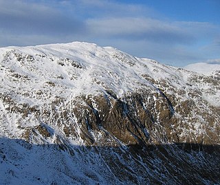
Creise is a mountain summit in the Black Mount range, in the Scottish Highlands. It overlooks the northern end of Glen Etive and its height is 1,100 metres (3,600 ft). Creise is one of four Munros in the Black Mount, along with Meall a' Bhuiridh, Stob Ghabhar and Stob a' Choire Odhair. The mountain is a long and flattish ridge, whose highest point was unnamed until 1981. It is popular with cross-country skiers, being near the White Corries ski area from where it is often climbed along with adjoining Meall a' Bhuiridh. The steep and craggy northern buttress, Sròn na Crèise, is well seen from the A82 road and the Kings House Hotel.
Creag Mhòr is a mountain in the Breadalbane region of the Scottish Highlands. It is in the Forest of Mamlorn, ten kilometres northeast of Tyndrum, and is one of the remotest of the southern Highlands Creag Mhòr reaches a height of 1047 metres (3435 ft) and qualifies as a Munro and a Marilyn. It is often climbed with the neighbouring Munro of Beinn Heasgarnich; the two mountains form the high ground between Glen Lochay and Loch Lyon.

Meall a' Chrasgaidh is a Scottish mountain located in the Fannich group of mountains, 21 kilometres south-southeast of Ullapool.

Càrn Mairg is a mountain in the Breadalbane region of the Scottish Highlands, with a height of 1,042 metres (3,419 ft). It stands in a group of four Munro mountains known as the 'Càrn Mairg group', on the north side of Glen Lyon, Perthshire.

Càrn Gorm is a mountain in the Breadalbane region of the Scottish Highlands, with a height of 1,029 metres (3,376 ft). It stands in a group of four Munro mountains known as the Càrn Mairg group or the Glen Lyon Horseshoe, on the north side of Glen Lyon, Perthshire.

Beinn Bhuidhe is a mountain near the head of Loch Fyne in Argyll in the Scottish Highlands. It is a Munro with a height of 948 metres (3,110 ft).
Sgiath Chùil is a mountain situated in the southern highlands of Scotland. It stands within Loch Lomond and the Trossachs National Park, on its northern border. It is about 11 kilometres (6.8 mi) west of Killin.