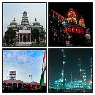
Begusarai is the industrial and financial capital of Bihar and the administrative headquarters of the Begusarai district, which is one of the 38 districts of the Indian state of Bihar. The district lies on the northern bank of the river Ganges in the Mithila region of India.
Khagaria is a town in Indian state of Bihar and the administrative headquarters of Khagaria district. Khagaria is a part of Munger division. It is located at 25.5°N 86.48°E and has an average elevation of 36 metres. The Khagaria Junction railway station serves the town. It is situated about 25 km north of Munger.

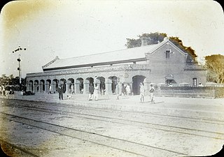
Muzaffarpur is a city located in Muzaffarpur district in the Tirhut region of the Indian state of Bihar. It serves as the headquarters of the Tirhut division, the Muzaffarpur district and the Muzaffarpur Railway District. It is the fourth most populous city in Bihar.
Motihari is a city and headquarters of East Champaran district in the Indian state of Bihar. It is located 80 kilometres west of Muzaffarpur and 152 kilometres northwest of the state capital Patna. In early days the land of Motihari was ruled by different kingdoms as Videha, Sunga, Kanvas. It is also believed that Champaran used to be a major part of King Janak's empire. Mahatma Gandhi Started his famous Satyagraha movement from here.

Begusarai District is one of the thirty-eight districts of the Indian state of Bihar. The city of Begusarai is its administrative headquarters and is part of the Munger division.
Ballia is a city with a municipal board in the Indian state of Uttar Pradesh. The eastern boundary of the city lies at the junction of two major rivers, the Ganges and the Ghaghara. The city is situated 140 km (87 mi) east of Varanasi and about 380 km from the state capital Lucknow. It is home to a protected area, the Jai Prakash Narayan bird sanctuary. Ballia is around 4 km (2.5 mi) from Bihar.
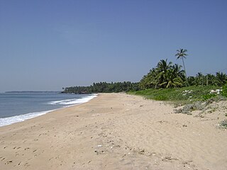
Thottada is a census town and suburb of Kannur city situated on NH 66 of about 8 km (5.0 mi) south of Kannur railway station in Kerala State, India.

Barauni IOC Township is a census town at Barauni in Begusarai district in the state of Bihar, India.
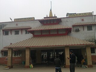
Raxaul is a sub-divisional town in the East Champaran district of the Indian state of Bihar. It is situated at the India-Nepal border with Birgunj city (Nepal). Raxaul is a major railway junction.
Guriahati is a census town in the Cooch Behar I CD block in the Cooch Behar Sadar subdivision of the Cooch Behar district in the Indian state of West Bengal.
Jhajha is a city and a notified area in Jamui district in the Indian state of Bihar. It lies in the southern part of Bihar and very close to the Jharkhand border. It falls on the Howrah - Mughalsarai mainline about halfway between Madhupur Junction and Kiul Junction.
Karunguzhi is a town in Chengalpattu district in the Indian state of Tamil Nadu.
Lalganj is an important town and Nearest City, (60 kilometres Morden Old City Mehsi), and river port situated in Vaishali district, Bihar.

Renukoot is a town and a nagar panchayat in Sonbhadra district in the Indian state of Uttar Pradesh. It is 68 km south from the district headquarters Robertsganj.
Rosera is a city (subdivision) on the bank of River Budhi Gandak. It is a municipality in Samastipur district in the Indian state of Bihar. Rosera block consists of 48 villages. Rosera is well connected by the rest of the country through railway or road network. Rosera is connected to Begusarai district via SH-55 and Darbhanga district via SH-88 and it's approx 120km from Capital Patna.
Salumbar is a city in Salumbar district, in the Indian state of Rajasthan. Salumbar is a part of "Mewar" dynasty. Salumbar is also known as "Hadirani nagri" which has history of queen Hadirani who sacrificed her life to motivate her husband to go to a battle.

Piro is a nagar parishad town and corresponding community development block in Bhojpur District, in the Indian state of Bihar. Piro is 39 KM from the Ara Railway Station. Jitaura is 6 KM from Piro.
Manjhaul is a village in the Begusarai district of Bihar state in India. It is notable for the Jaimangla Garh temple and Kaber Lake.
Subhanpur village is located in Kashi Chak Tehsil of Nawada district in Bihar, India. It is situated 6 km away from sub-district headquarter Kashi Chak and 40 km away from the district headquarter Nawada. As per 2009 stats, Subhanpur village is itself a gram panchayat. According to 2011 census information the location code or village code of Subhanpur village is 257666.

Deo also known as Dev is a city council, town and a notified area in Deo, Block of Aurangabad district in the Indian state of Bihar. Deo is located 10 km to the southeast of District Administrative Aurangabad Bihar.

