
Panchkula district was formed as the 17th district of the Indian state of Haryana on 15 August 1995. It comprises two sub divisions and two tehsils: Panchkula and Kalka. It has 264 villages out of which twelve are un-inhabited and ten wholly merged with towns or treated as census towns according to the 1991 census. There are five towns in the district: Barwala, Kalka, Panchkula, Pinjore and Raipur Rani. The total population of the district is 319,398 out of which 173,557 are males and 145,841 are females.

Ratnagiri District is a district in the state of Maharashtra, India. The administrative headquarter of the district is located in the town of Ratnagiri. The district is 11.33% urban. The district is bounded by the Arabian Sea to the west, Sindhudurg district to the south, Raigad district to the north and Satara, Sangli and Kolhapur districts to the east. This district is part of Konkan division.

Belagavi district, formerly known as also Belgaum district, is a district in the state of Karnataka, India. The district is known as Sugar Bowl of Karnataka with 1.5 lakh (150,000) hectares being used for commercial production and it has displaced Mandya district in sugar cane production over the last decade. The city of Belgaum (Belagavi) is the district headquarters in Belagavi district. It houses the Second legislative building, where the Karnataka Legislature hold session once a year. The district is famous for its native sweet, Kunda. According to the 2011 Census of India, it has a population of 4,779,661, of which 24.03% live in urban areas, making it the second most populous district in Karnataka, after Bangalore Urban. The district has an area of 13,415 km2 (5,180 sq mi) making it the largest district in Karnataka, and is bounded by Kolhapur District and Sangli district of Maharashtra state on the west and north, on the northeast by Bijapur district, on the east by Bagalkot district, on the southeast by Gadag district, on the south by Dharwad and Uttara Kannada districts, and on the southwest by the state of Goa.

Madurai district is one of the 38 districts of the state of Tamil Nadu in southeastern India. The city of Madurai serves as the district headquarters. It houses the famous Sri Meenakshi Sundareshwarar temple and is situated on the banks of the river Vaigai. Thiruparankundram is one of the major tourist place in the district. As of 2011, the district had a population of 3,038,252 with a sex-ratio of 990 females for every 1,000 males. Aside from the city of Madurai, the larger towns are Melur, Vadipatti, Thirumangalam, Thirupparankundram, Peraiyur, and Usilampatti. It is an important hub for various film shootings. Alanganallur is a popular spot in the district for Jallikattu, as are Palamedu and Avaniyapuram.

Deoria district, one of the districts of eastern Uttar Pradesh, India has its headquarters located at Deoria and is a part of Gorakhpur division. It came into existence on 16 March 1946 from Gorakhpur district.
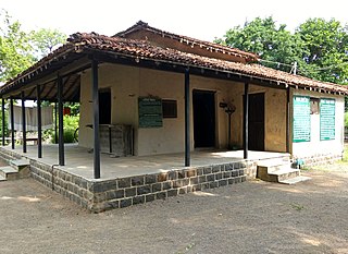
Wardha District is in the state of Maharashtra in western India. This district is a part of Nagpur Division. The city of Wardha is the administrative headquarter of the district. Hinganghat, Pulgaon, Arvi and Wardha are the major cities in the District. The District had a population of 1,300,774, of which 26.28% were urban as of 2011.

Damoh District is a district of Madhya Pradesh state in central India. The town of Damoh is the district headquarters. The district is part of the Sagar Division.

Tonk district is a district of the state of Rajasthan in western India. The city of Tonk is the administrative headquarters of the district. The district is bounded on the north by Jaipur district, on the east by Sawai Madhopur district, on the southeast by Kota district, on the south by Bundi district, on the southwest by Bhilwara district, and on the west by Ajmer district.
Ashta is a city and a municipality in Sehore district in the state of Madhya Pradesh, India. The nearest airport is in the city of Bhopal.
Bhatpar Rani is a town and tehsil in Deoria District in the state of Uttar Pradesh in India. It belongs to Gorakhpur Division. It is located 48 km towards East from District headquarters Deoria.The Member of Legislative Council of Bhatpar Rani Constituency is Shri. Sabhakunwar Kushwaha In Bhatpar Rani, the block number of village is 127. The biggest village in this tehsil is Sarayan. Khan Sir(Teacher), Shilpi Raj(Singer) were born here.

Bawali is a census town within the jurisdiction of the Nodakhali police station in the Budge Budge II CD block in the Alipore Sadar subdivision of the South 24 Parganas district in the Indian state of West Bengal.
Nelliyalam is a panchayat town in The Nilgiris district in the Indian state of Tamil Nadu. As of 2011, the town had a population of 44,590.
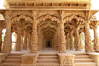
Jasol is a village in Pachpadra tehsil of Balotra District of the Indian state of Rajasthan.The historical village of Jasol, the capital of the former Malani area was ruled by the independent Mahecha clan of the Rathore Rajputs. It includes cenotaphs, and the temple of Rani Bhatiyani. The horses of the indigenous Malani breed are raised there.

Jagdishpur is a panchayat village in the Bhopal district of Madhya Pradesh, India. It is located in the Huzur tehsil and the Phanda block.
Kukurghati, also known as Kukur Ghati, is a village of the Bhatpar Rani Vidhan Sabha Constituency in Deoria district in the state of Uttar Pradesh, India.

Deo also known as "Dev", is a city council, town and a notified area in Deo community development block in Aurangabad subdivision in Aurangabad district in the Indian state of Bihar. Deo is located 10 km to the southeast of District Administrative Aurangabad Bihar.
Karnagarh is a village and a gram panchayat in the Salboni CD block in the Medinipur Sadar subdivision of the Paschim Medinipur district in the state of West Bengal, India.

Rani Khera is a village in Bachhrawan block of Rae Bareli district, Uttar Pradesh, India. As of 2011, its population is 2,042, in 460 households. It is located 6 km from Bachhrawan, the block headquarters, and the main staple foods are wheat and rice. It has one primary school and no healthcare facilities.

Rani Khera is a village in Shivgarh block of Rae Bareli district, Uttar Pradesh, India. As of 2011, its population is 368, in 75 households. It has one primary school and no healthcare facilities. It is located 20 km from Maharajganj, the tehsil headquarters. The main staple foods are wheat and rice.

Rani Khera is a village in Sareni block of Rae Bareli district, Uttar Pradesh, India. It is located 27 km from Lalganj, the tehsil headquarters. As of 2011, it has a population of 1,451 people, in 278 households. It has one primary school and no healthcare facilities. It belongs to the nyaya panchayat of Murarmau.

