Astoria is a port city and the seat of Clatsop County, Oregon, United States. Founded in 1811, Astoria is the oldest city in the state and was the first permanent American settlement west of the Rocky Mountains. The county is the northwest corner of Oregon, and Astoria is located on the south shore of the Columbia River, where the river flows into the Pacific Ocean. The city is named for John Jacob Astor, an investor and entrepreneur from New York City, whose American Fur Company founded Fort Astoria at the site and established a monopoly in the fur trade in the early 19th century. Astoria was incorporated by the Oregon Legislative Assembly on October 20, 1856.

U.S. Route 101, or U.S. Highway 101 (US 101), is a north–south United States Numbered Highway that runs through the states of California, Oregon, and Washington, on the West Coast of the United States. It is also known as El Camino Real where its route along the southern and central California coast approximates the commemorative trail which links the Spanish missions, pueblos, and presidios. It merges at some points with California State Route 1 (SR 1).

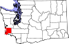
Clatsop County is one of the 36 counties in the U.S. state of Oregon. As of the 2020 census, the population was 41,072. The county seat is Astoria. The county is named for the Clatsop tribe of Native Americans, who lived along the coast of the Pacific Ocean prior to European settlement. Clatsop County comprises the Astoria, OR Micropolitan Statistical Area, or Sunset Empire, and is located in Northwest Oregon.

Maryhill is an unincorporated community and census-designated place (CDP) in Klickitat County, Washington, United States. The population was 58 at the 2010 census, down from 98 at the 2000 census.
Wishram is an unincorporated community and census-designated place (CDP) in Klickitat County, Washington, United States. The population was 342 at the 2010 census, up from 213 at the 2000 census. The site of the historic Celilo Falls is nearby.

The Astoria–Megler Bridge is a steel cantilever through truss bridge in the northwest United States that spans the lower Columbia River, between Astoria, Oregon, and Point Ellice near Megler, Washington. Opened 57 years ago, in 1966, it is the longest continuous truss bridge in North America.

The Lewis and Clark National Historic Trail is a route across the United States commemorating the Lewis and Clark Expedition of 1804 to 1806. It is part of the National Trails System of the United States. It extends for some 4,900 miles (7,900 km) from Pittsburgh, Pennsylvania, to the mouth of the Columbia River in Oregon.
U.S. Route 101 (US 101), is a major north–south U.S. Highway in Oregon that runs through the state along the coastline near the Pacific Ocean. It runs from the California border, south of Brookings, to the Washington state line on the Columbia River, between Astoria, Oregon, and Megler, Washington.

In the U.S. state of Oregon, U.S. Route 30, a major east–west U.S. Highway, runs from its western terminus in Astoria to the Idaho border east of Ontario. West of Portland, US 30 generally follows the southern shore of the Columbia River; east of Portland the highway has largely been replaced with Interstate 84, though it is signed all the way across the state, and diverges from the I-84 mainline in several towns, as a de facto business route. Out of all the states U.S. Route 30 traverses, it spends the most time in Oregon. At 477 miles, it is also the longest road in the state.

State Route 401 (SR 401) is a 12.13-mile (19.52 km) long state highway in Pacific County within the U.S. state of Washington. The highway originates at the north end of the Astoria–Megler Bridge west of Megler at an intersection with U.S. Route 101 (US 101). The roadway travels northeast, paralleling cliffs, the Columbia River and the South Fork of the Naselle River to Naselle, ending at SR 4. The road was designated Secondary State Highway 12B (SSH 12) between 1937 and 1964, when SR 401 was created to replace SSH 12B. The Astoria–Megler Bridge, completed in 1966, replaced a ferry east of the bridge, where the highway originally ended, and is known locally as Kingston Ferry Road. The roadway was extended west to the north end of the bridge, where it currently terminates. The former ferry terminal became the Dismal Nitch rest area, named after the Lewis and Clark Expedition's description of the place.

Westport is an unincorporated community and census-designated place on the Columbia River in Clatsop County, Oregon, United States. As of the 2010 census, it had a population of 321.
The Ilwaco Railway and Navigation Company operated a 3 ft narrow gauge railroad that ran for over forty years from the bar of the Columbia River up the Long Beach Peninsula to Nahcotta, Washington, on Willapa Bay. The line ran entirely in Pacific County, Washington, and had no connection to any outside rail line. The railroad had a number of nicknames, including the "Clamshell Railroad" and the "Irregular, Rambling and Never-Get-There Railroad."
Historic ferries in Oregon are water transport ferries that operated in Oregon Country, Oregon Territory, and the state of Oregon, United States. These ferries allowed people to cross bodies of water, mainly rivers such as the Willamette in the Willamette Valley, and the Columbia, in order to transport goods, move people, and further communications until permanent bridges were built to allow faster crossing of the water. The early ferries were used by wagons and pedestrians, while later ones transported trains and then automobiles. Oregon has a few automobile ferries still in operation.
U.S. Route 101 (US 101) is a United States Numbered Highway that runs along the West Coast from Los Angeles, California to Tumwater, Washington. Within the state of Washington, US 101 connects cities on the coast of the Pacific Ocean and encircles the Olympic Peninsula around the Olympic Mountains. It also serves as the main access for Olympic National Park, several state parks, and other scenic and recreational areas.

State Route 409 (SR 409) is a short Washington state highway in Wahkiakum County. The highway runs north from the Wahkiakum County Ferry on Puget Island to SR 4 in the county seat of Cathlamet over a distance of 3.84 miles (6.18 km). The route connects Westport, Oregon, which is served by the county ferry, and Cathlamet. The highway was referred to as Secondary State Highway 12F (SSH 12F) from 1943 until 1964.
Dismal Nitch is the name of a cove along the lower Columbia River in Washington state, notable as the Lewis and Clark Expedition's last campsite before sighting the Pacific Ocean. Today it is a rest stop on the Washington State Route 401 highway just east of the Astoria–Megler Bridge and is affiliated with Lewis and Clark National Historical Park.

The Astoria–Megler ferry, also called the Astoria–McGowan ferry and the Astoria–North Beach ferry, ran across the Columbia River between Astoria, Oregon, and two ferry docks near the present small community of Megler, Washington, from 1921 to 1966.

Joseph George Megler, generally known as J.G. Megler, was a German-American salmon cannery owner and politician in Washington. He was a member of the Washington House of Representatives for the first legislature in 1889 and five terms thereafter. He was also a member of the Washington State Senate for two terms.
Brookfield was a salmon-canning and fishing town located on the Columbia River in Wahkiakum County, Washington, United States, from 1873 to 1957. It was the home of the J.G. Megler Company.

Nahcotta was a steamboat operated from 1898 to 1928 on a route from Astoria, Oregon to Ilwaco, Washington, and then, from 1908 on, from Astoria to Megler, Washington. Nahcotta ran on the same route for its entire service life, and for much of that time was commanded by Capt. Tom Parker, who started his marine career as a deckhand and who had only three months of formal education.