Lebam, Washington

Last updated

Lebam, Washington
CDP
Pacific County Washington Incorporated and Unincorporated areas Lebam Highlighted.svg
Location of Lebam, Washington
Coordinates: 46°33′51″N123°33′03″W / 46.56417°N 123.55083°W / 46.56417; -123.55083
Country United States
State Washington
County Pacific
Area
  Total
1.5 sq mi (3.8 km2)
  Land1.5 sq mi (3.8 km2)
  Water0.0 sq mi (0.0 km2)
Elevation
[1]
210 ft (60 m)
Population
 (2020)
  Total
150
  Density100/sq mi (39/km2)
Time zone UTC-8 (Pacific (PST))
  Summer (DST) UTC-7 (PDT)
ZIP code
98554
Area code 360
FIPS code 53-38880 [2]
GNIS feature ID2408594 [1]

Lebam is a census-designated place (CDP) in Pacific County, Washington, United States. The population was 160 at the 2010 census. At the 2020 census, the population decreased to 150. 16 percent had a bachelor's degree or higher. The employment rate was 45.6 percent.

Contents

History

Lebam was originally called Half Moon [3] or Half Moon Creek. [4] The town was later named Lebam, the reversed spelling of early settler J.W. Goodell's daughter's name, Mabel. [5] [6]

Geography

According to the United States Census Bureau, the CDP has a total area of 1.5 square miles (3.8 km2), all of it land.

Demographics

Historical population
CensusPop.Note
2000 176
2010 160−9.1%
2020 150−6.2%
US Decennial Census 2020 Census [7]

As of the census [2] of 2000, there were 176 people, 77 households, and 43 families residing in the CDP. The population density was 120.2 people per square mile (46.5/km2). There were 82 housing units at an average density of 56.0/sq mi (21.7/km2). The racial makeup of the CDP was 84.09% White, 6.82% Native American, 1.14% Asian, 4.55% from other races, and 3.41% from two or more races. 25.4% were of German, 9.2% Polish, 9.2% Swiss, and 6.9% English ancestry according to Census 2000

There were 77 households, out of which 26.0% had children under the age of 18 living with them, 44.2% were married couples living together, 7.8% had a female householder with no husband present, and 42.9% were non-families. 35.1% of all households were made up of individuals, and 15.6% had someone living alone who was 65 years of age or older. The average household size was 2.29 and the average family size was 3.02.

In the CDP, the population was spread out, with 26.1% under the age of 18, 4.0% from 18 to 24, 27.3% from 25 to 44, 22.2% from 45 to 64, and 20.5% who were 65 years of age or older. The median age was 40 years. For every 100 females, there were 125.6 males. For every 100 females age 18 and over, there were 116.7 males.

The median income for a household in the CDP was $33,125, and the median income for a family was $40,000. Males had a median income of $45,313 versus $51,250 for females. The per capita income for the CDP was $15,831. About 8.0% of families and 11.9% of the population were below the poverty line, including 15.9% of those under the age of eighteen and 20.8% of those 65 or over. 23 of the current 160 residents carry the last name Friese, which means they make up 14% of the current population. While 7 residents carry the last name Camenzind, or about 4 percent.

See also

Related Research Articles

<span class="mw-page-title-main">Mount Lena, Maryland</span> CDP in Maryland, United States

Mount Lena is a census-designated place (CDP) in Washington County, Maryland, United States. The population was 547 at the 2020 census.

<span class="mw-page-title-main">Greentree, New Jersey</span> Populated place in Camden County, New Jersey, US

Greentree is an unincorporated community and census-designated place (CDP) located within Cherry Hill Township, in Camden County, in the U.S. state of New Jersey. As of the 2010 United States Census, the CDP's population was 11,367.

<span class="mw-page-title-main">Society Hill, Middlesex County, New Jersey</span> Populated place in Middlesex County, New Jersey, US

Society Hill is an unincorporated community and former census-designated place (CDP) in Piscataway Township, Middlesex County, New Jersey, United States. As of the 2010 United States Census, the CDP's population was 3,829. The area was not listed as a CDP for the 2020 census.

<span class="mw-page-title-main">Fairview, Monmouth County, New Jersey</span> Populated place in Monmouth County, New Jersey, US

Fairview is an unincorporated community and census-designated place (CDP) in Middletown Township, Monmouth County, New Jersey, United States. As of the 2020 United States census, the CDP's population was 3,731.

<span class="mw-page-title-main">Barnegat (CDP), New Jersey</span> Populated place in Ocean County, New Jersey, US

Barnegat is an unincorporated community and census-designated place (CDP) located within Barnegat Township, in Ocean County, in the U.S. state of New Jersey. As of the 2010 United States census, the CDP's population was 2,817.

<span class="mw-page-title-main">Cedar Glen Lakes, New Jersey</span> Populated place in Ocean County, New Jersey, US

Cedar Glen Lakes is an unincorporated community and census-designated place (CDP) located within Manchester Township, in Ocean County, in the U.S. state of New Jersey. As of the 2010 United States Census, the CDP's population was 1,421.

<span class="mw-page-title-main">Holiday Heights, New Jersey</span> Populated place in Ocean County, New Jersey, US

Holiday Heights is an unincorporated community and census-designated place (CDP) located within Berkeley Township, in Ocean County, in the U.S. state of New Jersey. As of the 2010 United States Census, the CDP's population was 2,099.

<span class="mw-page-title-main">Leisure Knoll, New Jersey</span> Populated place in Ocean County, New Jersey, US

Leisure Knoll is an unincorporated community and census-designated place (CDP) located within Manchester Township, in Ocean County, in the U.S. state of New Jersey. As of the 2010 United States Census, the CDP's population was 2,490.

<span class="mw-page-title-main">Leisure Village East, New Jersey</span> Populated place in Ocean County, New Jersey, US

Leisure Village East is an unincorporated community and census-designated place (CDP) located within Lakewood Township, in Ocean County, in the U.S. state of New Jersey. As of the 2010 United States Census, the CDP's population was 4,217. Leisure Village East is one of several active adult communities bearing similar names. Leisure Village and Leisure Village West are the other two communities nearby.

<span class="mw-page-title-main">Silver Ridge, New Jersey</span> Populated place in Ocean County, New Jersey, US

Silver Ridge is an unincorporated community and census-designated place (CDP) located within Berkeley Township, in Ocean County, in the U.S. state of New Jersey. As of the 2010 United States Census, the CDP's population was 1,133.

<span class="mw-page-title-main">Cuyamungue, New Mexico</span> Census-designated place in New Mexico, United States

Cuyamungue is a census-designated place (CDP) in Santa Fe County, New Mexico, United States. It is part of the Santa Fe, New Mexico Metropolitan Statistical Area. The population was 479 at the 2010 census.

Pump Back is a census-designated place (CDP) in Mayes County, Oklahoma, United States. The population was 175 at the 2010 census compared to 155 at the 2000 census, a gain of 13 percent.

<span class="mw-page-title-main">Meadow Glade, Washington</span> Census-designated place in Washington, United States

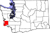
Meadow Glade is a census-designated place (CDP) in Clark County, Washington, United States. The population was 2,758 at the 2020 census.

<span class="mw-page-title-main">East Hill-Meridian, Washington</span> Former CDP in Washington, United States

East Hill-Meridian is a former census-designated place (CDP) in King County, Washington. The population was 29,878 at the time of the 2010 census. The majority of the census area is now within the limits of Kent and Renton.

<span class="mw-page-title-main">Tracyton, Washington</span> Census-designated place in Washington, United States

Tracyton is a census-designated place (CDP) in Kitsap County, Washington, United States. Its population was 5,967 at the 2020 census. It was named for 19th century Secretary of the Navy Benjamin F. Tracy.

<span class="mw-page-title-main">Cathcart, Washington</span> CDP in Washington, United States

Cathcart is a census-designated place (CDP) in Snohomish County, Washington, United States. The population was 2,647 at the 2020 census, up from 2,458 at the 2010 census. Based on per capita income, one of the more reliable measures of affluence, Cathcart ranks 45th of 522 areas in the state of Washington to be ranked. Cathcart was named for Isaac Cathcart, a lumberman, entrepreneur, and Snohomish County pioneer.

<span class="mw-page-title-main">Lochsloy, Washington</span> CDP in Washington, United States

Lochsloy is a census-designated place (CDP) in Snohomish County, Washington, United States. The population was 2,806 at the 2020 census, up from 2,533 at the 2010 census.

<span class="mw-page-title-main">Maltby, Washington</span> Census-designated place in Washington, United States

Maltby is a census-designated place (CDP) in Snohomish County, Washington. The population was 11,277 at the 2020 census.

<span class="mw-page-title-main">Woods Creek, Washington</span> CDP in Washington, United States

Woods Creek is a census-designated place (CDP) in Snohomish County, Washington, United States. The population was 6,017 at the 2020 census.

<span class="mw-page-title-main">Loveland Park, Ohio</span> Census-designated place in Ohio, United States

Loveland Park is a census-designated place (CDP) located in Symmes Township, Hamilton County and Deerfield Township, Warren County, in the southwestern part of the U.S. state of Ohio. The CDP is named after the city of Loveland. The population was 1,737 at the 2020 census.

References

  1. 1 2 U.S. Geological Survey Geographic Names Information System: Lebam, Washington
  2. 1 2 "U.S. Census website". United States Census Bureau . Retrieved January 31, 2008.
  3. Washington Place Names. Tacoma Public Library.
  4. Majors, Harry M. (1975). Exploring Washington. Van Winkle Publishing Co. p. 115. ISBN   978-0-918664-00-6.
  5. "Unusual names, odd spellings found in Washington". The Spokesman-Review. December 24, 1977. pp. A12. Retrieved May 20, 2015.
  6. Meany, Edmond S. (1923). Origin of Washington geographic names. Seattle: University of Washington Press. p. 144.
  7. "Census Bureau profile: Lebam, Washington". United States Census Bureau. May 2023. Retrieved May 12, 2024.