Mekong River Commission

Last updated
Mekong River Commission
AbbreviationMRC
PredecessorMekong Committee, Interim Mekong Committee
FormationApril 5, 1995;28 years ago (1995-04-05)
Legal status1995 Mekong Agreement
Headquarters Vientiane, Laos
Region served
Southeast Asia
Membership
Cambodia, Laos, Thailand, Vietnam
Main organ
Council, Joint Committee and MRC Secretariat
Staff
64
Website www.mrcmekong.org

The Mekong River Commission (MRC) is an "...inter-governmental organisation that works directly with the governments of Cambodia, Laos, Thailand, and Vietnam to jointly manage the shared water resources and the sustainable development of the Mekong River". [1] Its mission is "To promote and coordinate sustainable management and development of water and related resources for the countries' mutual benefit and the people's well-being". [2]

Contents

History

Mekong Committee (1957–1978)

The origins of the Mekong Committee are linked to the legacy of (de)colonialism in Indochina and subsequent geopolitical developments. The political, social, and economic conditions of the Mekong River basin countries evolved dramatically since the 1950s, when the Mekong represented the "only large river left in the world, besides the Amazon, which remained virtually unexploited." [3] The impetus for the creation of the Mekong cooperative regime progressed in tandem with the drive for the development of the lower Mekong, following the 1954 Geneva Conference which granted Cambodia, Laos, and Vietnam independence from France. A 1957 United Nations Economic Commission for Asia and the Far East (ECAFE) report, Development of Water Resources in the Lower Mekong Basin, recommended development to the tune of 90,000 km2 of irrigation and 13.7 gigawatts (GW) from five dams. [4] Based largely on the recommendations of ECAFE, the "Committee for Coordination on the Lower Mekong Basin" (known as the Mekong Committee) was established in September 1957 with the adoption of the Statute for the Committee for Coordination of Investigations into the Lower Mekong Basin. ECAFE's Bureau of Flood Control had prioritized the Mekongof the 18 international waterways within its jurisdictionin the hopes of creating a precedent for cooperation elsewhere. [5] and "one of the UN's earliest spin-offs", [6] as the organization functioned under the aegis of the UN, with its Executive Agent (EA) chosen from the career staff of the United Nations Development Programme (UNDP).

The US governmentwhich feared that poverty in the basin would contribute to the strength of communist movementsproved one of the most vocal international backers of the committee, with the U.S. Bureau of Reclamation conducting a seminal 1956 study on the basin's potential. [7] [5] Another 1962 study by U.S. geographer Gilbert F. White, Economic and Social Aspects of Lower Mekong Development, proved extremely influential, resulting in the postponement of (in White's own estimation) the construction of the (still unrealized) mainstream Pa Mong Dam, which would have displaced a quarter-million people. [8] The influence of the United States in the committee's formation can also been seen in development studies of General Raymond Wheeler, the former Chief of the Army Corps of Engineers, the role of C. Hart Schaaf as the Mekong Committee's Executive Agent from 1959 to 1969, and President Lyndon Johnson’s promotion of the committee as having the potential to "dwarf even our own T.V.A." [5] However, US financial support was terminated in 1975 and did not resume for decades due to embargoes against Cambodia (until 1992) and Vietnam (until 1994), followed by periods of trade restrictions. [9] However, Makim [10] argues that the committee was "largely unaffected by formal or informal U.S. preferences" given the ambivalence of some riparians about US technical support, in particular Cambodia's rejection of some specific types of assistance. However, the fact remains that "international development agencies have always paid the bills for the Mekong regime," with European (especially Scandinavian) nations picking up the slack left by the United States, and then (to a lesser extent) Japan. [11]

The Mekong Committee was a forceful advocate for large-scale dams and other projects, primarily preoccupied with facilitating projects. For example, the 1970 Indicative Basin Plan called for 30,000 km2 of irrigation by the year 2000 (up from 2,130 km2) as well as 87 short-term tributary development projects and 17 long-term development projects on the mainstream. The Indicative Basin Plan was crafted largely in response to criticisms of the committee's "piecemeal" approach and declining political support of the organization; for example, the Committee had received no funds from Thailand, normally the biggest contributor, during the 1970 fiscal year. [12] The completion of all 17 projects was never intended; rather the list was meant to serve as a "menu" for international donors, who were to select 9 or 10 of the projects. [5] While a few of the short-term projects were implemented, none of the long-term projects prevailed in the political climate of the ensuing decade, which included the end of the Vietnam War in 1975. [13] Several tributary dams were constructed, but only onethe Nam Ngum Dam (completed 1971), in Laosoutside of Thailand, whose electricity was sold to Thailand. [5] According to Makim, [14] Nam Ngum was the "only truly intergovernmental project achieved" by the committee.

This period was also marked by efforts to expand the jurisdiction and mandate of the committee between 1958 and 1975, which did not receive the consent of all four riparians. [15] However, these efforts culminated, in January 1975, in the adoption of a 35-article Joint Declaration of Principles for Utilization of the Waters of the Mekong Basin by the sixty-eighth session of the Mekong Committee, prohibiting the "unilateral appropriation" without "prior approval" and "extra-basin diversion" without unanimous consent. [16] However, no committee sessions were held in 1976 or 1977, as no plenipotentiary members had been appointed by Cambodia, Laos, or Vietnamall of which experienced regime change in 1975. [17]

Interim Mekong Committee (1978–1995)

Mekong River Mekong river, near the Golden Triangle.jpg
Mekong River

The rise of the xenophobic and paranoid Khmer Rouge government in Cambodia made Cambodia's continued participation unsustainable, so in April 1977 the other three riparians agreed to the Declaration Concerning the Interim Mekong Committee, which resulted in the establishment of the Interim Mekong Committee in January 1978. The weakened interim organization was only able to study large-scale projects and implement a few small-scale projects in Thailand and Laos, where the Dutch Government through the IMC funded fisheries and agricultural development projects along the Nam Ngum, as well as port facilities at Keng Kabao near Savannakhet; the institutional role of the organization shifted nonetheless largely to data collection. [17] The 1987 Revised Indicative Basin Planthe high-water mark of the Interim Committee's activityscaled back the ambitions of the 1970 plan, envisioning a cascade of smaller dams along the Mekong's mainstream, divided into 29 projects, 26 of which were strictly national in scope. [5] The Revised Indicative Basin Plan can also be seen as laying the groundwork for Cambodia's readmission. [18] The Supreme National Council of Cambodia did request readmission in June 1991.

Cambodia's readmission was largely a side-show which masked the true issue facing the riparians: that the rapid economic growth experienced in Thailand relative to its neighbors had made even the modest sovereignty limitations imposed by Mekong agreements seem undesirable in Bangkok. Thailand and the other three riparians (led by Vietnam, the most powerful of the remaining three states) were locked in disagreement over whether Cambodia should be readmitted under the terms of the 1957 Statute (and more importantly, the 1975 Joint Declaration), with Thailand preferring to negotiate an entirely new framework to allow its planned Kong-Chi-Moon Project (and others) to proceed without a Vietnamese veto. [19] Article 10 of the Joint Declaration, requiring unanimous consent for all mainstream development and inter-basin diversion proved to be the main sticking point of Cambodia's readmission, with Thailand perhaps prepared to walk away from the regime altogether. [5] The conflict came to a head in April 1992 when Thailand forced the executive agent of the Committee, Chuck Lankester, to resign and leave the country after barring the secretariat from the March 1992 meeting. [20] This prompted a series of meetings organized by the UNDP (which was terrified that the regime in which it had invested so much might disappear), culminating in the April 1995 Agreement on the Cooperation for the Sustainable Development of the Mekong River Basin signed by Cambodia, Laos, Thailand, and Vietnam in Chiang Rai, Thailand, creating the Mekong River Commission (MRC).

Since the dramatic confrontation of 1992, several seemingly overlapping organizations were created, including the Asian Development Bank's Greater Mekong Subregion (ADB-GMS, 1992), Japan's Forum of Comprehensive Development of Indochina (FCDI, 1993), the Quadripite Economic Cooperation (QEC, 1993), the Association of South East Asian Nations and Japan's Ministry of International Trade and Industry's Working Group on Economic Cooperation in Indochina and Burma (AEM-MITI, 1994), and (almost finalized) Myanmar and Singapore's ASEAN-Mekong Basin Development Cooperation (ASEAN-ME, 1996).

Mekong River Commission (1995–present)

Mekong River Commission banderole au Laos.jpg

The MRC has evolved since 1995. Some of the "thorny issues" set aside during the negotiation of the agreement were at least partially resolved by the implementation of subsequent programmes such as the Water Utilization Programme (WUP) agreed to in 1999 and committed to implementation by 2005. [21] The commission’s hierarchical structure has been repeatedly tweaked, as in July 2000 when the MRC Secretariat was restructured. The 2001 Work Programme has largely come to be viewed as a shift "from a project-oriented focus to an emphasis on better management and preservation of existing resources." [5] On paper, the Work Programme represents a rejection of the ambitious development schemes embodied by the 1970 and 1987 Indicative Basin Plans (calling for no mainstream dams) and a shift to a holistic rather than programmatic approach. [5] In part, these changes represent a response to criticism of the MRC's failure to undertake a "regional-scale project" or even a region-level focus. [22]

2001 also saw a major shift in the MRCat least on paperwhen it committed to a role as a "learning organization" with an emphasis on "the livelihoods of the people in the Mekong region." [23] In the same year its annual report emphasized the importance of "bottoms-up" solutions and the "voice of the people directly affected." [24] Similarly, the 2001 MRC Hydropower Development Strategy explicitly disavowed the "promotion of specific projects" in favor of "basin-wide issues." [25] In part, these shifts mark a retreat from past project failures and recognition that the MRC faces multiple, and often more lucrative, competitors in the project arena. [26] [27]

Governance

The MRC is governed by its four member countries through the Joint Committee and the Council. Members of the Joint Committee are usually senior civil servants heading government departments. There is one member from each country. The Joint Committee meets two to three times a year to approve budgets and strategic plans. Members of the Council are cabinet ministers. The Council meets once a year.

Technical and administrative support is provided by the MRC Secretariat. The secretariat is based in Vientiane, Laos, with over 120 staff including scientists, administrators, and technical staff. A chief executive officer manages the secretariat.

In April 2010, the Mekong River Commission convened a summit in Hua Hin, Thailand. All six riparian nations were in attendance, including China, Burma (Myanmar), Laos, Thailand, Cambodia, and Vietnam. [28]

Leadership

From its conception until 1995 the organization was under the leadership of an "executive agent". Since then it has had CEO's. [29]

Relations with the People's Republic of China and Burma

The Mekong River Commission and its predecessors have never included PR China (which was not a member of the United Nations in 1957) or Burma (which does not significantly rely on or tap the Mekong), whose territory contains the upper Basin of the Mekong. Part of a joint initiative by the US agency for International Development (USAID) and NASA, SERVIR Mekong project, with five countries, Thailand, Cambodia, Laos, and Vietnam including Myanmar which aims to tap into the latest technologies to help the Mekong River region protect its vital ecosystem. [34] Although China contributes only 16–18 percent of the Mekong's overall water volume, the glacial melt waters of the Tibetan plateau take on increasing importance during the dry season. [35] The ability of upstream nations to undermine downstream cooperation was perhaps best symbolized by an April 1995 ceremonial boat trip from Thailand to Vietnamto celebrate the signing of the 1995 Agreementwhich ran aground mid-river as a result of China filling the reservoir of the Manwan Dam. [36] Although China and Burma became "dialogue partners" of the MRC in 1996 and slowly but steadily escalated their (non-binding) participation in its various forums, it is at present unthinkable that either would join the MRC in the near future. [37]

In April 2002, China began providing daily water level data to the MRC during the flood season. [38] Critics noted that the emphasis on "flood control" rather than dry season flows represented an important omission given the concerns prioritized by the Mekong regime. [39] In July 2003, MRC CEO Joern Kristensen reported that China had agreed to scale back its plans to blast rapids by implementing only phase one (of three) of its Upper Mekong Navigation Improvement Project; however, China’s future intentions in this area are far from certain. [40] One area in which China has been particularly reticent is in providing information about the operation of its dams, rather than just flow data, including refusing to join emergency meetings in 2004. [41] Only in 2005 did China agreed to hold technical discussions directly with the MRC. [42] On 2 June 2005, at the invitation of the Chinese Ministry of Foreign Affairs and the Ministry of Water Resources, MRC CEO Dr. Olivier Cogels and a delegation of the secretariat's senior staff made the first official visit to Beijing to hold technical consultations under the framework of cooperation between China and the MRC, within the scope of the Mekong Programme. The delegation identified a number of potential areas of cooperation with the Ministry of Foreign Affairs, the Ministry of Water Resources, and the Ministry of Communication, Information and Transport. These discussions resulted in China supplying the MRC (beginning in 2007) with 24-hour water level and 12-hour rainfall data for flood forecasts in exchange for monthly flow data from the MRC Secretariat. [43] The incentives for China to enter into cooperative regimes on the Mekong are substantially reduced by the alternative of the Salween River as a commercial outlet for China's Yunnan province, made considerably more attractive by requiring negotiation solely with Burma, rather than with four different riparians. [36] News media and official sources often portray China's joining the commission as a panacea for resolving the over-development of the Mekong. [44] However, there is no indication that China's joining the MRC would provide downstream riparians with any real capacity to challenge China's development plans, given the dramatic power imbalances exhibited by these countries' relations with China. [45]

The MRC has been hesitant to fully register concerns about Chinese upstream hydro-development. For example, in a letter to the Bangkok Post , MRC CEO Dr. Olivier Cogels in fact argued that Chinese dams would increase the river's dry season volume as their purpose was electricity generation and not irrigation. [46] While such dams certainly could increase dry season flows, the only certainty about future Chinese reservoir policies seems to be that they will be crafted outside of downstream cooperation regimes. [5] Public statements from MRC leaders in the same vein as Cogels' comments have—to some—earned the MRC a reputation of being complicit in allowing "China's dam-building machine float downstream." [47]

See also

Related Research Articles

<span class="mw-page-title-main">Geography of Cambodia</span> Geography of the country of Cambodia

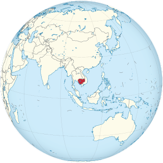
Cambodia is a country in mainland Southeast Asia. It borders Thailand, Laos, Vietnam, the Gulf of Thailand and covers a total area of approximately 181,035 km2 (69,898 sq mi). The country is situated in its entirety inside the tropical Indomalayan realm and the Indochina Time zone (ICT).
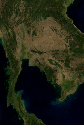
<span class="mw-page-title-main">Mekong</span> Major river in Southeast Asia

The Mekong or Mekong River is a trans-boundary river in East Asia and Southeast Asia. It is the world's twelfth-longest river and the third-longest in Asia with an estimated length of 4,909 km (3,050 mi) and a drainage area of 795,000 km2 (307,000 sq mi), discharging 475 km3 (114 cu mi) of water annually. From its headwaters in the Tibetan Plateau, the river runs through Southwest China, Myanmar, Laos, Thailand, Cambodia, and southern Vietnam. The extreme seasonal variations in flow and the presence of rapids and waterfalls in the Mekong make navigation difficult. Even so, the river is a major trade route between western China and Southeast Asia. The construction of hydroelectric dams along the Mekong in recent decades causes serious problems for the river's ecosystem, including the exacerbation of drought.

<span class="mw-page-title-main">Tonlé Sap</span> Combined lake and river system in Cambodia

Tonlé Sap is a lake in the northwest of Cambodia. It belongs to the Mekong River system. It is the largest freshwater lake in Southeast Asia and one of the most diverse and productive ecosystems in the world, designated as a Biosphere Reserve by UNESCO in 1997 due to its high biodiversity. Entering the 21st century, the lake and its surrounding ecosystems are under increasing pressure from deforestation, infrastructure development and climate change.

<span class="mw-page-title-main">Dams and reservoirs in Laos</span>

Dams and reservoirs in Laos are the cornerstone of the Lao government's goal of becoming the "battery of Asia".

<span class="mw-page-title-main">Mekong giant catfish</span> Species of fish

The Mekong giant catfish, is a large, threatened species of catfish in the shark catfish family (Pangasiidae), native to the Mekong basin in Southeast Asia and adjacent China. It is considered critically endangered due to accelerating habitat loss.

The Nam Ngum Dam is a hydroelectric dam on the Nam Ngum River, a major tributary of the Mekong River in Laos. It was the first hydropower dam built in the Lao PDR.

The East–West Economic corridor is an economic development program initiated in order to promote development and integration of 5 Southeast Asian countries, namely: Myanmar, Thailand, Laos, Cambodia and Vietnam. The concept was agreed upon in 1998 at the Ministerial Conference of the Greater Mekong Subregion, organized in Manila, the Philippines. This corridor became operational on December 12, 2006.

<span class="mw-page-title-main">Greater Mekong Subregion</span> Trans-national region of the Mekong River in Southeast Asia

The Greater Mekong Subregion, (GMS) or just Greater Mekong, is a trans-national region of the Mekong River basin in Southeast Asia. The region is home to more than 300 million people. It came into being with the launch of a development program in 1992 by the Asian Development Bank that brought together the six Asian countries of Cambodia, China, Laos, Myanmar (Burma), Thailand, and Vietnam.

<span class="mw-page-title-main">Jullien's golden carp</span> Species of fish

The Jullien's golden carp is a species of endangered freshwater ray-finned fish in the family Cyprinidae found in Southeast Asian river basins. Its existence is being threatened by various economic activities, such as large-scale agriculture and the building of dams for hydropower.

<span class="mw-page-title-main">River systems of Thailand</span>

Thailand has 22 river basins with 254 sub-basins. Rainwater is one of the most important sources of water. Thailand's water resource per capita is less than that of other countries in the region.

<span class="mw-page-title-main">Water conflict</span> Conflict over an access to water resources

Water conflict is a term describing a conflict between countries, states, or groups over the rights to access water resources. The United Nations recognizes that water disputes result from opposing interests of water users, public or private. A wide range of water conflicts appear throughout history, though rarely are traditional wars waged over water alone. Instead, water has long been a source of tension and one of the causes for conflicts. Water conflicts arise for several reasons, including territorial disputes, a fight for resources, and strategic advantage.

Living River Siam is a Thai non-governmental organization (NGO) which analyzes the impact of Thailand's various dam projects and coordinates the research of indigenous peoples to give Thai villagers the power to document the influence of local rivers and dams. Founded in 1999, it gained prominence during the Pak Mun Dam study period in 2001, when it developed a method for instructing villagers on how to document the effects of the dammed river on their lives. When the Thai government proposed other dam sites, Living River Siam took its research methods to the villages surrounding those sites as well. Today, the organization works with other NGOs in Southeast Asia to counter government-sponsored research that encourages dam construction.

<span class="mw-page-title-main">Hydropower in the Mekong River Basin</span>

The estimated hydropower potential of the lower Mekong Basin is 30,000 MW, while that of the upper Mekong Basin is 28,930 MW. In the lower Mekong, more than 3,235 MW has been realized via facilities built largely over the past ten years, while projects under construction will represent an additional 3,209 MW. An additional 134 projects are planned for the lower Mekong, which will maximize the river's hydropower generating capacity. The single most significant impact—both now and in the future—on the use of water and its management in the Mekong Region is hydropower.

The Sambor Dam is a proposed dam and hydroelectric power station on the Mekong River south of Sambor village in Prek Kampi District, Kratie Province, Cambodia. If built, it would be the lowest dam of the Mekong's mainstream dams, and largest in Cambodia.

The Stung Battambang 1 is a dam planned for construction on the Battambang River in Cambodia. The river is a major tributary of the Tonlé Sap. Of the two dams planned for this river, the larger is the Stung Battambang 1. A letter of commitment has been issued by the Cambodian authorities for a pre-feasibility study of the dam by an unknown Korean company

The Stung Treng Dam is a proposed hydroelectric dam on the Mekong River in Stung Treng Province, Cambodia. It would be located on the mainstream of the Lower Mekong River. The project is controversial for several reasons, including its possible impact on the fisheries, as well as other ecological and environmental factors.

<span class="mw-page-title-main">Xayaburi Dam</span> Dam in Xayaburi

The Xayaburi Dam is a run-of-river hydroelectric dam on the Lower Mekong River, approximately 30 kilometres (19 mi) east of Sainyabuli (Xayaburi) town in northern Laos. Commercial operation of the dam started in October 2019. The main purpose of the dam is to produce hydroelectric power, 95% of which is to be purchased by the Electricity Generating Authority of Thailand (EGAT). The project is surrounded in controversy due to complaints from downstream riparians and environmentalists. Preliminary construction began in early-2012, but work on the dam itself was suspended shortly thereafter due to complaints from Cambodia and Vietnam downstream. After making modifications to the dam's design, Laos started construction with a ceremony on 7 November 2012. The Xayaburi Dam is the first of the 11 dams planned on the lower Mekong.

The Don Sahong is a hydroelectric dam commissioned in 2020 on the Mekong River in Siphandone area of Champasak Province, Laos, less than two kilometers upstream of the Laos–Cambodia border.

This page describes energy and electricity production, consumption and import in Laos.

Lancang-Mekong Cooperation is a multilateral format established in 2016 for cooperation between the riparian states of the Lancang River and Mekong River. The Lancang is the part of the Mekong that flows through China. Cambodia, Laos, Myanmar, Vietnam and Thailand are five downstream countries of the Mekong River.

References

  1. "About MRC". Mekong River Commission (MRC). Retrieved 21 December 2017.
  2. "Visions and Mission". Mekong River Commission (MRC). Retrieved 21 December 2017.
  3. Nakayama 2002: 274–275.
  4. Nakayama 2002: 275–276.
  5. 1 2 3 4 5 6 7 8 9 10 Jacobs, Jeffrey W (December 2002). "The Mekong River Commission: Transboundary Water Resources Planning and Regional Security". The Geographical Journal. Water Wars? Geographical Perspectives. 168 (4): 354–364. doi:10.1111/j.0016-7398.2002.00061.x. JSTOR   3451477. PMID   17494227.
  6. Straits Times 2006.
  7. Nakayama 2002: 276
  8. Jacobs 1998: 591.
  9. Jacobs 1998.
  10. Makim 2002: 14.
  11. Browder 2000: 237.
  12. Jacobs 1995: 142.
  13. Nakayama 2002: 276; Jacobs 1995.
  14. Makim 2002: 18.
  15. Radosevich and Olson 1999: 6–7.
  16. MRC 1975.
  17. 1 2 Nakayama 2002: 277.
  18. Jacobs 1995: 145.
  19. Nakayama 2002: 278.
  20. Browder 2000: 247.
  21. Sneddon and Fox 2006: 191.
  22. Bakker 1999: 223.
  23. MRC 2001b.
  24. MRC 2001a: 23.
  25. Sneddon and Fox 2007a: 2177.
  26. Makim 2002: 38.
  27. Maxwell, Daniel M. "Exchanging Power: Prospects of Nepal-India Cooperation for Hydropower Development". SSRN   2193796.
  28. First MRC Summit & International Conference, 2–5 April 2010 http://www.mrcsummit2010.org/ Archived 2010-04-03 at the Wayback Machine
  29. Henriette Litta (1 November 2011). Regimes in Southeast Asia: An Analysis of Environmental Cooperation. Springer Science & Business Media. p. 173. ISBN   978-3-531-94276-6.
  30. MRC MRC appoints new Chief Executive Officer
  31. AIT Mekong River Commission and AIT have over a hundred years of work in the region
  32. MRC First riparian Chief Executive Officer assumes his office today, MRC
  33. MRC Second riparian Chief Executive Officer assumes office today
  34. "Asia: USAID and NASA today launched 'SERVIR-Mekong'". www.preventionweb.net. Retrieved 2015-11-02.
  35. Robertson 2006.
  36. 1 2 The Economist 1995.
  37. Radosevich and Olsen 1999.
  38. Paul 2003.
  39. Dore 2003: 422.
  40. Pinyorat 2000.
  41. Pearce 2004.
  42. MRC 2007.
  43. "Cambodia lauds China's green drive along Mekong". China Daily. 15 November 2007. Retrieved 21 December 2017.
  44. Klare, Michael (2007-04-15). "Wars for Water?". Newsweek. Retrieved 21 December 2017.
  45. Wain 2004.
  46. Cogels 2007.
  47. Sherman 2004.

Bibliography