Melipilla Airport

Last updated
Melipilla Airport
Summary
Airport typePublic
Serves Melipilla, Chile
Elevation  AMSL 574 ft / 175 m
Coordinates 33°40′35″S71°11′35″W / 33.67639°S 71.19306°W / -33.67639; -71.19306 (Melipilla Airport (Melipilla)) Coordinates: 33°40′35″S71°11′35″W / 33.67639°S 71.19306°W / -33.67639; -71.19306 (Melipilla Airport (Melipilla))
Map
Chile location map.svg
Airplane silhouette.svg
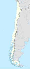
SCMP
Location of Melipilla Airport in Chile
Runways
Direction LengthSurface
mft
08/265351,755Dirt
Source: Landings.com [1] Google Maps [2] GCM [3]

Melipilla Airport (Spanish : Aeropuerto de Melipilla), ( ICAO : SCMP) is a small general aviation airport adjacent to the east side of Melipilla, a city in the Santiago Metropolitan Region of Chile.

Contents

There are nearby hills to the north of the airport and, along with the city, it sits in the Maipo Valley. The runway has an additional 200 metres (660 ft) of unpaved overrun on the west end.

The Melipilla non-directional beacon (Ident: PIL) is located 1.5 nautical miles (2.8 km) west of the runway. [4]


It has different types of aircraft, like this interesting Erco Ercoupe 415C. Erco Ercoupe 415C CC-ABS.jpg
It has different types of aircraft, like this interesting Erco Ercoupe 415C.

See also

Related Research Articles

San Gerónimo Airport is an airstrip serving Algarrobo, a Pacific coastal city in the Valparaíso Region of Chile. The airstrip is 4.6 kilometres (2.9 mi) inland from the coast.

Alto Palena Airport is an airport serving Palena, a small town in the mountains of the Los Lagos Region of Chile. Palena is 5 kilometres (3.1 mi) from the Argentina border. The airport is just north of the town, and south of a bend in the Palena River.

Los Confines Airport is an airport serving Angol, a city in the Araucanía Region of Chile. The airport is just northeast of the city.

Chépica Airport was an airstrip 4 kilometres (2.5 mi) west of Chépica, a town in the O'Higgins Region of Chile.

<span class="mw-page-title-main">Cochrane Airfield</span> Airport

Cochrane Airport Spanish: Aeródromo Cochrane, is an airport serving Cochrane, a town in the Aysén Region of Chile. The airport is just northwest of the town, at the foot of Cerro Tamanguito (sv).

General Freire Airport is an airport serving Curicó, a city in the Maule Region of Chile. The airport is within the northeast part of the city.

Futaleufú Airfield is an airport serving Futaleufú, a town in the Los Lagos Region of Chile.

San Rafael Airport Spanish: Aeródromo de San Rafael de Los Andes, is an airport serving Los Andes, a city in the Valparaíso Region of Chile. The airport is 5 kilometres (3.1 mi) west-northwest of the city.

Guadaba Airport Spanish: Aeropuerto Guadaba, is an airstrip 8 kilometres (5.0 mi) west of Los Sauces, a town in the La Araucanía Region of Chile.

El Alba Airport, is an airport 6 kilometres (3.7 mi) northwest of Melipilla, a city in the Santiago Metropolitan Region of Chile.

Santa Teresa del Almendral Airport, is an airport 12 kilometres (7.5 mi) north-northwest of Melipilla, a city in the Santiago Metropolitan Region of Chile. The airport is 1 kilometre (0.6 mi) west of the Puangue River.

Los Cuatro Diablos Airport, is an airport 9 kilometres (5.6 mi) east of Melipilla, a city in the Santiago Metropolitan Region of Chile.

El Tuqui Airport, is an airport serving Ovalle, a city in the Coquimbo Region of Chile.

Juan Enrique Airport Spanish: Aeropuerto de Juan Enrique, is an airport 16 kilometres (10 mi) west-southwest of Paine, a city in the Santiago Metropolitan Region of Chile.

Papageno Airport, was an airstrip 1 kilometre (0.6 mi) west of Calafquén Lake. Panguipulli, a city in the Los Ríos Region of Chile, is 11 kilometres (6.8 mi) to the south.

Pisagua Airport, is an airstrip 2 kilometres (1 mi) east of the Pacific coastal village of Pisagua, in the Tarapacá Region of Chile.

Cabo Juan Román Airport is an airport serving Puerto Aysén, a city at the head of the Aysén Fjord in the Aysén Region of Chile.

De la Independencia Aerodrome is an airport serving Rancagua, a city in the O'Higgins Region of Chile.

Santa Cruz Airport is an airport 2 kilometres (1.2 mi) west of Santa Cruz, a city in the O'Higgins Region of Chile.

Las Breas Airport is an airport 20 kilometres (12 mi) south-southeast of Taltal, a Pacific coastal town in the Antofagasta Region of Chile.

References

  1. Airport record for Melipilla Airport at Landings.com. Retrieved 2013-09-10
  2. Google (2013-09-10). "location of Melipilla Airport" (Map). Google Maps . Google. Retrieved 2013-09-10.
  3. Airport information for Melipilla Airport at Great Circle Mapper.
  4. Melipilla NDB