Tipton is an industrial town in the metropolitan borough of Sandwell, in the county of the West Midlands, England. It had a population of 38,777 at the 2011 UK Census. It is located northwest of Birmingham and southeast of Wolverhampton. It is also contiguous with nearby towns of Darlaston, Dudley, Wednesbury and Bilston.
Sedgley is a town in the north of the Dudley district, in the county of the West Midlands, England.
Holt Park is a medium-sized low-rise 1970s housing estate in the northwest suburbs of Leeds, West Yorkshire, England. It is approximately 6 miles (10 km) from Leeds city centre situated between Tinshill, Cookridge and Adel, and is at the edge of the Leeds urban fringe, bordering the green belt which makes up two thirds of the metropolitan borough of the City of Leeds. The nearby Tinshill BT Tower dominates the skyline.

Burnt Oak is a suburb of London, England, located 9 miles (14 km) northwest of Charing Cross. It lies to the west of the M1 motorway between Edgware and Colindale, located predominantly in the London Borough of Barnet, with parts in the London Boroughs of Brent and Harrow. It was part of Middlesex until it was transferred to Greater London in 1965.

Bushbury is a suburban village and ward in the City of Wolverhampton in the West Midlands, England. It lies two miles north-east of Wolverhampton city centre, divided between the Bushbury North and Bushbury South and Low Hill wards. Bushbury also lies near to the villages of Coven, Featherstone and Four Ashes which are in South Staffordshire.

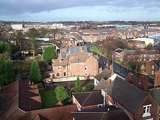
Whitmore Reans is in Wolverhampton, West Midlands, England. It is situated to the north-west of the city centre, in the city council's Park and St Peter's wards.

Abbotskerswell is a village and civil parish in the English county of Devon. The village is in the north part of the parish and is located two miles (3 km) south of the town of Newton Abbot, 7 miles (11 km) from the seaside resort of Torquay and 32 miles (51 km) from the city of Plymouth. The A381 road between Newton Abbot and Totnes runs down the western side of the parish and the main railway line between these two towns forms part of its eastern boundary.

Bradmore is a suburb of Wolverhampton in the West Midlands of England. It lies at the meeting point of the Graiseley, Park and Merry Hill wards of Wolverhampton City Council.
Park, or Park Ward, is a ward of Wolverhampton City Council, West Midlands. It is located to the west of the city centre, and covers parts of the suburbs Bradmore, Compton, Finchfield, Merridale, Newbridge and Whitmore Reans. It borders the St Peter's, Graiseley, Merry Hill, Tettenhall Wightwick and Tettenhall Regis wards. It forms part of the Wolverhampton West constituency.
Graiseley is both an inner-city area of Wolverhampton, situated immediately to the south-west of the city centre, and the name of a ward of Wolverhampton City Council.
Pendeford is a suburb of Wolverhampton, West Midlands, England. Historically part of Staffordshire, it is situated north-north-west of the city centre, within the Oxley ward of the City of Wolverhampton Council. At the 2011 Census, the population of Pendeford was 5,826, increasing from 4,356 at the 2001 Census.
Low Hill is in Wolverhampton, West Midlands, England. It is north-east of Wolverhampton city centre, within the Bushbury South and Low Hill ward.

Bantock House Museum and Park is a museum of Edwardian life and local history, with 48 acres (190,000 m2) of surrounding parkland in Wolverhampton, England. It is named after Alderman Baldwin and Kitty Bantock who once lived there. It is run by Wolverhampton City Council's Arts and Museums service.

Wolverhampton is a city and metropolitan borough in the West Midlands, England, 13 miles (21 km) northwest of Birmingham. The population in 2021 was 263,700.

Hillsborough is a suburb in north-west Sheffield, South Yorkshire, England. The centre of the district is popularly thought to be 'Hillsborough Corner' where Langsett Road, Middlewood Road, Holme Lane and Bradfield Road all meet. The Hillsborough ward population at the 2011 Census was 18,605.
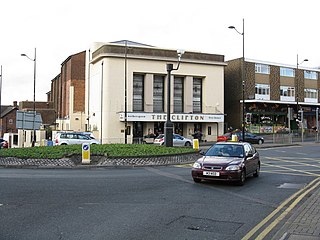
Chapel Ash is a small area in Wolverhampton surrounded by the City Centre, Whitmore Reans & Merridale.

Upperthorpe is a part of the City of Sheffield, England. It lies 1.2 miles (2 km) west of the city centre. The area falls within the Walkley ward of the City. It is an area of residential housing and is bounded by Walkley to the north, Crookes to the west and Netherthorpe to the south.
Gleadless Valley is a housing estate and electoral ward of the City of Sheffield in England. The population of the estate at the 2021 Census was 9,724. It lies 2.5 miles (4.0 km) south-southeast of the city centre. Formerly a rural area, Gleadless Valley was developed as a large housing project with around 4000 dwellings by Sheffield City Council between 1955 and 1962. It is an area of undulating land drained by the Meers Brook, which has its source on the high ground in the woodland at Gleadless. Adjacent are Gleadless to the east, Norton to the south-west, Heeley to the west and Arbourthorne to the north.

Prestonville is a largely residential area in the northwest of Brighton, part of the English city of Brighton and Hove. It covers a long, narrow and steeply sloping ridge of land between the Brighton Main Line and Dyke Road, two major transport corridors which run north-northwestwards from the centre of Brighton. Residential development started in the 1860s and spread northwards, further from central Brighton, over the next six decades. The area is characterised by middle-class and upper-middle-class housing in various styles, small-scale commercial development and long eastward views across the city. Two Anglican churches serve Prestonville—one at each end of the area—and there are several listed buildings.
