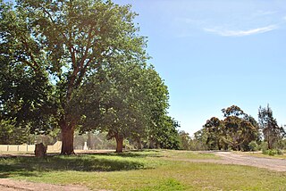
The Shire of Delatite was a local government area in Victoria, Australia, located in the north-east part of the state. It covered an area of 6,218 square kilometres (2,401 sq mi) and, at the 2001 census, had a population of 21,553. It included the towns of Benalla and Mansfield, and was formed in 1994 from the amalgamation of the City of Benalla, Shire of Benalla, the then Shire of Mansfield and part of the Shire of Violet Town. In 2002 the shire was split into the Rural City of Benalla and Shire of Mansfield. This process has been cited as an example of successful de-amalgamation by residents of other councils who are unhappy with the forced mergers that affected almost all Victorian local government areas in 1994.
The Rural City of Benalla is a local government area in the Hume region of Victoria, Australia, located in the north-east part of the state. It covers an area of 2,353 square kilometres (908 sq mi) and, in August 2021, had a population of 14,528.

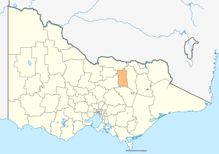
The Shire of Mansfield is a local government area in the Hume region of Victoria, Australia, located in the north-east part of the state. It covers an area of 3,844 square kilometres (1,484 sq mi) and in August 2021, had a population of 10,178.

Mansfield is a small town in the foothills of the Victorian Alps in the Australian state of Victoria. It is approximately 180 kilometres (110 mi) north-east of Melbourne by road. The population around Mansfield was 4,787 as at the 2016 census. The town itself has 3410 persons.
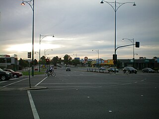
Nunawading is a suburb of Melbourne, Victoria, Australia, 18 km east of Melbourne's Central Business District, located within the City of Whitehorse and City of Manningham local government areas. Nunawading recorded a population of 12,413 at the 2021 census.

Officer is a suburb of Melbourne, Victoria, Australia, 48 km south-east of Melbourne's Central Business District and the second most populous in the Shire of Cardinia after Pakenham. Officer recorded a population of 18,503 at the 2021 census.

Essendon is a suburb in Melbourne, Victoria, Australia, 8 km (5.0 mi) north-west of Melbourne's central business district, located within the City of Moonee Valley local government area. Essendon recorded a population of 21,240 at the 2021 census.

Derrimut is a suburb in Melbourne, Victoria, Australia, 17 km (11 mi) west of Melbourne's Central Business District, located within the City of Brimbank Local government area. Derrimut recorded a population of 8,651 at the 2021 census.
Noojee is a town in the Gippsland region of Victoria, Australia, north of Warragul and east of Melbourne, in the Baw Baw local government area. At the 2016 census, Noojee and the surrounding area had a population of 157. The town benefits from tourists passing through to the Mount Baw Baw Alpine Resort, 48 kilometres away, as it is the last stop with tourism services. There are also a number of walks in the area, including the Noojee Trestle Bridge, a 100m wooden rail bridge.

Mount Gambier is the second most populated city in South Australia, with an estimated urban population of 33,233 as of 2021. The city is located on the slopes of Mount Gambier, a volcano in the south east of the state, about 450 kilometres (280 mi) south-east of the capital Adelaide and just 17 kilometres (11 mi) from the Victorian border. The traditional owners of the area are the Bungandidj people. Mount Gambier is the most important settlement in the Limestone Coast region and the seat of government for both the City of Mount Gambier and the District Council of Grant.
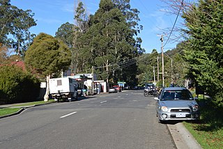
Bonnie Doon is a town in Victoria, Australia. It is located on the Maroondah Highway, in the Shire of Mansfield. Bonnie Doon is 168 kilometres north-east from Melbourne. At the 2021 census, Bonnie Doon township had a population of 666.

Alexandra is a town in north-east Victoria, Australia, 130 kilometres north-east of the State Capital, Melbourne. It is located at the junction of the Goulburn Valley Highway (B340) and Maroondah Highway (B360), in the Shire of Murrindindi local government area. At the 2021 census, the town had a population of 2,801 and the broader area a population of 6,828.

Donald is a town in Victoria, Australia, located on the Richardson River, at the junction of Sunraysia Highway and Borung Highway, in the Shire of Buloke. At the 2021 census, it had a population of 1,472.

Mount Stirling is a mountain in the Victorian Alps of the Great Dividing Range, located in the Hume region of Victoria, Australia. The mountain has an elevation of 1,747–1,749 metres (5,732–5,738 ft) above sea level.
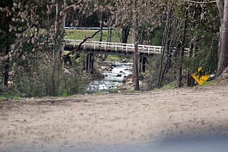
The Delatite River, an inland perennial river of the Goulburn Broken catchment, part of the Murray-Darling basin, is located in the lower South Eastern Highlands bioregion and Northern Country/North Central regions of the Australian state of Victoria. The headwaters of the Delatite River rise on the western slopes of the Victorian Alps and descend to flow into the Goulburn River within Lake Eildon.

Mount Cottrell is a town in Victoria, Australia, 31 km (19 mi) west of Melbourne's Central Business District, located within the Cities of Melton and Wyndham local government areas. Mount Cottrell recorded a population of 496 at the 2021 census.

Mulwala is a town in the Federation Council local government area in the Riverina district of New South Wales, Australia. The town is situated on Lake Mulwala, an artificial lake formed by the damming of the Murray River. At the 2021 census, Mulwala had a population of 2,557 people. The town's name is derived from an aboriginal word for 'rain'.

The County of Delatite is one of the 37 counties of Victoria which are part of the cadastral divisions of Australia, used for land titles. It is located south west of Ovens River. Wangaratta is partly located in the county, at the northern end.

The Shire of Mansfield was a local government area about 185 kilometres (115 mi) northeast of Melbourne, the state capital of Victoria, Australia. The shire covered an area of 3,919.10 square kilometres (1,513.2 sq mi), and existed from 1865 until 1994.

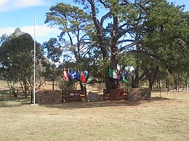
Maindample is a town in north east Victoria (Australia). It is located in the Mansfield Shire local government area, 174 kilometres (108 mi) north east of the state capital Melbourne.