Lake Champlain is a natural freshwater lake in North America. It mostly lies between the US states of New York and Vermont, but also extends north into the Canadian province of Quebec.

Washington County is a county in the U.S. state of New York. As of the 2020 census, the population was 61,302. The county seat is Fort Edward. The county was named for U.S. President George Washington. The county is part of the Capital District region of the state.

Chazy is a town in northeastern Clinton County, New York, United States. The population was 4,096 at the 2020 census. The closest city is Plattsburgh, 14 miles (23 km) to the south. Chazy is 8 miles (13 km) south of the Canada–United States border. The ZIP code is 12921 and the community is in area code 518.

Crown Point is a town in Essex County, New York, United States, located on the west shore of Lake Champlain. The population was 2,024 at the 2010 census. The name of the town is a direct translation of the original French name, Pointe à la Chevelure.

Rupert is a town in Bennington County, Vermont, United States. The population was 698 at the 2020 census.

Champlain is a town in Clinton County, New York, United States. The population was 5,754 at the 2010 census. The town is located on the western shore of Lake Champlain, near the northern end of Lake Champlain and is on the U.S./Canadian border.

Granville is a town on the eastern border of Washington County, New York, United States, abutting Rutland County, Vermont. It is part of the Glens Falls Metropolitan Statistical Area. The town population was 6,215 at the 2020 census.

The West Branch Delaware River is one of two branches that form the Delaware River. It is approximately 90 mi (144 km) long, and flows through the U.S. states of New York and Pennsylvania. It winds through a mountainous area of New York in the western Catskill Mountains for most of its course, before joining the East Branch along the northeast border of Pennsylvania with New York. Midway or so it is empounded by the Cannonsville Dam to form the Cannonsville Reservoir, both part of the New York City water supply system for delivering drinking water to the City.

The Great Sacandaga Lake is a large lake situated in the Adirondack Park in northern New York in the United States. The lake has a surface area of about 41.7 square miles (108 km2) at capacity, and the length is about 29 miles (47 km). The word Sacandaga means "Land of the Waving Grass" in the native Mohawk language. The lake is located in the northern parts of Fulton County and Saratoga County near the southern border of the Adirondack Park. A small portion also extends northward into southern Hamilton County. The broader, south end of the lake is northeast of the City of Johnstown and the City of Gloversville. Great Sacandaga Lake is a reservoir created by damming the Sacandaga River. The primary purpose for the creation of the reservoir was to control flooding on the Hudson River and the Sacandaga River, floods which had a historically significant impact on the surrounding communities.

The Winooski River is a tributary of Lake Champlain, approximately 90 miles (145 km) long, in the northern half of Vermont. Although not Vermont's longest river, it is one of the state's most significant, forming a major valley way from Lake Champlain through the Green Mountains towards the Connecticut River valley.

Otter Creek is the longest river entirely contained within the borders of Vermont. Roughly 112 miles (180 km) long, it is the primary watercourse running through Rutland County and Addison County. The mouth of the river flows into Lake Champlain.

Vermont Route 30 (VT 30) is a 111.870-mile-long (180.037 km) north–south state highway in the U.S. state of Vermont. VT 30 runs from U.S. Route 5 and VT 9 in Brattleboro to US 7 and VT 125 in Middlebury. The northern portion, from Poultney to Middlebury, was part of the New England road marking system's Route 30, from which VT 30 got its number. The route passes through many historic small towns, and travel writers such as those at Southern Vermont have described the route as "idyllic" and "picturesque".

New York State Route 22A (NY 22A) is a short north–south state highway located within Washington County, New York, in the United States. The route extends for 10.6 miles (17.1 km) from an intersection with NY 22 in the town of Granville to the Vermont state line in the town of Hampton, where it becomes Vermont Route 22A (VT 22A). NY 22A was originally designated as New York State Route 286 in the 1930 renumbering of state highways in New York. It was renumbered to its current designation in the early 1940s.

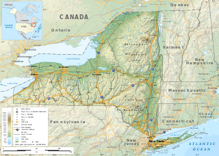
The geography of New York varies widely across the state. Most of New York is dominated by farms, forests, rivers, mountains, and lakes. New York's Adirondack Park is larger than any U.S. National Park in the contiguous United States. Niagara Falls, on the Niagara River as it flows from Lake Erie to Lake Ontario, is a popular attraction. The Hudson River begins near Lake Tear of the Clouds and flows south through the eastern part of the state without draining lakes George or Champlain. Lake George empties at its north end into Lake Champlain, whose northern end extends into Canada, where it drains into the Richelieu River and then the St. Lawrence. Four of New York City's five boroughs are on the three islands at the mouth of the Hudson River: Manhattan Island, Staten Island, and Brooklyn and Queens on Long Island.
West Pawlet is an unincorporated village and census-designated place (CDP) in the town of Pawlet, Rutland County, Vermont, United States. As of the 2020 census, it had a population of 220, slightly more than the population of the village of Pawlet at the town center.

Whitehall is a town in Washington County, New York, United States. It is part of the Glens Falls Metropolitan Statistical Area. The town population was 4,023 at the 2020 census.
Wells is the central village and a census-designated place (CDP) in the town of Wells, Rutland County, Vermont, United States. As of the 2020 census, it had a population of 386, out of 1,214 in the entire town.
Mount Roosevelt is a mountain in the Green Mountains in the U.S. state of Vermont. Located in the Breadloaf Wilderness of the Green Mountain National Forest, its summit is in the town of Ripton in Addison County. The mountain is named after Theodore Roosevelt, former president of the United States. Mount Roosevelt is one of five peaks in Vermont's Presidential Range.
Pawlet is the central village and a census-designated place (CDP) in the town of Pawlet, Rutland County, Vermont, United States. As of the 2020 census, it had a population of 194, out of 1,424 in the entire town.

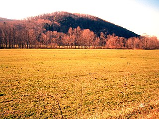
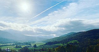
The Mettawee Valley is the valley of the Mettawee River in the Taconic Mountains of southwestern Vermont centered on the agricultural communities of North Rupert and Pawlet, and stretching toward Granville, New York. Known for "some of the most beautiful natural landscapes in all of Vermont," almost 5,000 acres (20 km2) of Mettawee Valley land have been conserved in partnership with the Vermont Land Trust.


