Meyuns

Last updated
Meyuns
Palau location map.svg
Red pog.svg
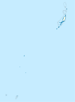
Meyuns
Location in Palau
Coordinates: 7°21′07″N134°27′14″E / 7.352°N 134.454°E / 7.352; 134.454
Country Flag of Palau.svg  Palau
State Flag of Koror State.png  Koror
Population
  Total1,000
Time zone UTC+9 (Palau Standard Time)
Area code (+680) 488

Meyuns is the second most populous city in the tiny Pacific island nation of Palau, with a population of approximately 1,000. Meyuns is comparable in population to Palau's third largest city, Airai. It is located in the State of Koror, where the nation's largest city, also called Koror, is located. Other than Koror, Meyuns is the only sizable town in the state of Koror. Unlike the city of Koror, Meyuns is on Ngerekebesang Island, along with the towns of Ngerekebesang and Echang, although Meyuns is the only town that is incorporated on the island. It is linked by a causeway to Oreor Island, where the city of Koror is situated. Meyuns is the location of Belau National Hospital, the largest hospital in the country.

Education

The Ministry of Education operates public schools.

Meyuns Elementary School was built circa 1969 and expanded in 1973. It was established since Typhoon Sally destroyed Koror Elementary School in Koror, where Meyuns students previously attended. The Trust Territory of the Pacific Islands administration was previously uninterested in building a school in Melyuns. [1]

Palau High School in Koror is the country's only public high school, so children from this community go there. [2]

Related Research Articles

Palau Island country in the western Pacific Ocean

Palau, officially the Republic of Palau, is an island country located in the western Pacific Ocean. The country contains approximately 340 islands, and together with parts of the Federated States of Micronesia, forms the western chain of the Caroline Islands. Its area is 466 square kilometers (180 sq mi). The most populous island is Koror. The capital Ngerulmud is located on the nearby island of Babeldaob, in Melekeok State. Palau shares maritime boundaries with the Philippines, Indonesia, and Micronesia.

Koror State in Palau

Koror is the state comprising the main commercial centre of the Republic of Palau. It consists of several islands, the most prominent being Koror Island.

Airai State in Palau

Airai, located on the southern coast of Babeldaob island, is the second-most populous state of Palau. It contains the country's chief airport, Roman Tmetuchl International Airport, and is connected by the Koror-Babeldaob Bridge to nearby Koror Island.

Peleliu State in Palau

Peleliu is an island in the island nation of Palau. Peleliu, along with two small islands to its northeast, forms one of the sixteen states of Palau. The island is notable as the location of the Battle of Peleliu in World War II.

Angaur State in Palau

Angaur or Ngeaur is an island in the island nation of Palau. The island, which forms its own state, has an area of 8 km² (3 mi²). Its population was 130 in 2012. The state capital is the village of Ngeremasch on the western side. A second village, Rois, is immediately east of Ngeremasch.

Ngarchelong State in Palau

Ngarchelong is a state in Palau. Ngarchelong is at the northernmost tip of the island of Babeldaob. Only the state of Kayangel is farther north. Ngarchelong is an important historical site and has undergone archeological excavation.

Aimeliik State in Palau

Aimeliik is an administrative division of the island country of Palau. It is one of the Republic of Palau's 16 states. It has an area of 52 km² and a population of 270. State capital is the village of Mongami. Following the four other villages which are: Medorm, Imul, Elechui and Ngmechiangel.

Ngchesar State in Palau

Ngchesar also known as Oldiais is one of the sixteen states of the nation of Palau. There are about 300 inhabitants, and its capital is Ngchesar. It is the sixth largest state in terms of land, with an area of roughly 40 square kilometers, and it is located on the eastern side of the island of Babeldaob, northwest of Airai State, and southeast of Melekeok State, where the Palauan government is situated. The sacred totem of Ngchesar is the Stingray. Ngchesar is famous for its war canoe "kabekel" named Bisbush which means Lightning.

Kayangel State in Palau

Kayangel is the northernmost state of Palau 24 km (15 mi) north of Koror. The land area is about 1.4 km2 (0.54 sq mi). The population is 138. The state consists of three atolls in different states of development:

Ngiwal State in Palau

Ngiwal is one of the sixteen states of Palau. It has a population of 223 and an area of 26 km². The administrative center is Ngerkeai.

Hatohobei State in Palau

Tobi Island, or Hatohobei (Tobian), also ハトホベイ州 (Japanese), is the southernmost of Palau's sixteen states, consisting of Tobi Island and Helen Reef. The total land area is about 0.88 km². The population was 80 in 1962, 51 in 1995, 23 in 2000, and 40 in 2014. Tobian, English and Sonsorolese are the official languages of Hatohobei State.

Ngatpang State in Palau

Ngatpang is one of Palau's sixteen states. It comprises an area of around 47 square kilometers in the west of Palau's largest island, Babeldaob, facing onto Ngeremeduu Bay. The state capital is Ngerdubech. It has a population of a little over 500, making it Palau's 5th largest state in population.

Ngeremlengui State in Palau

Ngeremlengui is one of Palau's sixteen states. It has a population of about 317, and is just west of the capital in Melekeok state. The capital of the state of Ngeremlengui is Imeong. Ngeremlengui is on the western side of Babeldaob, which is the largest island in Palau. Ngarelemgui is the largest of Palau's sixteen states in terms of land, and has an area of roughly 65 km2.

Ngerekebesang Island is an island in the state of Koror, Palau, where the office of the President of the Republic of Palau was located before the capital was moved to the state of Melekeok. It is composed of three towns: Ngerekebesang, Meyuns, and Echang, where most Southwest Islanders moved to after a storm struck the southwest islands. They were later resettled.

Chol (Choll) is a village at the northern end of Ngaraard State in Palau. This village consists of a large, long beach that runs along its entire east coast. The village has a series of ancient paths and platforms, similar to the rest of the villages in Ngaraard. There is also a large man-made channel that connects the village to the sea on the western coast. At the center of village, along the compact road, there is a small marketplace with benches where one can purchase some village refreshments.

Melekeok State in Palau

Melekeok is a state of the Republic of Palau located on the central east coast of Babeldaob Island. The seat of government of the country, Ngerulmud, is located in the state. The state consists of long beaches, hills, steep ridges, rivers, and the largest and only natural freshwater lake in the Republic of Palau and Micronesia, Lake Ngardok.

Ngerulmud Capital city of Palau

Ngerulmud is the seat of government of the Republic of Palau, an island nation in the Pacific Ocean. It replaced Koror City, Palau's largest city, as capital in 2006. The settlement is located in the state of Melekeok on Babeldaob, the country's largest island, located 20 kilometres northeast of Koror City and 2 km northwest of Melekeok City. It is the smallest capital city in the world.

Sonsorol State in Palau

Sonsorol is one of the sixteen states of Palau. The administrative center, and only village, is Dongosaru on Sonsorol island. The inhabitants speak Sonsorolese, a local Trukic language, and Palauan.

Palau High School High school in Koror City, Palau

Palau High School (PHS) is a senior high school in Koror City, Palau. Opened in 1962, it is the country's only public high school, and the first high school established in Palau. The Western Association of Schools and Colleges (WASC) accredits the school.

Ministry of Education (Palau) government ministry in Palau

The Ministry of Education is a government agency of Palau, headquartered in Koror City.

References

  1. "Meyuns Elementary School Archived 2018-08-09 at the Wayback Machine ." Ministry of Education (Palau). Retrieved on February 22, 2018.
  2. "About Archived 2018-03-03 at the Wayback Machine ." Palau High School. Retrieved on February 22, 2018.

Coordinates: 7°21′07″N134°27′14″E / 7.352°N 134.454°E / 7.352; 134.454