Mill Pond (Milton, Ontario)

Last updated

Mill Pond
Milton Condos1.jpg
Mill Pond, Milton, Ontario
Canada Ontario relief location map.jpg
Red pog.svg
Mill Pond
Location of Mill Pond in Ontario
Canada relief map 2.svg
Red pog.svg
Mill Pond
Mill Pond (Canada)
Location Milton, Ontario
Coordinates 43°30′51″N79°53′11″W / 43.51417°N 79.88639°W / 43.51417; -79.88639
Type reservoir
Basin  countries Canada

Mill Pond [1] is a manmade freshwater reservoir [2] in downtown Milton, Ontario, Canada. [3] [4] [5]

Contents

The pond is located on the main street of downtown Milton, a suburban town north of Lake Ontario in the Regional Municipality of Halton. [4] [6] [7] [8] Halton is the west wing of Greater Toronto Area bordering Niagara escapement to the west.

The pond powered a gristmill [9] for almost a century, within which time a pioneering settlement grew up to be the town of Milton around the pond and the mill. [9]

History

Oakville Sixteen Mile Creek Aerial Oakville Sixteen Mile Creek Aerial (41040636952).jpg
Oakville Sixteen Mile Creek Aerial

The town and the Mill Pond share the same origin in the history. The 16-mile creek flowing right in the middle of the town was dammed to create the pond to power gristmill by the town’s pioneering entrepreneur and founder Jasper Martin in 1820-1822. [6] [10] [1]

The original settlement in 1837 with a population of 100 people became a fully incorporated town in 1857. [1] It was named after the English Poet John Milton. [11] The town of Milton grew around the pond and the mill; according to 2016 census to be 110,128 in population. [12]

The town, Milton ON was named after English poet John Milton (1608-74) John-milton.jpg
The town, Milton ON was named after English poet John Milton (1608–74)
Milton, Ontario in 1858 Milton, Ontario in 1858.jpg
Milton, Ontario in 1858

The current historic old building standing adjacent to the pond is the third mill surviving on the property after two great fires. [1] The first fire in 1855 consumed the stone building that replaced the original frame building. [11] The second fire was just two years after Dr. C.A. Martin, the great-grandson of the mill’s founder, sold the mill to Robin Hood Flour Mills in 1961. [13] The fire consumed the century old grinding mill in a few hours in the morning of February 12, 1963. [1]  According to Milton Fire Brigade, they poured 1.5 million gallons of water from the creek, hydrants and from the pond, reducing the water level of the pond by a foot, without being able to save the third building constructed in the property. [14] [1] This fire destroyed the original water-wheel that was used to power the flour grinding equipment until 1962. Housed at the back of the building, the wheel was operated by water from the millpond and creek, and drove the assembly of belts and pulleys to operate the entire mill. [1]

1967 Dominion Centennial project

In conjunction with the yearlong Canadian Centennial celebrations held in 1967 to celebrate the 100th anniversary of Canadian Confederation, [15] the town of Milton decided to redesign the Mill Pond. After the fire, the pond area had been donated to the town by its former owners, Robin Hood Flour Mills for development as parkland. [1] Although the plans by a committee of locals included a proposed 60 ft x 150 ft island with a mini zoo and boat rental service, none of those materialized. [1]

The official opening ceremonies of the Mill Pond took place on June 25, 1967. [11] In May, the pond had been refilled, after extensive dredging resulting extended pond banks, a new drainage system and a unique curving bridge over a waterfall spillway. The clear water was stocked with 2,500 speckled trout for recreational fishing. According to Conservation Halton (2020), subsequent fishing derbies for stocked trout have been organized at the Mill Pond. [16]

Rejuvenation project

Inside Halton reported in 2017 that the project to rejuvenate the Mill Pond took place in 2000. [1] The aim of the project was to clean the pond from invasive weed Eurasian Watermilfoil [17] and to expand the pond. The centerpiece gazebo, popular wedding photography setting, was built in 2001. [1] In July 2024 a program of improvements was announced including the rehabilitation of structures such as the weir wall and inlet structure and the implementation of erosion protection between the pond and Garden Lane.

Recreation

Hiking and bird watching

According to AllTrails.com (2020), Mill Pond is a 2.1-kilometer, lightly trafficked loop trail featuring waterfront, flora and fauna and is good for all skill levels. [18] [19] This comprises a network of trails around the mill pond known as the Jaycee Trail, which includes the Miller’s Walk, Livingston Park Trail and a trestle bridge. [20] primarily used for hiking, walking, nature trips, and bird watching. [19] Bird feeding is a popular pastime of the towners that birds get very close to human in the pond. [1]

Recreational Angling

The mill pond and the north arms of Sixteen mile creek was native to northern pikes. During the 1967 Dominion Centennial project, in order to be stocked with trout more than 100 northern pikes were rehomed to Fairy Lake in Acton. With newly expanded pond banks and clear water 2,500 speckled trout were introduced, followed by fishing derbies only to find, later, that the pond does not provide suitable habitat to sustain trout. [1] According to Conservation Halton (2020), recreational fishing opportunities exist throughout the Sixteen Mile Creek watershed. The Mill Pond, provides excellent angling opportunities for a number of panfish and carp.

Venue

Mill pond and the mill site now provide recreation, after a century of carrying the burden of creating livelihood for the towners. It is an excellent parkland for all seasons; light snow, spring blossom, summer green and the fall foliage on the water provide spectacular venue for numerous pleasure activities. [20]

It included dredging the entire pond of about 30,000 cubic metres of sediment to eradicate the roots of the invasive weed European milfoil. The weed created an esthetic and ecological mess since the milfoil strangled native plant life, such as bulrushes and lily pads, in the pond. The much-photographed gazebo was built in 2001.

Related Research Articles

<span class="mw-page-title-main">Milton, Ontario</span> Town in Ontario, Canada

Milton is a town in Southern Ontario, Canada, and part of the Halton Region in the Greater Toronto Area. Between 2001 and 2011, Milton was the fastest growing municipality in Canada, with a 71.4% increase in population from 2001 to 2006 and another 56.5% increase from 2006 to 2011. In 2016, Milton's census population was 110,128 with an estimated growth to 228,000 by 2031. It remained the fastest growing community in Ontario but was deemed to be the sixth fastest growing in Canada at that time.
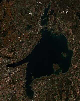
<span class="mw-page-title-main">Lake Simcoe</span> Lake in Ontario, Canada

Lake Simcoe is a lake in southern Ontario, Canada, the fourth-largest lake wholly in the province, after Lake Nipigon, Lac Seul, and Lake Nipissing. At the time of the first European contact in the 17th century, the lake was called Ouentironk by the native Wendat/Ouendat (Huron) people. It was also known as Lake Taronto until it was renamed by John Graves Simcoe, the first Lieutenant-Governor of Upper Canada, in memory of his father, Captain John Simcoe of the Royal Navy. In Anishinaabemowin, the historical language of the First Nations living around this lake, namely Anishinaabek of Rama and Georgina Island First Nations, the lake is called Zhooniyaang-zaaga'igan, meaning "Silver Lake".

<span class="mw-page-title-main">Georgetown, Ontario</span> Community in Ontario, Canada

Georgetown is a large unincorporated community in the town of Halton Hills, Ontario, Canada, in the Regional Municipality of Halton. The town includes several small villages or settlements such as Norval, Limehouse, Stewarttown and Glen Williams near Georgetown and another large population centre, Acton. In 2016, the population of Georgetown was 42,123. It sits on the banks of the Credit River, approximately 40 km west of Toronto, and is part of the Greater Toronto Area. Georgetown was named after entrepreneur George Kennedy who settled in the area in 1821 and built several mills and other businesses.

<span class="mw-page-title-main">Halton Hills</span> Town in Ontario, Canada

Halton Hills is a town in the Regional Municipality of Halton, located in the northwestern end of the Greater Toronto Area, Ontario, Canada with a population of 62,951 (2021).

<span class="mw-page-title-main">Acton, Ontario</span> Rural area in Ontario, Canada

Acton is a community located in the town of Halton Hills, in Halton Region, Ontario, Canada. At the northern end of the Region, it is on the outer edge of the Greater Toronto Area and is one of two of the primary population centres of the Town; the other is Georgetown. From 1842 until 1986, the town was a major centre for the tanning and leather goods industry. In the early years, it was often referred to as "Leathertown".

<span class="mw-page-title-main">John Tonelli</span> Canadian ice hockey player

John Alexander Tonelli is a Canadian former professional ice hockey forward from Milton, Ontario. He was a four-time Stanley Cup champion with the New York Islanders, and also played with the Calgary Flames, Los Angeles Kings, Chicago Blackhawks, and the Quebec Nordiques of the National Hockey League.
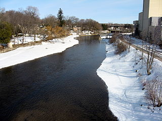
<span class="mw-page-title-main">Speed River</span> River in Canada

The Speed River is a river that flows through Wellington County and the Region of Waterloo in southwestern Ontario, Canada. It flows south from its source near Orton, through Guelph, where it is joined by the Eramosa River, then through the towns of Hespeler and Preston, finally uniting with the Grand River in north-west Cambridge.

<span class="mw-page-title-main">Sixteen Mile Creek (Halton Region)</span> River in Ontario, Canada

Sixteen Mile Creek is a river in Halton Region in the Greater Toronto Area of Ontario, Canada. It is in the Great Lakes Basin, and flows from the Niagara Escarpment through the towns of Milton and Oakville to Lake Ontario.

<span class="mw-page-title-main">Country Heritage Park</span> Events Venue, Agricultural museum & More! in Ontario, Canada

The Country Heritage Park is located next to Highway 401 and the Niagara Escarpment in Milton, Ontario, Canada, and recreates rural life in the 19th century in Ontario. During the day it also acts as a private school and office, and hosts parties at night.

<span class="mw-page-title-main">West Canada Creek</span> River in New York, United States

The West Canada Creek is a 76-mile-long (122 km) river in upstate New York, United States. West Canada Creek is an important water way in Hamilton, Oneida, and Herkimer counties, draining the south part of the Adirondack Mountains before emptying into the Mohawk River near the Village of Herkimer. The name "Canada" is derived from an Iroquoian word for "village" (Kanata).

<span class="mw-page-title-main">Trout River, Newfoundland and Labrador</span> Town in Newfoundland and Labrador, Canada

Trout River is a small rural fishing town located on the southern coastal edge of Gros Morne National Park in Newfoundland, near the Tablelands. Trout River was settled in 1815 by George Crocker and his family, who were its only inhabitants until 1880. The community is served by Route 431.

<i>Myriophyllum spicatum</i> Species of flowering plant in the family Haloragaceae

Myriophyllum spicatum is a submerged aquatic plant which grows in still or slow-moving water. It is native to Europe, Asia, and North Africa, but has a wide geographic and climatic distribution among some 57 countries, extending from northern Canada to South Africa. It is considered to be a highly invasive species.

<span class="mw-page-title-main">Bishop Reding Catholic Secondary School</span> Roman catholic secondary school in Milton, Ontario, Canada

Bishop Paul Francis Reding Secondary School is a coeducational Catholic Secondary School in Milton, Ontario, Canada. The school offers grades nine through twelve and is run by the Halton Catholic District School Board.

<span class="mw-page-title-main">Floradale, Ontario</span> Unincorporated community in Ontario, Canada

Floradale is an unincorporated rural community in Southwestern Ontario, Canada. It is part of the township of Woolwich in the Regional Municipality of Waterloo. The community is located 5 kilometres to the north of the town of Elmira, Ontario and 20 kilometres to the north of the city of Waterloo, Ontario. Canagagigue Creek, a tributary of the Grand River, flows through the village. The community is located in an area where there is an historically large settlement of Old Order Mennonites noted for their traditional customs, dress, and use of horse and buggies.

Bob Izumi is a Canadian professional angler, and the host of Bob Izumi's Real Fishing Show. He is most known for his success in bass fishing, and has won numerous bass tournaments.

Travis Gerrits is a former Canadian freestyle skier. Gerrits was the silver medalist from the 2013 FIS World Championships and was named the FIS Rookie of the Year in 2011.
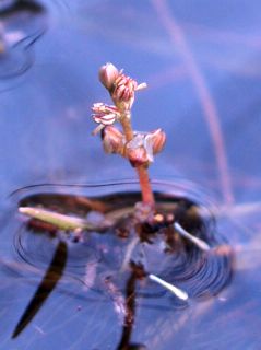
<i>Myriophyllum alterniflorum</i> Species of flowering plant in the family Haloragaceae

Myriophyllum alterniflorum, known as alternate water-milfoil or alternateflower watermilfoil, is a species of water-milfoil. It is native to Europe and Asia,has been introduced to North America and inhabits aquatic habitat, such as ponds and streams.

Esquesing Township was a municipality within the historic Halton County in Ontario, Canada. It is today a geographic township in the town of Halton Hills in the Regional Municipality of Halton.

Gordon "Gord" Krantz is the mayor of Milton, Ontario, in Canada. He was first elected mayor in 1980, after serving as town councillor from 1965 to 1980. He has been re-elected for a total of 21 terms. With his re-election in 2014, Krantz surpassed the retired Hazel McCallion as Ontario's longest-serving mayor on December 1, 2016, and the longest-serving mayor of a major municipality in Canada. He was re-elected by a 1,000 vote margin in the 2022 municipal election.

Gail Brown is a Canadian musician who was the first female bagpipe player to play in the World Pipe Band Championships. She is also the first female bagpiper to win the highest level competition in the World Pipe Band Championships in 1973, with the Shotts & Dykehead Caledonia Pipe Band.

References

  1. 1 2 3 4 5 6 7 8 9 10 11 12 13 "MILTON 160: Mill Pond's long and storied past". InsideHalton.com. 30 June 2017. Retrieved 20 December 2020.
  2. "Sixteen Mile Creek". Oakville News. Retrieved 20 December 2020.
  3. Canada, Service (17 September 2020). "Basic search". aem. Retrieved 20 December 2020.
  4. 1 2 "Building a Complete Community". www.milton.ca. 19 November 2019. Retrieved 20 December 2020.
  5. www.ontario.ca https://www.ontario.ca/search/search-results?query=milton%20mill%20pond . Retrieved 20 December 2020.{{cite web}}: Missing or empty |title= (help)
  6. 1 2 Coulter, Eleanor B. "Mill Pond, Milton". images.milton.halinet.on.ca. Retrieved 20 December 2020.
  7. www.ontario.ca https://www.ontario.ca/page/getting-settled-ontario/en/living/OI_HOW_LIVE_HALTON.html . Retrieved 20 December 2020.{{cite web}}: Missing or empty |title= (help)
  8. "Lake Ontario | lake, North America". Encyclopedia Britannica. Retrieved 20 December 2020.
  9. 1 2 Milton; Ontario; L9t 2p4. "Martin's Grist Mill. Milton, Ontario". images.milton.halinet.on.ca. Retrieved 20 December 2020.{{cite web}}: CS1 maint: numeric names: authors list (link)
  10. "Milton - Martin Family Collection". images.milton.halinet.on.ca. Retrieved 20 December 2020.
  11. 1 2 3 "A Brief History of Milton". Milton Historical Society. Retrieved 20 December 2020.
  12. "2016 Census QuickStats: Milton (Qld)". quickstats.censusdata.abs.gov.au. Retrieved 20 December 2020.
  13. "100 years of Robin Hood". Bakers Journal. 10 March 2010. Retrieved 20 December 2020.
  14. "Milton. Fire Department, Milton Fire Department Headquarters". search.hipinfo.info. Retrieved 20 December 2020.
  15. "Canada's Centennial Celebrations, 1967 | The Canadian Encyclopedia". www.thecanadianencyclopedia.ca. Retrieved 20 December 2020.
  16. "Web Maps". conservationhalton-camaps.opendata.arcgis.com. Retrieved 20 December 2020.
  17. "Worst Water Weeds #2: Eurasian Watermilfoil". Weedoo Workboats. 10 March 2017. Retrieved 20 December 2020.
  18. "Mill Pond". AllTrails.com. Retrieved 20 December 2020.
  19. 1 2 "Best trails in Milton, Ontario". AllTrails.com. Retrieved 20 December 2020.
  20. 1 2 "Milton Mill Pond". HALTON HILLS CAMERA CLUB. Retrieved 20 December 2020.