
Uinta County is a county in the U.S. state of Wyoming. As of the 2020 United States Census, the population was 20,450. Its county seat is Evanston. Its south and west boundary lines abut the Utah state line.

Sweetwater County is a county in southwestern Wyoming, United States. As of the 2020 United States Census, the population was 42,272, making it the fourth-most populous county in Wyoming. Its county seat is Green River. By area, it is the largest county in Wyoming. Its southern boundary line abuts the north lines of the states of Colorado and Utah.

Robertson is a census-designated place (CDP) in Uinta County, Wyoming, United States. The population was 97 at the 2010 census.

The Green River, located in the western United States, is the chief tributary of the Colorado River. The watershed of the river, known as the Green River Basin, covers parts of the U.S. states of Wyoming, Utah, and Colorado. The Green River is 730 miles (1,170 km) long, beginning in the Wind River Mountains of Wyoming and flowing through Wyoming and Utah for most of its course, except for a short segment of 40 miles (64 km) in western Colorado. Much of the route traverses the arid Colorado Plateau, where the river has carved some of the most spectacular canyons in the United States. The Green is only slightly smaller than the Colorado when the two rivers merge, but typically carries a larger load of silt. The average yearly mean flow of the river at Green River, Utah is 6,121 cubic feet (173.3 m3) per second.

The Belle Fourche River is a tributary of the Cheyenne River, approximately 290 miles (470 km) long, in the U.S. states of Wyoming and South Dakota. It is part of the Mississippi River watershed via the Cheyenne and Missouri rivers. In the latter part of the 19th century, the Belle Fourche River was known as the North Fork of the Cheyenne River. Belle Fourche is a name derived from French meaning "beautiful fork".

The Uinta Mountains are an east-west trending chain of mountains in northeastern Utah extending slightly into southern Wyoming in the United States. As a subrange of the Rocky Mountains, they are unusual for being the highest range in the contiguous United States running east to west, and lie approximately 100 miles (160 km) east of Salt Lake City. The range has peaks ranging from 11,000 to 13,528 feet, with the highest point being Kings Peak, also the highest point in Utah. The Mirror Lake Highway crosses the western half of the Uintas on its way to Wyoming.

The Uinta Basin is a physiographic section of the larger Colorado Plateaus province, which in turn is part of the larger Intermontane Plateaus physiographic division. It is also a geologic structural basin in eastern Utah, east of the Wasatch Mountains and south of the Uinta Mountains. The Uinta Basin is fed by creeks and rivers flowing south from the Uinta Mountains. Many of the principal rivers flow into the Duchesne River which feeds the Green River—a tributary of the Colorado River. The Uinta Mountains forms the northern border of the Uinta Basin. They contain the highest point in Utah, Kings Peak, with a summit 13,528 feet above sea level. The climate of the Uinta Basin is semi-arid, with occasionally severe winter cold.

Blacks Fork is a 175-mile-long (282 km) tributary of the Green River in Utah and Wyoming in the United States.
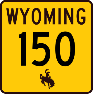
Wyoming Highway 150 is a 23.05-mile-long (37.10 km) north–south Wyoming State Road that runs from the Wyoming–Utah state border to north to Evanston. It is the Wyoming portion of the Mirror Lake Scenic Byway.

Wyoming Highway 414 (WYO 414) is a 46.12-mile-long (74.22 km) state highway in eastern Uinta and extreme southwestern Sweetwater counties in the U.S. state of Wyoming. Although primarily a north–south highway, WYO 414 travels in a more east–west orientation near its southern end. It connects Utah State Route 43 (UT-43) at the Utah state line, southeast of McKinnon with Interstate 80 (I-80) and WYO 412, at a point northwest of Lyman.

Wyoming Highway 413 (WYO 413) is a 2.73-mile (4.39 km) state highway in eastern Uinta County. Wyoming, United States. That connects Interstate 80 Business Loop (I-80 BL) in Lyman with Interstate 80 (I-80).

Wyoming Highway 412 (WYO l412), also known as the Carter–Lyman Road and previously as the Cater Cutoff Road, is a 24.73-mile (39.80 km) state highway in Uinta and Lincoln counties in western Wyoming, United States, that connects Interstate 80, northwest of Lyman, with U.S. Route 189 (US 189), south of Kemmerer..
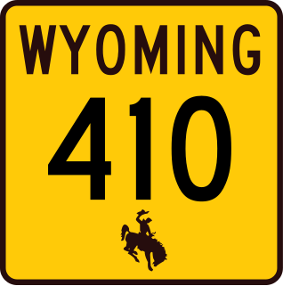
Wyoming Highway 410 (WYO 410) is a 13.36-mile (21.50 km) state highway in Uinta County, Wyoming, United States, that connects areas west of Roberston with Mountain View.

Wyoming Highway 411 (WYO 411), also known as Millburne Road, is a 3.97-mile (6.39 km) state highway in central Uinta County, Wyoming, United States, that connects the unincorporated community of Millburne with Wyoming Highway 410 (WYO 411), southwest of Mountain View.

Dewey is an unincorporated community near the southwest corner of Custer County, South Dakota, United States, less than one mile from the Wyoming border in a prairie region of the Black Hills. There are approximately five or six homes in town. Dewey has a volunteer fire department in the Edgemont city district.
Interstate 80 Business is a 15.63-mile (25.15 km) southern business loop of Interstate 80 (I-80) through Fort Bridger and Lyman in eastern Uinta County, Wyoming, United States.

Ostler Peak is a 12,718-foot elevation (3,876 m) mountain summit located in Summit County, Utah, United States.

Mount Lovenia is a 13,219-foot elevation (4,029 m) mountain summit located on the common border that Duchesne County shares with Summit County in the U.S. state of Utah.

Dead Horse Peak is a 12,642-foot elevation (3,853 m) mountain summit located on the common border that Duchesne County shares with Summit County in the U.S. state of Utah.


