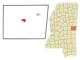
Kemper County is a county located on the central eastern border of the U.S. state of Mississippi. As of the 2020 census, the population was 8,988. Its county seat is De Kalb. The county is named in honor of Reuben Kemper.

New Minden is a village in Washington County, Illinois, United States. The population was 215 at the 2010 census. It possessed a post office from 1868 to 1976.

De Kalb is a town in and the county seat of Kemper County, Mississippi, United States. The population was 1,164 at the 2010 census. De Kalb is named after General Johann de Kalb, a Franconian-French military officer who served as a major general in the Continental Army during the American Revolutionary War.

Scooba is a town in Kemper County, Mississippi, United States. The population was 732 as of the 2010 Census.

Minden is a census-designated place (CDP) in Douglas County, Nevada, United States. The population was 3,001 at the 2010 census. It is the county seat of Douglas County and is adjacent to the town of Gardnerville. The Douglas campus of the Western Nevada College is located in Minden.
Wahalak is a small unincorporated community in central Kemper County, Mississippi, United States.

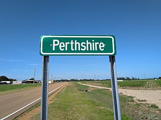
Perthshire is an unincorporated community located in Bolivar County, Mississippi, United States along Mississippi Highway 1. Perthshire is approximately 5 miles (8.0 km) south of Deeson and approximately 3 miles (4.8 km) north of Gunnison. Perthshire is located on the Riverside Division of the former Yazoo and Mississippi Valley Railroad. Perthshire was once home to six general stores.
Moscow is an unincorporated community in Kemper County, Mississippi. It lies along State Highway 493 southwest of the city of De Kalb, the county seat of Kemper County. Its elevation is 509 feet (155 m). A post office operated under the name Moscow from 1871 to 1922. In 1900, Moscow's population was 30.
Porterville is a census-designated place and unincorporated community in Kemper County, Mississippi. It lies a slight distance away from U.S. Route 45 southeast of the city of De Kalb, the county seat of Kemper County. Its elevation is 200 feet (61 m). It has a post office with the ZIP code 39352. It is adjacent to Lake Porterville.

McHenry, is an unincorporated community in southern Stone County, Mississippi. It is situated approximately 10 miles (16 km) south of Wiggins and 3 miles (4.8 km) north of Saucier. The community is part of the Gulfport-Biloxi metropolitan area.

Lamont is an unincorporated community located in southern Bolivar County, Mississippi, United States on Mississippi Highway 1 on the Bolivar County/Washington County border. Lamont is approximately 4 miles (6.4 km) north of Winterville and approximately 5 miles (8.0 km) south of Scott. Lamont is located at the junction of two branches of the former Yazoo and Mississippi Valley Railroad.

Hushpuckena is an unincorporated community located in Bolivar County, Mississippi, United States along U.S. Route 61. Hushpuckena is located approximately 3 miles (4.8 km) south of Duncan and approximately 4 miles (6.4 km) north of Shelby. Hushpuckena is located on the former Yazoo and Mississippi Valley Railroad.

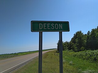
Deeson is an unincorporated community located in Bolivar County, Mississippi, United States along Mississippi Highway 1. Deeson is approximately 11 miles (18 km) south of Rena Lara and approximately 8 miles (13 km) north of Gunnison.

O'Reilly is an unincorporated community located in Bolivar County, Mississippi, United States, along U.S. Route 61. O'Reilly is approximately 3 miles (4.8 km) south of Boyle and approximately 6 miles (9.7 km) north of Shaw. O'Reilly is located on the former Yazoo and Mississippi Valley Railroad.
Clover Hill is an unincorporated community located in Coahoma County, Mississippi, United States. Clover Hill is approximately 4 miles (6.4 km) north of Lyon and approximately 4 miles (6.4 km) south of Rudyard. The community is located on the former plantation of J. T. Fargason. Clover Hill once had a depot on the former Yazoo and Mississippi Valley Railroad. A post office operated under the name Clover Hill from 1884 to 1935.
Sucarnoochee is an unincorporated community in Kemper County, Mississippi, United States. Its post office has been closed. It was also known as Sucarnooche.
Howison is an unincorporated community located in Harrison County, Mississippi. Howison is approximately 1.9 miles (3.1 km) north of Saucier and 4 miles (6.4 km) south of McHenry and part of the Gulfport-Biloxi metropolitan area.

Binnsville is a ghost town in Kemper County, Mississippi, United States.

During the afternoon of April 27, 2011, a violent EF5 tornado touched down in eastern Mississippi, killing three people. Part of the historic 2011 Super Outbreak, the largest tornado outbreak on record, this was the first of four EF5 tornadoes to touch down that day and the first such storm in Mississippi since the 1966 Candlestick Park tornado. While on the ground for 30 minutes, it traveled along a 28.28-mile (45.51 km) path through four counties, leaving behind three deaths, eight injuries, and $1.1 million in damage.
Cullum is an unincorporated community in Kemper County, Mississippi, United States. A post office operated under the name Cullum from 1895 to 1914. In 1900, Cullum's population was 24.


