Bogue Chitto, Mississippi | |
---|---|
Coordinates: 32°49′47″N88°55′12″W / 32.82972°N 88.92000°W | |
Country | United States |
State | Mississippi |
Counties | Neshoba, Kemper |
Area | |
• Total | 6.39 sq mi (16.55 km2) |
• Land | 6.35 sq mi (16.44 km2) |
• Water | 0.04 sq mi (0.12 km2) |
Elevation | 486 ft (148 m) |
Population (2020) | |
• Total | 864 |
• Density | 136.15/sq mi (52.57/km2) |
Time zone | UTC-6 (Central (CST)) |
• Summer (DST) | UTC-5 (CDT) |
FIPS code | 28-07330 |
GNIS feature ID | 0685013 |
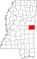
Bogue Chitto is a census-designated place (CDP) situated in Kemper and Neshoba counties, Mississippi. The population was 864 at the 2020 census. It is part of the Mississippi Band of Choctaw Indians Reservation and the population is 93% Choctaw.
During Freedom Summer of 1964 and a voter registration drive, three civil rights workers: James Chaney, Andrew Goodman and Michael Schwerner, were killed by Ku Klux Klan members about 10 miles north of Bogue Chitto on the night of June 21, 1964. Their bodies were discovered by the FBI and other law enforcement, buried in an earthen dam on the Old Jolly Farm in Neshoba County, Mississippi in August 1964. [2] The murders galvanized national attention and contributed to passage of the Voting Rights Act of 1965.
The events were the subject of the 1988 drama film Mississippi Burning .
The name Bogue Chitto, meaning "Big Creek," comes from the Choctaw words "bok" (creek) and "chito" (big). [3]
Much of the Mississippi Choctaw Indian Reservation is in Neshoba County with a portion extending into western Kemper County. [4] Bogue Chitto is one of 8 communities in the nation.
According to the United States Census Bureau, the CDP has a total area of 6.3 square miles (16.4 km2), of which 6.3 square miles (16.3 km2) are land and 0.04 square mile (0.1 km2) (0.63%) is water.
Census | Pop. | Note | %± |
---|---|---|---|
2020 | 864 | — | |
U.S. Decennial Census [5] |
Race | Number | Percentage |
---|---|---|
White (NH) | 49 | 5.67% |
Black or African American (NH) | 36 | 4.17% |
Native American or Alaska Native (NH) | 731 | 84.61% |
Mixed/Multi-Racial (NH) | 33 | 3.82% |
Hispanic or Latino | 15 | 1.74% |
Total | 864 |
As of the 2020 United States census, there were 864 people, 114 households, and 92 families residing in the CDP.
As of the census [8] of 2000, there were 533 people, 160 households, and 127 families residing in the CDP. The population density was 84.6 inhabitants per square mile (32.7/km2). There were 169 housing units at an average density of 26.8 units per square mile (10.3 units/km2). The racial makeup of the CDP was 5.82% White, 0.38% African American, 92.68% Native American, and 1.13% from two or more races. Hispanic or Latino comprised 0.38% of the population.
There were 160 households, out of which 40.6% had children under the age of 18 living with them, 31.9% were married couples living together, 31.9% had a female householder with no husband present, and 20.6% were non-families. 11.9% of all households were made up of individuals, and 3.1% had someone living alone who was 65 years of age or older. The average household size was 3.33 and the average family size was 3.48.
In the CDP, the population was spread out, with 34.1% under the age of 18, 11.1% from 18 to 24, 31.0% from 25 to 44, 16.9% from 45 to 64, and 6.9% who were 65 years of age or older. The median age was 28 years. For every 100 females, there were 94.5 males. For every 100 females age 18 and over, there were 86.7 males.
The median income for a household in the CDP was $18,641, and the median income for a family was $16,597. Males had a median income of $18,250 versus $15,240 for females. The per capita income for the CDP was $6,080. About 56.1% of families and 54.2% of the population were below the poverty line, including 58.3% of those under age 18 and 80.6% of those age 65 or over.
The Neshoba County portion of Bogue Chitto is served by the Neshoba County School District. [9] The Kemper County School District serves the portion of Bogue Chitto that lies in Kemper County.
Native American students are eligible to attend schools in the Choctaw Tribal School System, which is operated by the Mississippi Band of Choctaw Indians. Bogue Chitto Elementary School is in the community. [10]
Winston County is a county located in the U.S. state of Mississippi. In the 2020 census, the population was 17,714. Its county seat is Louisville. The county is named for Louis Winston (1784–1824), a colonel in the militia, a prominent lawyer, and a judge of the Mississippi Supreme Court.
Newton County is a county located in the U.S. state of Mississippi. As of the 2020 census, the population was 21,291. Its county seat is Decatur.
Neshoba County is a county located in the central part of the U.S. state of Mississippi. As of the 2020 census, the population was 29,087. Its county seat is Philadelphia.
Lincoln County is a county located in the U.S. state of Mississippi. As of the 2020 census, the population was 34,907. Its county seat is Brookhaven. The county was created by the legislature on April 7, 1870, during the Reconstruction Era. It was formed from portions of Lawrence, Pike, Franklin, Copiah, and Amite counties. It was named for Abraham Lincoln, the 16th President of the United States. Lincoln County comprises the Brookhaven, MS Micropolitan Statistical Area, which is included in the Jackson–Vicksburg–Brookhaven Combined Statistical Area. The county is southwest of the state capital of Jackson.
Leake County is a county in the center of the U.S. state of Mississippi. As of the 2020 census, the population was 21,275. Its county seat is Carthage. The county is named for Walter Leake, the Governor of Mississippi from 1822 to 1825.
Kemper County is a county located on the central eastern border of the U.S. state of Mississippi. As of the 2020 census, the population was 8,988. Its county seat is De Kalb. The county is named in honor of Reuben Kemper.
Weir is a town in Choctaw County, Mississippi, United States. The population was 459 at the 2010 census, down from 553 at the 2000 census.
Big Point is an unincorporated community and census-designated place (CDP) in Jackson County, Mississippi, United States. It is part of the Pascagoula, Mississippi Metropolitan Statistical Area. Per the 2020 Census, the population was 618.
Escatawpa is an unincorporated community and census-designated place (CDP) in Jackson County, Mississippi, United States. It is part of the Pascagoula Metropolitan Statistical Area. The population was 3,254 at the 2020 census.
Helena is an unincorporated community and census-designated place (CDP) in Jackson County, Mississippi, United States. It is part of the Moss Point Metropolitan Statistical Area. Per the 2020 Census, the population was 983.
Redwater is a census-designated place (CDP) in Leake County, Mississippi, United States. It is one of the eight communities of the Mississippi Band of Choctaw Indians Reservation, and the population is 61% Choctaw. The population was 633 at the 2010 census, up from 409 at the 2000 census.
Standing Pine is a census-designated place (CDP) in Leake County, Mississippi, United States. It is one of the eight communities of the Mississippi Band of Choctaw Indians Reservation, and the population is 94% Choctaw. The total population of the CDP was 517 at the 2020 census.
Pearl River is a census-designated place (CDP) in Neshoba County, Mississippi. It is one of the eight communities of the Mississippi Band of Choctaw Indians Reservation and the population is 80% Choctaw. The population was 3,156 at the 2000 census.
Tucker is a census-designated place (CDP) in Neshoba County, Mississippi. It is one of the eight communities of the Mississippi Band of Choctaw Indians Reservation and the population is 93% Choctaw. The population was 642 at the 2020 census.
Chunky is a town in Newton County, Mississippi, United States. The population was 344 at the 2000 census.
Collinsville is an unincorporated community and census-designated place (CDP) in Lauderdale County, Mississippi, United States. The population was 1,984 at the 2020 census.
Conehatta is a census-designated place (CDP) in Newton County, Mississippi. The population was 1376 at the 2020 census. It is one of the eight communities included in the Mississippi Band of Choctaw Indians Reservation and the population is 76% Choctaw.
Spanish Lake is an unincorporated community and census-designated place (CDP) in St. Louis County, Missouri, United States. The population was 18,413 at the 2020 census.
Choctaw Lake is a census-designated place (CDP) in Madison County, Ohio, United States. The population was 2,047 at the 2020 census.
Bogue Chitto is an unincorporated community and census-designated place (CDP) in Lincoln County, Mississippi, United States. As of the 2020 census, it had a population of 437. Bogue Chitto is the only municipal hamlet in the state of Mississippi.
13241 Highway 491 North Philadelphia, MS 39050