Tamola, Mississippi | |
|---|---|
 Tamola  Tamola | |
| Coordinates: 32°35′12″N88°28′37″W / 32.58667°N 88.47694°W | |
| Country | United States |
| State | Mississippi |
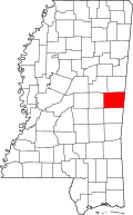
| County | Kemper |
| Elevation | 229 ft (70 m) |
| Time zone | UTC-6 (Central (CST)) |
| • Summer (DST) | UTC-5 (CDT) |
| GNIS feature ID | 692255 [1] |
Tamola is an unincorporated community that is located in Kemper County, in the U.S. state of Mississippi. [2]