Miranda, Cauca

Last updated

Miranda
Flag of Miranda (Cauca).svg
Escudo de Miranda (Cauca).svg
Colombia - Cauca - Miranda.svg
Location of the municipality and town of Miranda, Cauca in the Cauca Department of Colombia.
CountryColombia
Department Cauca Department
Government
  AlcaldeJosé Leonardo Valencia Narvaez (2016–2019)
Population
 (2020 est. [1] )
  Total43,333
Time zone UTC-5 (Colombia Standard Time)
Climate Aw

Miranda is a town and municipality in the Cauca Department, Colombia.

Contents

History

It was on May 7, 1899, when Don Julio Fernández Medina founded the city, since then the community mixed among Afro-Descendant, Indigenous people, Mulattoes and from different regions have built one of the most prosperous towns in the department. Today Miranda has strengths in the agroindustrial field, and growth in the tourism sector, because the natural wealth framed in its rivers, makes natural spas suitable for national and foreign tourists. Precisely in this year – towards the month of October – the War of the Thousand Days broke out, that lived in the Municipality of Miranda, it was known with the name of Revolution of the Manigua, according to narration of the caloteño historian Mariano Sendoya. [2]

Climate

Climate data for Miranda, elevation 1,128 m (3,701 ft), (1981–2010)
MonthJanFebMarAprMayJunJulAugSepOctNovDecYear
Mean daily maximum °C (°F)29.3
(84.7)
29.5
(85.1)
29.5
(85.1)
29.1
(84.4)
28.6
(83.5)
29.0
(84.2)
29.4
(84.9)
29.7
(85.5)
29.4
(84.9)
28.5
(83.3)
28.3
(82.9)
28.7
(83.7)
29.2
(84.6)
Daily mean °C (°F)23.5
(74.3)
23.6
(74.5)
23.6
(74.5)
23.5
(74.3)
23.4
(74.1)
23.5
(74.3)
23.6
(74.5)
23.9
(75.0)
23.6
(74.5)
23.2
(73.8)
23.1
(73.6)
23.3
(73.9)
23.5
(74.3)
Mean daily minimum °C (°F)18.1
(64.6)
18.2
(64.8)
18.3
(64.9)
18.3
(64.9)
18.4
(65.1)
18.2
(64.8)
17.9
(64.2)
18.1
(64.6)
18.1
(64.6)
18.0
(64.4)
18.0
(64.4)
18.1
(64.6)
18.1
(64.6)
Average precipitation mm (inches)118.8
(4.68)
118.0
(4.65)
155.5
(6.12)
203.0
(7.99)
120.4
(4.74)
73.6
(2.90)
55.6
(2.19)
45.1
(1.78)
117.6
(4.63)
221.9
(8.74)
213.8
(8.42)
123.1
(4.85)
1,554.3
(61.19)
Average precipitation days12111517171311913191714164
Average relative humidity (%)84838384848381808283838383
Mean monthly sunshine hours 148.8127.0124.0105.0105.4114.0139.5139.5114.0114.7117.0127.11,476
Mean daily sunshine hours 4.84.54.03.53.43.84.54.53.83.73.94.14.0
Source: Instituto de Hidrologia Meteorologia y Estudios Ambientales [3]
Climate data for Miranda (Ing Cauca), elevation 1,000 m (3,300 ft), (1981–2010)
MonthJanFebMarAprMayJunJulAugSepOctNovDecYear
Mean daily maximum °C (°F)30.0
(86.0)
30.3
(86.5)
30.3
(86.5)
29.6
(85.3)
29.4
(84.9)
29.6
(85.3)
29.9
(85.8)
30.3
(86.5)
30.1
(86.2)
29.4
(84.9)
29.0
(84.2)
29.4
(84.9)
29.8
(85.6)
Daily mean °C (°F)23.6
(74.5)
23.7
(74.7)
23.6
(74.5)
23.4
(74.1)
23.4
(74.1)
23.5
(74.3)
23.6
(74.5)
23.8
(74.8)
23.5
(74.3)
23.2
(73.8)
22.9
(73.2)
23.3
(73.9)
23.5
(74.3)
Mean daily minimum °C (°F)18.6
(65.5)
18.8
(65.8)
18.7
(65.7)
19.1
(66.4)
19.1
(66.4)
18.8
(65.8)
18.2
(64.8)
18.0
(64.4)
18.2
(64.8)
18.5
(65.3)
18.8
(65.8)
18.7
(65.7)
18.6
(65.5)
Average precipitation mm (inches)98.2
(3.87)
102.6
(4.04)
143.6
(5.65)
206.6
(8.13)
158.1
(6.22)
101.3
(3.99)
71.6
(2.82)
67.3
(2.65)
123.7
(4.87)
182.1
(7.17)
182.6
(7.19)
113.3
(4.46)
1,518
(59.8)
Average precipitation days1011141716129912171613150
Average relative humidity (%)79797981818077777880828179
Mean monthly sunshine hours 167.4149.6145.7132.0136.4138.0161.2164.3138.0145.7144.0151.91,774.2
Mean daily sunshine hours 5.45.34.74.44.44.65.25.34.64.74.84.94.9
Source: Instituto de Hidrologia Meteorologia y Estudios Ambientales [3]

Related Research Articles

<span class="mw-page-title-main">Cauca Department</span> Department of Colombia

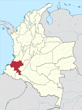
Cauca Department is a department of Southwestern Colombia. Located in the southwestern part of the country, facing the Pacific Ocean to the west, the Valle del Cauca Department to the north, Tolima Department to the northeast, Huila Department to the east, and Nariño Department to the south. Putumayo and Caqueta Departments border the southeast portion of Cauca Department as well. It covers a total area of 29,308 km2 (11,316 sq mi), the 13th largest in Colombia. Its capital is the city of Popayán. The offshore island of Malpelo belongs to the department. It is located in the southwest of the country, mainly in the Andean and Pacific regions plus a tiny part (Piamonte) in the Amazonian region. The area makes up 2.56% of the country.

<span class="mw-page-title-main">Andalucía, Valle del Cauca</span> Municipality and town in Valle del Cauca Department, Colombia

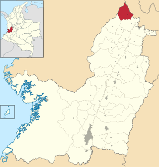
Andalucía is a town and municipality located in the north of the Department of Valle del Cauca, in Colombia.

<span class="mw-page-title-main">Almaguer, Cauca</span> Municipality and town in Cauca Department, Colombia

Almaguer is a town and municipality in the Cauca Department, Colombia.

<span class="mw-page-title-main">Bolívar, Cauca</span> Municipality and town in Cauca Department, Colombia

Bolívar is a town and municipality in the Cauca Department, Colombia. Founded in October 1784 by Domingo Belisario Gómez, the municipality covers an area of 746.3 km (464 mi) and has a population of 57,511. The population is primarily engaged in agriculture and ranching.

<span class="mw-page-title-main">Buenos Aires, Cauca</span> Municipality and town in Cauca Department, Colombia

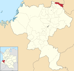
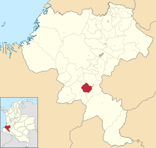
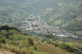
Buenos Aires is a town and municipality in the Cauca Department, Colombia. Founded in by Vasco de Guzmán and Alonso de Fuenmayor in 1551, the municipality covers an area 520 km2 (201 sq mi) and has a population of 21,300. The population is primarily engaged in agriculture and ranching.

<span class="mw-page-title-main">Cajibio, Cauca</span> Municipality and town in Cauca Department, Colombia

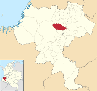
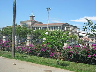
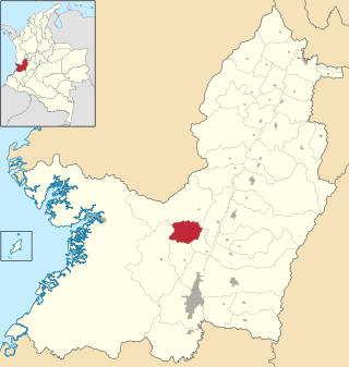
Cajibio is a town and municipality in the Cauca Department, Colombia.

<span class="mw-page-title-main">Caloto, Cauca</span> Municipality and town in Cauca Department, Colombia

Caloto is a town and municipality in the Cauca Department, Colombia. It was founded on June 29, 1543 by Sebastián de Belalcázar.

<span class="mw-page-title-main">Corinto, Cauca</span> Municipality and town in Cauca Department, Colombia

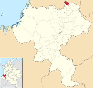
Corinto is a town and municipality in the Cauca Department, Colombia.

<span class="mw-page-title-main">La Sierra, Cauca</span> Municipality and town in Cauca Department, Colombia

La Sierra is a town and municipality in the Cauca Department, Colombia.

<span class="mw-page-title-main">Páez, Cauca</span> Municipality and town in Cauca Department, Colombia

Paéz is a municipality in the Cauca Department, Colombia. The town of Belalcazar, is the main urban center of the Municipality. It was founded in 1905 by Valencia, Mosquera and Lemus. The town is located by the steps of the Nevado del Huila Volcano, the municipality borders to the northeast with the Tolima Department, to the west with the Huila Department, southwest with the municipality of Inza, to the west with the municipalities of Silvia and Jambalo and to the north with the municipality of Toribio covering a total area of 1,258 km2 (486 sq mi).

<span class="mw-page-title-main">Puerto Tejada, Cauca</span> Municipality and town in Cauca Department, Colombia

Puerto Tejada is a town and municipality in the Cauca Department, Colombia.

<span class="mw-page-title-main">Puracé, Cauca</span> Municipality and town in Cauca Department, Colombia

Puracé is a town and municipality in the Cauca Department, Colombia.

<span class="mw-page-title-main">Santa Rosa, Cauca</span> Municipality and town in Cauca Department, Colombia

Santa Rosa is a Colombian municipality located in the department of Cauca, in the region known as the Bota Caucana. It is located on the eastern slope of the Colombian Massif, the mountainous area where the Central and Oriental Cordilleras merge. Its economy is based on agriculture, its main products are corn, sugar cane, plantain and livestock. It includes the corregiments of Carmelo, San Juan de Villalobos and Descanse.

<span class="mw-page-title-main">Sotará, Cauca</span> Municipality and town in Cauca Department, Colombia

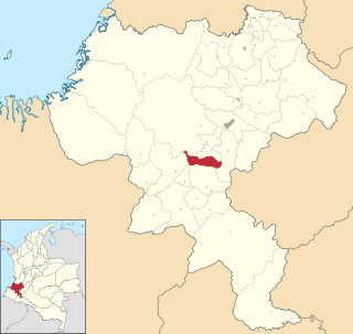
Sotará is a town and municipality in the Cauca Department, Colombia.

<span class="mw-page-title-main">Bugalagrande</span> Municipality and town in Valle del Cauca Department, Colombia

Bugalagrande is a town and municipality located in the Department of Valle del Cauca, Colombia.

<span class="mw-page-title-main">Calima, Valle del Cauca</span> Municipality in Valle del Cauca Department, Colombia

Calima is a municipality located in the Department of Valle del Cauca, Colombia. Its main urban area is the town of Darién.

<span class="mw-page-title-main">El Águila, Valle del Cauca</span> Municipality and town in Valle del Cauca Department, Colombia

El Águila is a town and municipality located in the Department of Valle del Cauca, Colombia.

<span class="mw-page-title-main">El Cairo</span> Municipality and town in Valle del Cauca Department, Colombia

El Cairo is a town and municipality located in the Department of Valle del Cauca, Colombia.

<span class="mw-page-title-main">Jamundí</span> Municipality and city in Valle del Cauca Department, Colombia

Jamundí is a town and municipality in the Department of Valle del Cauca, Colombia.

<span class="mw-page-title-main">Restrepo, Valle del Cauca</span> Municipality and town in Valle del Cauca Department, Colombia

Restrepo is a town and municipality located in the Department of Valle del Cauca, Colombia. It was founded December 1, 1913 by Julio Fernandez Medina, Anselmo Rendon Nicanor Grisales and other settlers. It has been a Municipality since April 3, 1925, under Ordinance No. 030 of the Departmental Assembly. Mostly mountainous, its major economic activities are agriculture and animal husbandry. Its key products are banana, pineapple, sugarcane cane, beans, fruits, vegetables and corn.

References

  1. "Resultados y proyecciones (2005-2020) del censo 2005" . Retrieved April 12, 2020.
  2. "Miranda, Cauca, celebra sus 113 años de fundación". Proclama del Cauca (In Spanish). Retrieved January 10, 2018.
  3. 1 2 "Promedios Climatológicos 1981–2010" (in Spanish). Instituto de Hidrologia Meteorologia y Estudios Ambientales. Archived from the original on August 15, 2016. Retrieved June 17, 2024.

3°15′N76°15′W / 3.250°N 76.250°W / 3.250; -76.250