Miravalles Jorge Manuel Dengo National Park

Last updated
Miravalles Jorge Manuel Dengo National Park
IUCN category II (national park)
Miravalles Jorge Manuel Dengo National Park
Location Costa Rica
Coordinates 10°45′0″N85°9′0″W / 10.75000°N 85.15000°W / 10.75000; -85.15000 Coordinates: 10°45′0″N85°9′0″W / 10.75000°N 85.15000°W / 10.75000; -85.15000
Area43 square kilometres (17 sq mi)
Established5 June 2019
Governing bodyNational System of Conservation Areas (SINAC)
Costa Rica relief location map.jpg
Red pog.svg
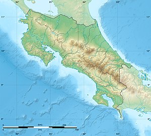
Location in Costa Rica

Miravalles Jorge Manuel Dengo National Park (Spanish : Parque Nacional Miravalles Jorge Manuel Dengo), is a national park and nature reserve in the northwest part of Costa Rica, which forms part of the Arenal Tempisque Conservation Area. The site contains the Miravalles Volcano, which is still active although the last recorded eruption was only of steam vents in 1946.

Contents

On 5 June 2019, it was created by allocating 43 square kilometres (17 sq mi) from Miravalles Protected Zone as declared by Executive Decree 41768-MINAE, [1] it became the twenty ninth national park of Costa Rica. [2]

Economy

Nearby there is a geothermal energy plant which uses the large underground heated reservoir to provide electricity. In the same premises is also located the Miravalles Solar Park.

Related Research Articles

San José, Costa Rica The capital city of Costa Rica

San José is the capital and largest city of Costa Rica, and the capital of the province of the same name. It is in the centre of the country, in the mid-west of the Central Valley, within San José Canton. San José is Costa Rica's seat of national government, focal point of political and economic activity, and major transportation hub. San José Canton's population was 288,054 in 2011, and San José's municipal land area is 44.2 square kilometers, with an estimated 333,980 residents in 2015. Together with several other cantons of the central valley, including Alajuela, Heredia and Cartago, it forms the country's Greater Metropolitan Area, with an estimated population of over 2 million in 2017. The city is named in honor of Joseph of Nazareth.

Liberia, Costa Rica District in Guanacaste, Costa Rica

Liberia is a district and the largest city in the Guanacaste Province of Costa Rica, located 215 kilometres (134 mi) northwest of the national capital, San José, in the canton with the same name, of which it is the head city or capital.

National System of Conservation Areas or SINAC,, is part of the Ministry of Environment and Energy or MINAE of Costa Rica. It is the administrator for the nation's national parks, conservation areas, and other protected natural areas.

Tapantí National Park

Tapantí - Cerro de la Muerte Massif National Park,, is a National Park in the Central Conservation Area of Costa Rica located on the edge of the Talamanca Range, near Cartago. It protects forests to the north of Chirripó National Park, and also contains part of the Orosí River. The area known as Cerro de la Muerte Massif was added to the park on January 14, 2000.

Palo Verde National Park

Palo Verde National Park, is a national park of Costa Rica, part of the Arenal Tempisque Conservation Area, that contains much of the area of the valley of the Tempisque River and covers an area of 45,492 acres in Guanacaste Province, 30 km west of Canas. The surrounding region is mostly tropical dry forests, and the park concentrates on conserving vital floodplain, marshes, limestone ridges, and seasonal pools from the encroachment of civilization which was putting the ecology of the area at risk.

Santa Rosa National Park

Santa Rosa National Park, is a national park, in Guanacaste Province, northwestern Costa Rica, it was created in 1966 by decree 3694.

Iguanita Wildlife Refuge

Iguanita Wildlife Refuge is a wildlife refuge, part of the Guanacaste Conservation Area, in Guanacaste Province, northwestern Costa Rica.

Arenal Tempisque Conservation Area Costa Rican conservation area

Arenal Tempisque Conservation Area, is an administrative area which is managed by SINAC for the purposes of conservation in the northwest part of Costa Rica, near the Arenal Volcano and covering part of the Cordillera de Tilarán and Cordillera de Guanacaste. It contains a number of National Parks, Wildlife refuges and Protected Zones. The area was previously known as Arenal Tilarán Conservation Area.

Arenal Volcano National Park

Arenal Volcano National Park is a Costa Rican national park in the central part of the country, part of the Arenal Huetar Norte Conservation Area. The park encompasses the Arenal Volcano, which "was" the most active in the country, which had previously been believed to be dormant until a major eruption in 1968. It neighbors Lake Arenal, which is the site of the country's largest hydroelectricity project, the Lake Arenal Dam.

Chirripó National Park

Chirripó National Park is a national park of Costa Rica, encompassing parts of three provinces: San José, Limón and Cartago. It was established in 1975.

The Ministry of Environment, Energy, and Telecommunications (MINAE) Spanish: Ministerio de Ambiente, Energía y Telecomunicaciones) is part of the government of Costa Rica.

San Lucas Island National Park on an island off the Pacific coast of Costa Rica in the Gulf of Nicoya

San Lucas Island National Park is an island located off the Pacific shore of Costa Rica in the Gulf of Nicoya. It is part of the Puntarenas district of Puntarenas Canton of the province of Puntarenas.

Bijagua de Upala district in Upala canton, Alajuela province, Costa Rica

Bijagua is the fourth district of the Upala canton, in the Alajuela province of Costa Rica.

Tortuguero National Park

Tortuguero National Park is a national park in the Limón Province of Costa Rica. It is situated within the Tortuguero Conservation Area of the northeastern part of the country. Despite its remote location, reachable only by airplane or boat, it is the third-most visited park in Costa Rica. The park has a large variety of biological diversity due to the existence within the reserve of eleven different habitats, including rainforest, mangrove forests, swamps, beaches, and lagoons. Located in a tropical climate, it is very humid, and receives up to 250 inches (6,400 mm) of rain a year.

Los Quetzales National Park

Los Quetzales National Park, located 97 kilometers from San Isidro de El General, Costa Rica, it was created in 2006 by decree 32981-MINAE. It is managed under the Central Conservation Area of the National System of Conservation Areas.

Miravalles Volcano is an andesitic stratovolcano in Costa Rica.

Renewable energy in Costa Rica

Renewable energy in Costa Rica supplied about 98.1% of the electrical energy output for the entire nation in 2016. Fossil fuel energy consumption in Costa Rica was 49.48 as of 2014, with demand for oil increasing in recent years. In 2014, 99% of its electrical energy was derived from renewable energy sources, about 80% of which from hydroelectric power. For the first 75 days of 2015, 100% of its electrical energy was derived from renewable energy sources and in mid 2016 that feat was accomplished for 110 consecutive days despite suboptimal weather conditions. As a country, Costa Rica has a geographic advantage over others in that its high concentration per capita of rivers, dams, and volcanoes allows for a high renewable energy output. In addition, Costa Rica is the fourth highest nation in terms of rainfall per capita: it receives an average of 2,926 mm of precipitation per year. As a smaller nation with a population of only 5 million and no major industry, the need for strong energy infrastructure is less than for larger countries of higher population density. The 1948 elimination of the military of Costa Rica freed up millions of dollars from the government defense budget which are now invested in social programs and renewable energy generation. As president of Costa Rica in 1948, José Figueres announced that the nation's former military budget would be refocused specifically in healthcare, education, and environmental protection.

María Teresa Obregón Zamora

María Teresa Obregón Zamora (1888-1956) was a teacher, suffragist and politician in Costa Rica. She was part of the group that formed the Asociación Nacional de Educadores (ANDE) and fought for women's enfranchisement. After winning the vote, she helped found the National Liberation Party of Costa Rica and was one of the first three women elected as a Deputy of the Legislative Assembly of Costa Rica. In 2002, Obregón was honored as one of the inaugural group of women inducted into La Galería de las Mujeres de Costa Rica.

Miravalles Protected Zone Nature reserve in Costa Rica

Miravalles Protected Zone is a nature reserve in the northwest part of Costa Rica, which forms part of the Arenal Tempisque Conservation Area. The site contains the Miravalles Volcano, which is still active although the last recorded eruption was only of steam vents in 1946. The zone was created on 16 March 1976 by Executive Decree 5836-A.

References

  1. "N° 41768-MINAE".
  2. "Gobierno declara zona protectora Miravalles como Parque Nacional" . Retrieved 5 June 2019.