Turrialba Volcano National Park

Last updated
Turrialba Volcano National Park
Turrialba volcano eruption 2014. Costa Rica (1).jpg
Turrialba Volcano
Turrialba Volcano National Park
Turrialba Volcano National Park area.
Location Costa Rica
Coordinates 10°1′48″N83°46′12″W / 10.03000°N 83.77000°W / 10.03000; -83.77000
Area~3,900 acres (16 km²)
Established30 July 1955
Governing bodyNational System of Conservation Areas (SINAC)
Costa Rica relief location map.jpg
Red pog.svg
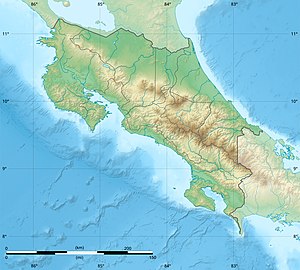
Location in Costa Rica

Turrialba Volcano National Park, or in Spanish the Parque Nacional Volcan Turrialba is a national park in the Central Conservation Area of Costa Rica that encompasses the area around the Turrialba Volcano in Cartago Province.

Contents

Major eruptions in the past have occurred in the years between 1864 and 1868. Volcanism increased in the park starting in 2014 and has featured ash clouds that have repeatedly impacted portions of Costa Rica with deposits of gritty soot and caused temporary closures of Juan Santamaría International Airport in the capital city of San Jose. [1]
Tourism

Besides the views of the crater, it is possible to see the Caribbean plains, Turrialba valley and Talamanca mountain range. There are eighty four species of birds and eleven species of mammals in the park.

A moderate to high difficulty hike is available to tourists, a previous phone reservation is required, the entry fee is set as CRC ₡1000 for residents and USD $12 for foreigners, and there is now a mandatory tour group guide fee of CRC ₡6000.

Tours start from 06:00 AM to 10:00 AM. [2]

2012—2020 Closure

Due to eruptions, the park was closed to tourists from 2012, and reopened on 4 December 2020. Meanwhile, new emergency shelters were created, the visitor center was renovated, and railings at lookout spots were added. A two kilometer perimeter closure around the crater is still in place. [3] [4] [5] [6]

Access

The main access is through Route 417, however as of December 2020 there is a conflict of interests between the owners of a farm, who want to declare the route private, and the government, so an alternative route is signaled along the way. [7]

Related Research Articles

<span class="mw-page-title-main">Popocatépetl</span> Stratovolcano in Puebla, Mexico

Popocatépetl is an active stratovolcano located in the states of Puebla, Morelos, and Mexico in central Mexico. It lies in the eastern half of the Trans-Mexican volcanic belt. At 5,393 m (17,694 ft) it is the second highest peak in Mexico, after Citlaltépetl at 5,636 m (18,491 ft).

<span class="mw-page-title-main">Arenal Volcano</span> Active volcano in Costa Rica

Arenal Volcano is an active andesitic stratovolcano in north-western Costa Rica around 90 km (56 mi) northwest of San José, in the province of Alajuela, canton of San Carlos, and district of La Fortuna. The Arenal volcano measures at least 1,633 metres (5,358 ft) high. It is conically shaped with a crater 140 metres (460 ft) in diameter. Geologically, Arenal is considered a young volcano and it is estimated to be less than 7,500 years old. It is also known as "Pan de Azúcar", "Canaste", "Volcan Costa Rica", "Volcan Río Frío" or "Guatusos Peak".

<span class="mw-page-title-main">Alajuela Province</span> Province of Costa Rica

Alajuela is a province of Costa Rica. It is located in the north-central part of the country, bordering Nicaragua to the north. It also borders the provinces of Heredia to the east, San José to the south, Puntarenas to the southwest and Guanacaste to the west. As of 2011, the province had a population of 885,571. Alajuela is composed of 16 cantons, which are divided into 111 districts. It covers an area of 9,757.53 square kilometers.

<span class="mw-page-title-main">Mount Aso</span> Volcano in Kumamoto Prefecture, Japan

Mount Aso, is also known as Aso Volcano and in this sense is the largest active volcano in Japan, and is among the largest in the world. Common use relates often only to the somma volcano in the centre of the Aso Caldera. It stands in Aso Kujū National Park in Kumamoto Prefecture, on the island of Kyushu. Its tallest peak, Takadake, is 1,592 meters (5,223 ft) above sea level. Mount Aso is in a fairly large caldera with a circumference of around 120 km (75 mi), although sources vary on the exact distance.

<span class="mw-page-title-main">Poás Volcano</span> Mountain in Costa Rica

The Poás Volcano, is an active 2,697-metre (8,848 ft) stratovolcano in central Costa Rica and is located within Poas Volcano National Park. It has erupted 40 times since 1828, including April 2017 when visitors and residents were evacuated. The volcano and surrounding park were closed for nearly 17 months, with a 2.5 kilometer safety perimeter established around the erupting crater. On September 1, 2018, the park reopened with limited access only to the crater observation area and required a reservation to be made on the National Park Website. Adjacent trails to Lake Botos as well as the museum at the visitor center remained closed. The volcano erupted briefly twice in September 2019.

<span class="mw-page-title-main">Masaya Volcano</span> Active complex volcano in Nicaragua

Masaya is a caldera located in Masaya, Nicaragua, 20 km (12 mi) south of the capital Managua. It is Nicaragua's first and largest national park, and one of 78 protected areas of Nicaragua. The complex volcano is composed of a nested set of calderas and craters, the largest of which is Las Sierras shield volcano and caldera. Within this caldera lies a sub-vent, which is Masaya Volcano sensu stricto. The vent is a shield type composing of basaltic lavas and tephras and includes a summit crater. This hosts Masaya caldera, formed 2,500 years ago by an 8 km3 (1.9 cu mi) basaltic ignimbrite eruption. Inside this caldera a new basaltic complex has grown from eruptions mainly on a semi-circular set of vents that include the Masaya and Nindiri cones. The latter host the pit craters of Masaya, Santiago, Nindiri and San Pedro. Observations in the walls of the pit craters indicate that there have been several episodes of cone and pit crater formation.

<span class="mw-page-title-main">Irazú Volcano</span> Active volcano in Costa Rica

The Irazú Volcano is an active volcano in Costa Rica, situated in the Cordillera Central close to the city of Cartago.

<span class="mw-page-title-main">Turrialba Volcano</span> Volcano in central Costa Rica

Turrialba Volcano is an active volcano in central Costa Rica that has been explosively eruptive in recent years including 2016 and in January, March and April 2017. Visitors used to be able to hike down into the main crater, but increased volcanic activity in 2014–17, resulting in large clouds of volcanic ash, led to the closure of the surrounding Turrialba Volcano National Park. However, with the eruptions subsiding, the park and access to the volcano reopened on December 4, 2020.

<span class="mw-page-title-main">Arenal Volcano National Park</span> National park of Costa Rica

Arenal Volcano National Park is a Costa Rican national park in the central part of the country, part of the Arenal Huetar Norte Conservation Area. The park encompasses the Arenal Volcano, the most active in the country, which was believed to be dormant until a major eruption in 1968. It neighbors Lake Arenal, which is the site of the country's largest hydroelectricity project, the Lake Arenal Dam.

<span class="mw-page-title-main">Poás Volcano National Park</span>

Poás Volcano National Park is a national park in Costa Rica that covers an area of approximately 65 square kilometres ; the summit of Poás Volcano located within the park is at an elevation of 2,700 metres (8,900 ft). The park was established on 25 January 1971. Depending on conditions, visitors can walk all the way to the edge of the main crater, but on 13 April 2017 the park was closed to visitors due to an explosive eruption on the evening of 12 April. Still further eruptions, including on Easter, 16 April, caused the park to be closed until August 2018.

<span class="mw-page-title-main">Irazú Volcano National Park</span>

Irazú Volcano National Park, or in Spanish the Parque Nacional Volcán Irazú, is a National Park in the Central Conservation Area of Costa Rica that encompasses the area around the Irazú Volcano in Cartago Province which incorporates what used to be the Ruben Torres Rojas Forest Reserve now called the Prusia Forest Reserve. The volcano is still active although the last major eruptions were between 1963 and 1965, with occasional minor eruptions and some small lava flows since that time.

<span class="mw-page-title-main">Guayabo National Monument</span> Archaeological site in Costa Rica

Guayabo National Monument, is an archaeological site near the city of Turrialba, within the Central Conservation Area in the Cartago Province, Costa Rica. It is almost directly in the center of the country on the Southern slope of the Turrialba Volcano. The National Monument covers about 2.3 square kilometres (0.89 sq mi) and is surrounded by rainforest plant vegetation causing it to be extremely vibrant green due to high precipitation and rich soils. Only a small portion of it has been unearthed, excavated, and studied.

<span class="mw-page-title-main">San Cristóbal Volcano</span>

Volcán San Cristóbal is the highest volcano in Nicaragua at 1,745 m (5,725 ft). Near the northwest corner of the country, close to the border with Honduras, it forms a backdrop to the city of Chichigalpa, Chinandega. It is also among the most active volcanoes in Nicaragua.

Turrialba is a canton in the Cartago province of Costa Rica. The head city is in Turrialba district.

<span class="mw-page-title-main">La Fortuna, San Carlos</span> District in San Carlos canton, Alajuela province, Costa Rica

La Fortuna is a district of the San Carlos canton, in the Alajuela province of Costa Rica.

<span class="mw-page-title-main">Rincón de la Vieja Volcano</span>

Rincón de la Vieja is an active andesitic complex volcano in north-western Costa Rica, about 23 km (14 mi) from Liberia, in the province of Guanacaste.

Turrialba is a district of the Turrialba canton, in the Cartago province of Costa Rica.

Events in the year 2015 in Costa Rica.

National Tertiary Route 417, or just Route 417 is a National Road Route of Costa Rica, located in the Cartago province.

References

  1. "UPDATE: Costa Rica's Turrialba Volcano erupts, forcing capital airport to temporarily close -". The Tico Times - Costa Rica News - Travel - Real Estate. 4 May 2015. Retrieved 8 July 2017.
  2. Zúñiga, Alejandro. "After eight years, Turrialba Volcano National Park reopens to the public". The Tico Times. Retrieved 5 December 2020.
  3. Zúñiga, Alejandro (19 November 2020). "Costa Rica announces reopening of Turrialba Volcano National Park". The Tico Times. Retrieved 19 November 2020.
  4. "Parque Nacional Volcán Turrialba". Archived from the original on 2015-06-28. Retrieved 2015-06-28.
  5. "VIDEO: Costa Rica's Turrialba Volcano launches ash 800 meters into the sky -". The Tico Times - Costa Rica News - Travel - Real Estate. 24 October 2015. Retrieved 8 July 2017.
  6. "Costa Rica's Turrialba Volcano sends ash, vapor 1 km high". The Tico Times - Costa Rica News - Travel - Real Estate. 7 July 2016. Retrieved 8 July 2017.
  7. Jiménez, Luis (3 December 2020). "Diputada y SINAC se enfrentan por finca privada que servirá de ingreso al Turrialba". Teletica.com (in Spanish). Retrieved 5 December 2020.