Juan Castro Blanco National Park

Last updated
Juan Castro Blanco National Park
Location Costa Rica
Nearest city San José
Coordinates 10°18′0″N84°21′58″W / 10.30000°N 84.36611°W / 10.30000; -84.36611
Area145 km²
Established1992
Governing bodyNational System of Conservation Areas (SINAC)
Costa Rica relief location map.jpg
Red pog.svg
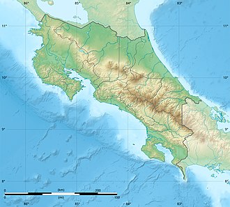
Location in Costa Rica

Juan Castro Blanco National Park is a national park, that is part of the Arenal Huetar Norte Conservation Area, in northern Costa Rica. [1]

Contents

Location

The park is located about 100 km north of San José, the Costa Rican capital, to the east of Ciudad Quesada in Alajuela Province.

Geography

It contains the active Platanar Volcano, the dormant Porvenir Volcano, and the inactive El Viejo Volcano. It was created in 1992 and covers an area of both rain and cloud forest.

The reserve contains the sources of the Aguas Zarcas, Platanar, Tora, Tres Amigos and La Vieja rivers.

Lake Pozo Verde is located within the park.

Flora and fauna

The park contains a wide variety of orchids and birds as well as natural hot springs. At least 57 species of mammal recorded in the reserve and include jaguar, tapir, ocelots, sloths, howler monkeys, red brocket deer and at least 22 species of bats. Over 233 species of birds, resident and migratory have been recorded including the national bird of Costa Rica the clay-coloured Thrush. Endangered species found on the park include the Resplendent quetzal, Great curassow, red brocket deer, and Black Guan.

Visitor facilities

There is an extensive trail system that winds through the park and offers visitors the chance to see an array of plants and animals. Aside from the trail system, however, there are not any public facilities at the park. [2]

Related Research Articles

<span class="mw-page-title-main">Geography of Costa Rica</span> Located on the Central American Isthmus

Costa Rica is located on the Central American Isthmus, surrounding the point 10° north of the equator and 84° west of the prime meridian. It has 212 km of Caribbean Sea coastline and 1,016 on the North Pacific Ocean.

<span class="mw-page-title-main">Alajuela Province</span> Province of Costa Rica

Alajuela is a province of Costa Rica. It is located in the north-central part of the country, bordering Nicaragua to the north. It also borders the provinces of Heredia to the east, San José to the south, Puntarenas to the southwest and Guanacaste to the west. As of 2011, the province had a population of 885,571. Alajuela is composed of 16 cantons, which are divided into 111 districts. It covers an area of 9,757.53 square kilometers.

La Selva Biological Station is a protected area encompassing 1,536 ha of low-land tropical rain forest in northeastern Costa Rica. It is owned and operated by the Organization for Tropical Studies, a consortium of universities and research institutions from the United States, Costa Rica, and Puerto Rico. Recognized internationally as one of the most productive field stations in the world for tropical forest research and peer-reviewed publications, La Selva hosts approximately 300 scientists and 100 university courses every year. The primary goal of La Selva Biological Station is to preserve and protect an intact forest, as well as providing laboratory facilities for tropical research and education. The research potential of the area is not only vital to tropical ecology, but it is also an important location in the effort to study relations between local communities and protected areas. In addition, its high diversity and ease of access to the Puerto Viejo-Horquetas highway makes La Selva an important ecotourism destination and environmental education center for tourists and the local community.

National System of Conservation Areas is part of the Ministry of Environment and Energy (MINAE) of Costa Rica. It is the administrator for the nation's national parks, conservation areas, and other protected natural areas.

<span class="mw-page-title-main">Wildlife of Costa Rica</span> Wildlife in Costa Rica

The wildlife of Costa Rica comprises all naturally occurring animals, fungi and plants that reside in this Central American country. Costa Rica supports an enormous variety of wildlife, due in large part to its geographic position between North and South America, its neotropical climate, and its wide variety of habitats. Costa Rica is home to more than 500,000 species, which represent nearly 5% of the species estimated worldwide, making Costa Rica one of the 20 countries with the highest biodiversity in the world. Of these 500,000 species, a little more than 300,000 are insects.

<span class="mw-page-title-main">Braulio Carrillo National Park</span> National park

Braulio Carrillo National Park is a national park in Heredia Province, Cartago Province, Limón Province and San José Province, in central Costa Rica. It is part of the Central Conservation Area.

<span class="mw-page-title-main">Arenal Huetar Norte Conservation Area</span> Administrative area of Costa Rica

Arenal Huetar Norte Conservation Area, is an administrative area which is managed by SINAC for the purposes of conservation in the northern part of Costa Rica. It contains two national park, a forest reserve and four wildlife refuges.

<span class="mw-page-title-main">Arenal Volcano National Park</span> National park of Costa Rica

Arenal Volcano National Park is a Costa Rican national park in the central part of the country, part of the Arenal Huetar Norte Conservation Area. The park encompasses the Arenal Volcano, the most active in the country, which was believed to be dormant until a major eruption in 1968. It neighbors Lake Arenal, which is the site of the country's largest hydroelectricity project, the Lake Arenal Dam.

<span class="mw-page-title-main">Carara National Park</span> Park in Costa Rica

Carara National Park is a national park in the Central Pacific Conservation Area located near the Pacific coast of Costa Rica. It was established on 27 April 1978 as a biological reserve, but its growing popularity after 1990 forced the government to upgrade its category to national park in November 1998.

<span class="mw-page-title-main">Poás Volcano National Park</span>

Poás Volcano National Park is a national park in Costa Rica that covers an area of approximately 65 square kilometres ; the summit of Poás Volcano located within the park is at an elevation of 2,700 metres (8,900 ft). The park was established on 25 January 1971. Depending on conditions, visitors can walk all the way to the edge of the main crater, but on 13 April 2017 the park was closed to visitors due to an explosive eruption on the evening of 12 April. Still further eruptions, including on Easter, 16 April, caused the park to be closed until August 2018.

Cerro Kamuk is a mountain in the Cordillera de Talamanca, in La Amistad International Park, in eastern Costa Rica, close to the border with Panama. It rises to 3,549 metres (11,644 ft) above sea level. It is one of the highest mountains in Central America. Indigenous peoples of the area include the Bribris and Cabecar. The area protected comprised four national parks clustered together that became La Amistad Biosphere Reserve. UNESCO declared it a natural World Heritage Site in 1983. It is part of the Mesoamerican Biological Corridor, UNESCO's project shared by eight Central American countries to help protect the remaining pristine mountain forest and wildlife of Central America.

<span class="mw-page-title-main">Alajuela (canton)</span> Canton in Alajuela province, Costa Rica

Alajuela is a canton in the Alajuela province of Costa Rica. Its head city is the provincial capital city of Alajuela.

<span class="mw-page-title-main">Zarcero (canton)</span> Canton in Alajuela province, Costa Rica

Zarcero is a canton in the Alajuela province of Costa Rica.

<span class="mw-page-title-main">Index of Costa Rica–related articles</span>

The following is an alphabetical list of topics related to the Republic of Costa Rica.

<span class="mw-page-title-main">Tortuguero National Park</span>

Tortuguero National Park is a national park in the Limón Province of Costa Rica. It is situated within the Tortuguero Conservation Area of the northeastern part of the country. Despite its remote location, reachable only by airplane or boat, it is the third-most visited park in Costa Rica. The park has a large variety of biological diversity due to the existence within the reserve of eleven different habitats, including rainforest, mangrove forests, swamps, beaches, and lagoons. Located in a tropical climate, it is very humid, and receives up to 250 inches (6,400 mm) of rain a year.

<span class="mw-page-title-main">San Carlos River (Costa Rica)</span>

The San Carlos River is a river in the Alajuela Province of Costa Rica that drains into the San Juan River and thus into the Caribbean Sea. Its basin covers an area of about 3,100 km2. The river has a length of 142 km of which about 60 km allow navigation. The river originates from the confluence of the Jabillos River and Peje River both originating on the eastern side of the Cordillera de Tilarán and traverses the San Carlos Canton. It meets the San Juan River close to Boca San Carlos.

<span class="mw-page-title-main">Platanar Volcano</span>

Platanar Volcano is located in the Cordillera Central mountain range. It is part of a complex that covers 900 square kilometres and is dominated by Porvenir Volcano at 2,267 m (7,438 ft). It is located within the Juan Castro Blanco National Park.

Porvenir Volcano is an inactive volcano, of stratovolcano type, in Costa Rica. Located in San Carlos canton of Alajuela, 3km from the related Platanar Volcano and part of the Cordillera Central mountain range. It is within the Juan Castro Blanco National Park.

Lake Pozo Verde, is a lake of volcanic origin in San Carlos, Alajuela province, Costa Rica.

References

  1. "Juan Castro Blanco National Park, Alajuela".
  2. "Juan Castro Blanco National Park".