Harhaj is a village and municipality in Bardejov District in the Prešov Region of north-east Slovakia.

Murquztala is a village in the Balakan Rayon of Azerbaijan. The village forms part of the municipality of Roçəhməd.
Xəlfəlikənd is a village in the Lerik Rayon of Azerbaijan. The village forms part of the municipality of Mistan.
Hovari is a village in the Lerik Rayon of Azerbaijan. The village forms part of the municipality of Şonacola. The village contains a necropolis dating from the late Bronze Age to early Iron Age.
Qadimkücə is a village in the Lerik Rayon of Azerbaijan. The village forms part of the municipality of Nüsomurya.
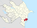
Seyidlər is a village in the Neftchala Rayon of Azerbaijan.
Tamozhnya is a village in the Neftchala Rayon of Azerbaijan.
Sahiloba is a village in the Neftchala Rayon of Azerbaijan. The village forms part of the municipality of Mikayıllı.
Qızqayıtdı is a village in the Neftchala Rayon of Azerbaijan. The village forms part of the municipality of Mikayıllı. According to Azerbaijan's State Statistics Committee, only three people lived in the village as of 2014.
Qədimkənd is a village and municipality in the Neftchala Rayon of Azerbaijan. It has a population of 2,320. The municipality consists of the villages of Qədimkənd and Birinci Qaralı.
Əyritala is a village in the Balakan Rayon of Azerbaijan. The village forms part of the municipality of Roçəhməd.
Şorkənd is a village in the Neftchala Rayon of Azerbaijan. The village forms part of the municipality of Qaraqaşlı.
Sübh is a village in the municipality of Birinci Mayak in the Neftchala Rayon of Azerbaijan.
Qaracıq is a village in the municipality of Qaracik Zeyid in the Khachmaz Rayon of Azerbaijan.
Hasıllı is a village and municipality in the Jalilabad Rayon of Azerbaijan. It has a population of 392.
Çünəxanlı is a village and municipality in the Jalilabad Rayon of Azerbaijan. It has a population of 233.
Fərəcullalı is a village and municipality in the Jalilabad Rayon of Azerbaijan. It has a population of 155.
Xaqani is a village and municipality in the Goygol Rayon of Azerbaijan. It has a population of 1,922.
Kotal is a village in the municipality of Ələt in the Qaradağ raion of Baku, Azerbaijan.