Yenikənd, is a village in Agsu Rayon, Azerbaijan. The village forms part of the municipality of Gürcüvan.
Məzrə is a village in the Jabrayil Rayon of Azerbaijan.
Dzherimbel is a village in the Jalilabad Rayon of Azerbaijan.
Bozayran is a village in the Jalilabad Rayon of Azerbaijan.
Kabagtepe is a village in the Lachin Rayon of Azerbaijan.
Mürsəqulu is a village in the Neftchala Rayon of Azerbaijan. The village forms part of the municipality of Xol Qaraqaşlı.
Yuxarı Astanlı is a village in the Yardymli Rayon of Azerbaijan.
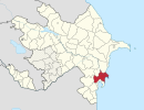
Ashim is a village in the Bilasuvar Rayon of Azerbaijan.
Korlar is a village in the Jalilabad Rayon of Azerbaijan.
Zaryar is a village in the Jalilabad Rayon of Azerbaijan.
Molday is a village in the Saatly Rayon of Azerbaijan.
Byandovan is a village in the Salyan Rayon of Azerbaijan.
Qaracıq is a village in the municipality of Qaracik Zeyid in the Khachmaz Rayon of Azerbaijan.
Fərəcullalı is a village and municipality in the Jalilabad Rayon of Azerbaijan. It has a population of 155.
Mirzənağılı is a village in the municipality of Qazaxlar in the Fizuli Rayon of Azerbaijan.
Qurbantəpə is a village in the Jabrayil Rayon of Azerbaijan.
Xallava is a village in the Qubadli Rayon of Azerbaijan.
Muncuqlu is a village in the municipality of Çatax in the Tovuz Rayon of Azerbaijan.
Musa is a village in the municipality of Aşağı Astanlı in the Yardymli Rayon of Azerbaijan. According to Azerbaijan's State Statistics Committee, only eight people lived in the village as of 2014.

The Pirsaat is a river in Azerbaijan which flows through Ismailli, Shamakhi and Salyan Rayons. Length - 199 km, basin area - 2,280 km2. The river is fed by snow, rain and groundwater. Its largest tributary is Zoghalava.